MyTopo
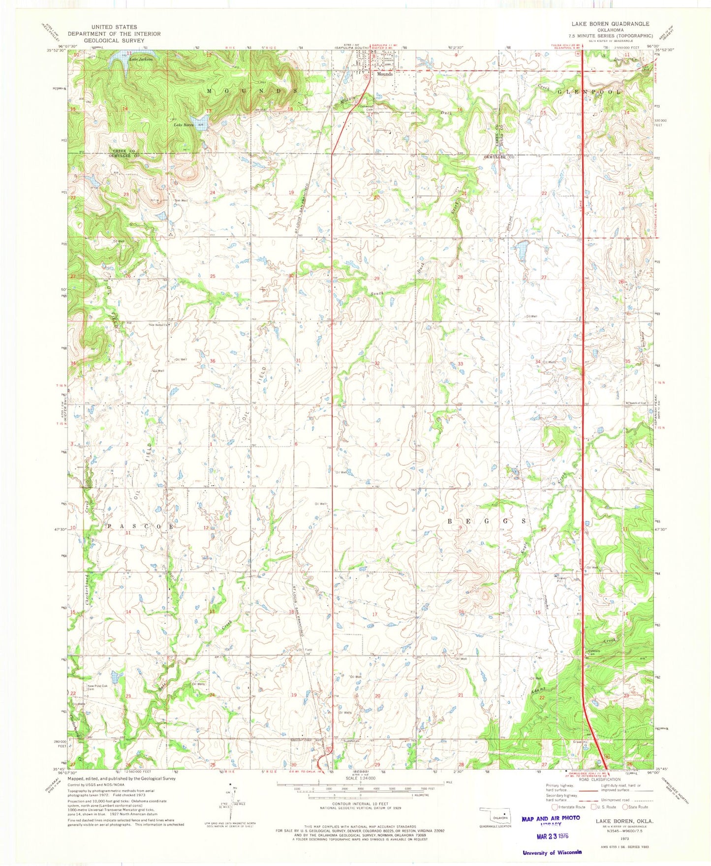
Classic USGS Lake Boren Oklahoma 7.5'x7.5' Topo Map
Couldn't load pickup availability
Historical USGS topographic quad map of Lake Boren in the state of Oklahoma. Map scale may vary for some years, but is generally around 1:24,000. Print size is approximately 24" x 27"
This quadrangle is in the following counties: Creek, Okmulgee, Tulsa.
The map contains contour lines, roads, rivers, towns, and lakes. Printed on high-quality waterproof paper with UV fade-resistant inks, and shipped rolled.
Contains the following named places: Ambassador Airport, Beggs Division, Beggs Elementary School, Beggs Middle School, Eagle Creek Airport, KGLB-TV (Okmulgee), KQMJ-FM (Henryetta), KTHK-FM (Okmulgee), Lake Boren, Lake Boren Dam, Lake Jackson, Middle Duck Creek, Mounds Fire Department Station 1 Headquarters, New Bethel Cemetery, New Bethel Church, New Post Oak Cemetery, North Duck Creek, Oakdale Cemetery, Oakwood Cemetery, Oknoname 111012 Dam, Oknoname 111012 Reservoir, Oknoname 111015 Dam, Oknoname 111015 Reservoir, Oknoname 111016 Dam, Oknoname 111016 Reservoir, Oknoname 111017 Dam, Oknoname 111017 Reservoir, Ragwing Acres Airport, South Duck Creek, Town of Mounds, Township of Beggs, ZIP Codes: 74047, 74421