
MyTopo
Classic USGS Lake Burton Georgia 7.5'x7.5' Topo Map
Couldn't load pickup availability
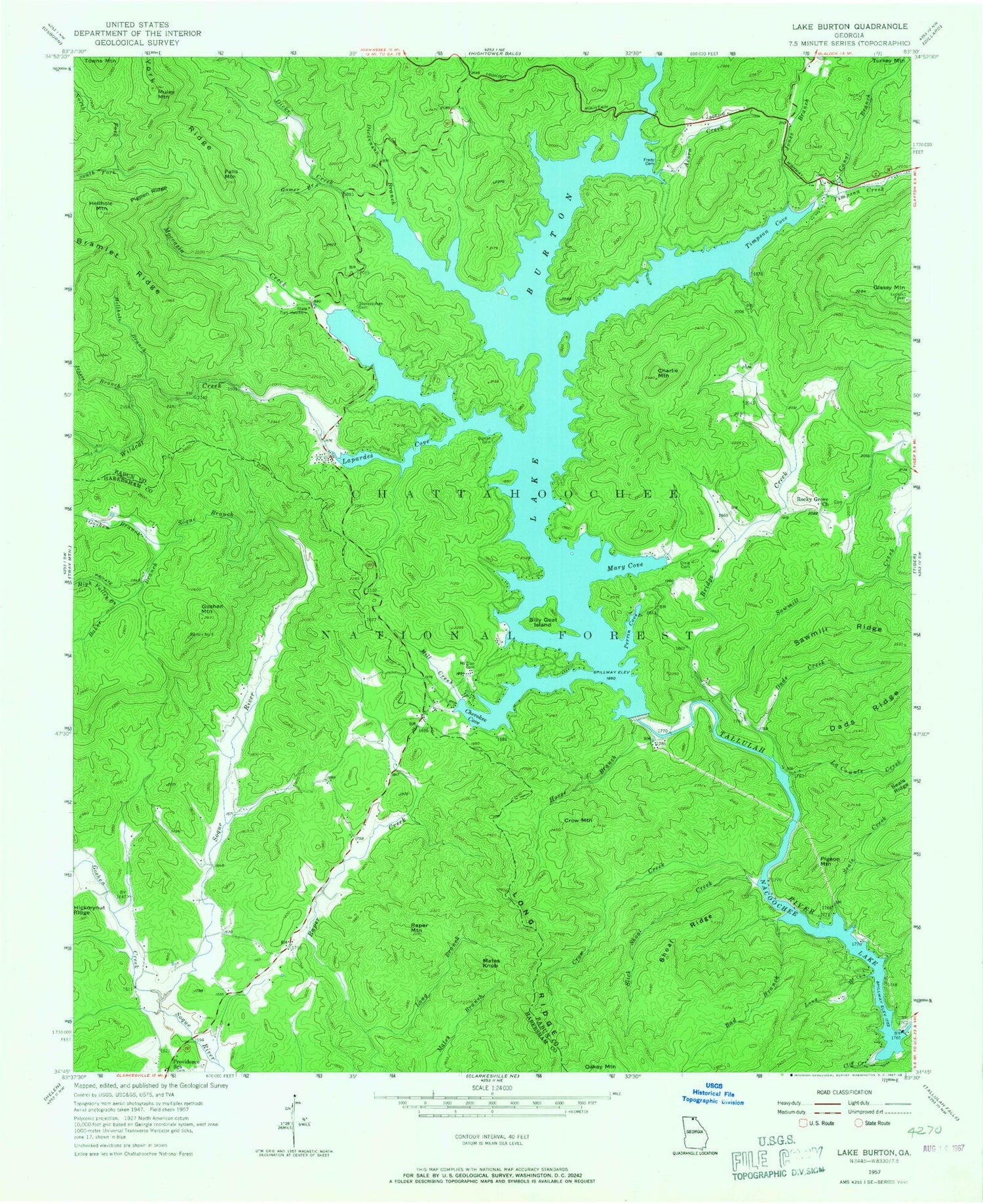
Historical USGS topographic quad map of Lake Burton in the state of Georgia. Typical map scale is 1:24,000, but may vary for certain years, if available. Print size: 24" x 27"
This quadrangle is in the following counties: Habersham, Rabun.
The map contains contour lines, roads, rivers, towns, and lakes. Printed on high-quality waterproof paper with UV fade-resistant inks, and shipped rolled.
Contains the following named places: Acorn Creek, Bad Branch, Baker Branch, Billy Goat Island, Bridge Creek, Burton Cemetery, Lake Burton, Canal Branch, Charlie Mountain, Cherokee Cove, Cliff Creek, Craig Cemetery, Crow Creek, Crow Mountain, Dads Creek, Dads Ridge, Dickenson Branch, Dicks Creek, Falls Mountain, Frady Cemetery, Gizzard Branch, Gomer Branch, Goshen Creek, Goshen Mountain, High Valley Branch, Horse Branch, Jessie Branch, Jones Branch, La Counts Creek, Lake Burton Game Management Area (historical), Wildcat Creek Cove, Chastain Branch, Long Branch, Long Ridge, Murray Cove, Mill Creek, Moccasin Creek, Mount Zion Cemetery, Muley Mountain, Seed Lake, North Fork Moccasin Creek, Perrin Cove, Pigpen Ridge, Providence School, Rocky Grove Church, Sawmill Creek, Sawmill Ridge, Seals Creek, Shoal Ridge, Slick Shoal Creek, Soque Branch, South Fork Moccasin Creek, Stonecyphen Cemetery, Timpson Cove, Wildcat Creek, York Ridge, Dicks Creek Cove, Goshen Branch, Magness Cove, Moccasin Creek Cove, Wilson Falls, Georgia State Fish Hatchery, Moccasin Creek State Park, Nacoochee Dam, Glassy Mountain Lookout, Moates Knob, Oakey Mountain, Pigeon Mountain, Raper Mountain, Right Fork Soquee River, Sportsman Club Dam, Sportsman Club Lake, Dean Lake Dam, Dean Lake, High Valley Boys Club Lake Dam, High Valley Boys Club Lake, Wikle Store, Hills Boat Dock, Mount Zion Church (historical), Powell Gap School (historical), King Sky Ranch Airport, Left Fork Soquee River, Glassy Mountain, Hellhole Branch, Hellhole Mountain, Timpson Creek, Burton (historical), Burton Post Office (historical), Tallulah Persimmon Volunteer Fire Station, Lakes Fire Station and Rescue


