MyTopo
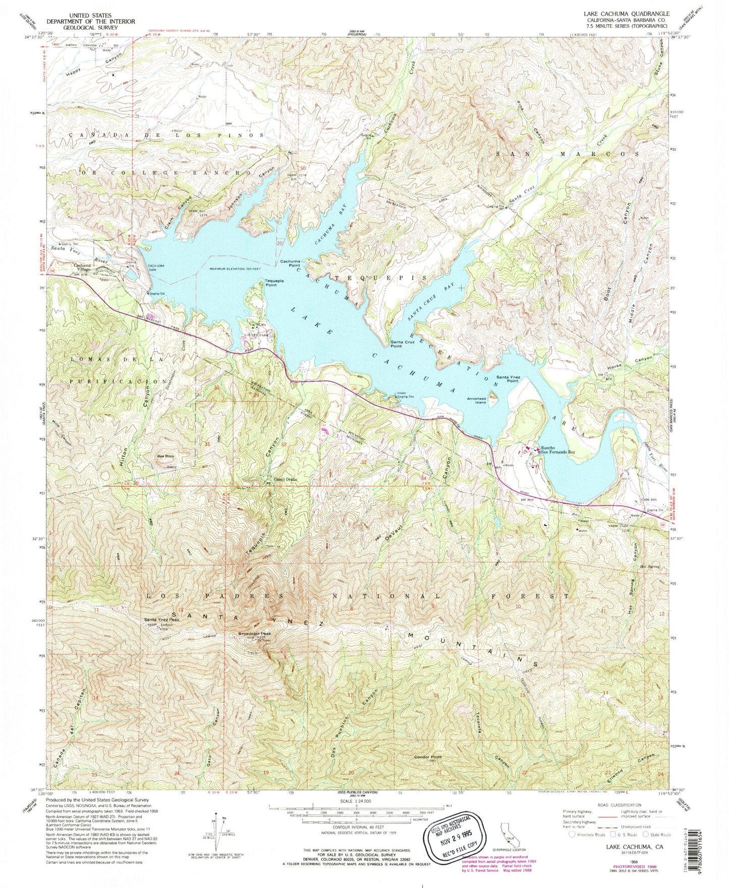
Classic USGS Lake Cachuma California 7.5'x7.5' Topo Map
Couldn't load pickup availability
Historical USGS topographic quad map of Lake Cachuma in the state of California. Typical map scale is 1:24,000, but may vary for certain years, if available. Print size: 24" x 27"
This quadrangle is in the following counties: Santa Barbara.
The map contains contour lines, roads, rivers, towns, and lakes. Printed on high-quality waterproof paper with UV fade-resistant inks, and shipped rolled.
Contains the following named places: San Marcos Ranch, Arrowhead Island, Bee Rock, Boot Canyon, Broadcast Peak, Cachuma Bay, Lake Cachuma County Park, Cachuma Creek, Bradbury Dam, Cachuma Point, Lake Cachuma Recreation Area, Lake Cachuma, Camp Drake, Clark Canyon, Condor Point, DeVaul Canyon, Foot Trail, Gato Trail, Hilton Canyon, Horse Canyon, Hot Spring, Hot Spring Canyon, Johnson Canyon, Middle Canyon, Oil Canyon, Pine Canyon, Rancho San Fernando Rey, Santa Cruz Bay, Santa Cruz Creek, Santa Cruz Point, Santa Ynez Peak, Santa Ynez Point, Stuke Canyon, Sweetwater Creek, Tecolote Tunnel, Tequepis, Tequepis Canyon, Tequepis Point, Tequepis Trail, Ptand T Electronic Site, Ranch Alegre Boy Scout Camp, Cachuma Church Camp, Cachuma Village, KCQR-FM (Ellwood), KRUZ-FM (Santa Barbara), KHTY-FM (Santa Barbara), KCSB-FM (Santa Barbara), KEYT-TV (Santa Barbara), Bradbury Dam Observation Point, Bear Canyon, Gray Ranch, Storke Ranch, Bee Rock Quarry