MyTopo
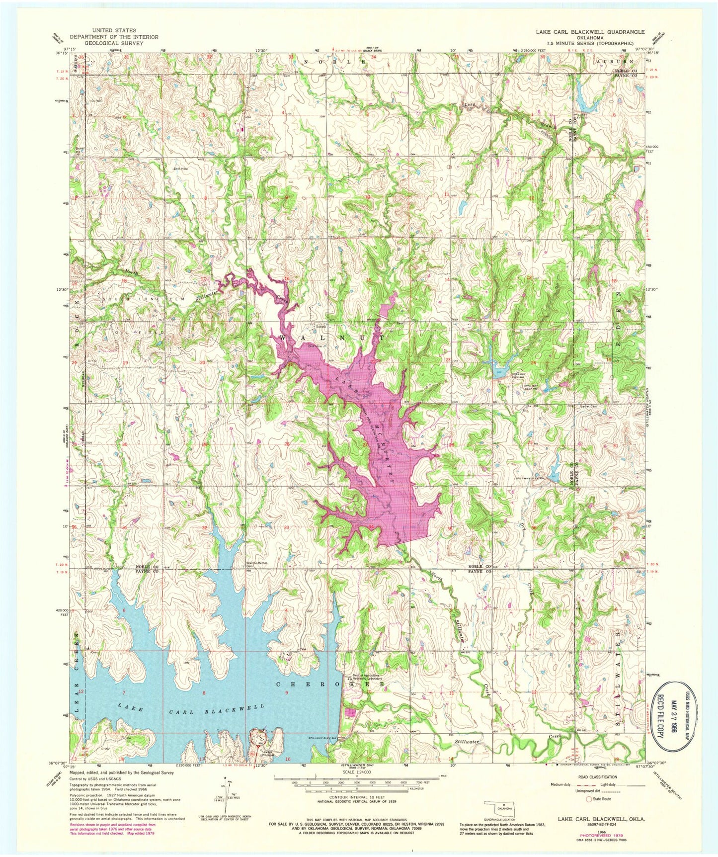
Classic USGS Lake Carl Blackwell Oklahoma 7.5'x7.5' Topo Map
Couldn't load pickup availability
Historical USGS topographic quad map of Lake Carl Blackwell in the state of Oklahoma. Map scale may vary for some years, but is generally around 1:24,000. Print size is approximately 24" x 27"
This quadrangle is in the following counties: Noble, Payne.
The map contains contour lines, roads, rivers, towns, and lakes. Printed on high-quality waterproof paper with UV fade-resistant inks, and shipped rolled.
Contains the following named places: Carl Blackwell Dam, Doxey Cemetery, Dry Creek, Ewy Cemetery, Harrington Creek, Lake Carl Blackwell, Lake McMurtry, Lanier Cemetery, Long Branch Site 3 Dam, Long Branch Site 3 Reservoir, North Stillwater Creek, Oknoname 103004 Dam, Oknoname 103004 Reservoir, Shelton-Bethel Cemetery, South Lone Elm Oil Field, Stillwater Creek Site 34 Dam, Stillwater Creek Site 34 Reservoir, Stillwater Creek Site 35 Dam, Stillwater Creek Site 35 Reservoir, Stillwater Creek Site 37 Dam, Stillwater Creek Site 37 Reservoir, Stillwater Creek Site 38 Dam, Stillwater Creek Site 38 Reservoir, Stillwater Creek Site 39 Dam, Stillwater Creek Site 39 Reservoir, Stillwater Creek Site 40 Dam, Stillwater Creek Site 41 Dam, Stillwater Creek Site 41 Reservoir, Township of Stillwater, Township of Walnut