MyTopo
Classic USGS Lake Catherine Arkansas 7.5'x7.5' Topo Map
Couldn't load pickup availability
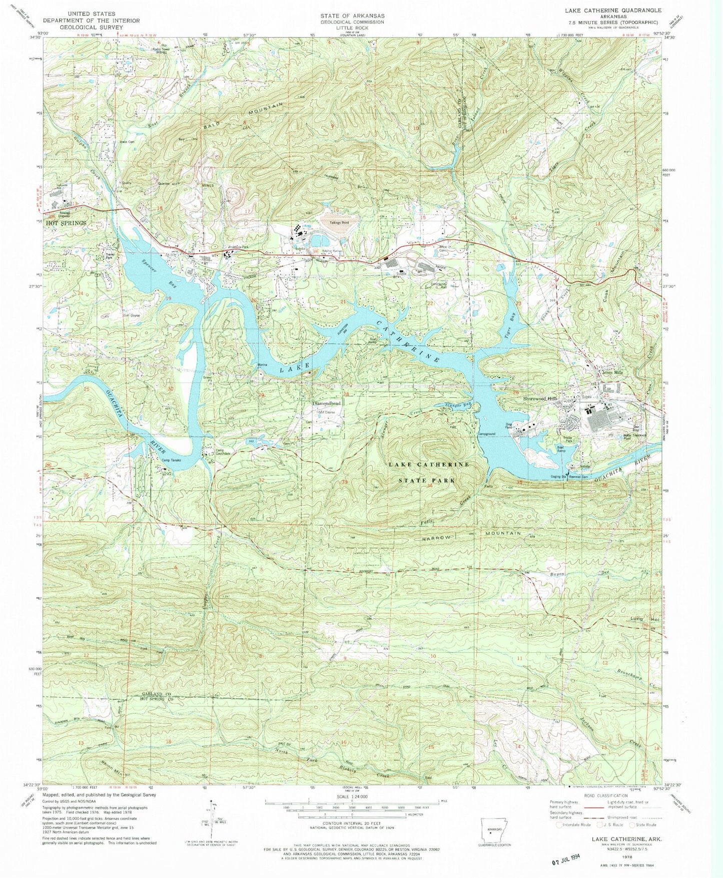
Historical USGS topographic quad map of Lake Catherine in the state of Arkansas. Typical map scale is 1:24,000, but may vary for certain years, if available. Print size: 24" x 27"
This quadrangle is in the following counties: Garland, Hot Spring.
The map contains contour lines, roads, rivers, towns, and lakes. Printed on high-quality waterproof paper with UV fade-resistant inks, and shipped rolled.
Contains the following named places: Bald Mountain, Boss Island Creek, Camp Couchdale, Camp Tanako, Cedar Creek, Cook Mountain, Cooper Creek, Cove Creek, East Branch Gulpha Creek, Falls Creek, Irwin Cemetery, Lake Catherine State Park, Narrow Mountain, Price Cemetery, Slunger Bay, Slunger Creek, Spencer Bay, Stony Creek, Sulphur Springs Church, Tigre Bay, Wiggins Creek, Diamondhead, Jones Mills, Shinn Mountain, Shorewood Hills, Lake Catherine, Lakeside Elementary School, Lakeside Intermediate School, Potash Sulphur Springs (historical), Price, Ross Ferry (historical), Spring Lake (historical), Spurlins Ferry (historical), Cove Creek (historical), Township of Sulphur (historical), Cove Creek Station (historical), Justus Mill (historical), Lake Catherine, Remmel Dam, Gulpha Creek, Tigre Creek, Lake Catherine, Crouchwood Lake Dam, Crouchwood Lake, Arkansas Noname 110 Dam, Tailings Pond, Lakeside High School, Jones Mills Post Office, Lecroy Post Office (historical), KBHS-AM (Hot Springs), Lakeside Primary School, Lakeside Junior High School, Lakeside Middle School, Lake Hamilton Fire Department Station 4, Lake Hamilton Fire Department Station 5, Morning Star Fire Department, Morning Star Fire Department Station 3, Morning Star Fire Department Station 4, Diamondhead Police Department, Jones Mills Census Designated Place