MyTopo
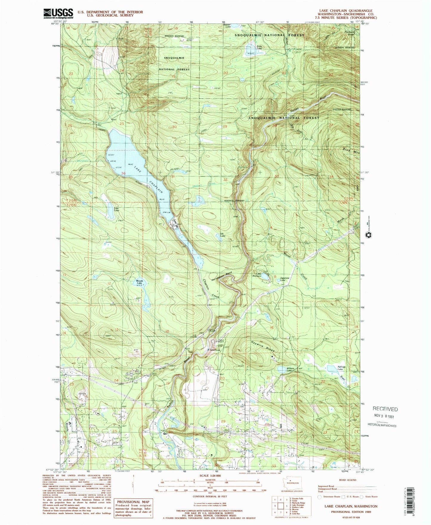
Classic USGS Lake Chaplain Washington 7.5'x7.5' Topo Map
Couldn't load pickup availability
Historical USGS topographic quad map of Lake Chaplain in the state of Washington. Map scale may vary for some years, but is generally around 1:24,000. Print size is approximately 24" x 27"
This quadrangle is in the following counties: Snohomish.
The map contains contour lines, roads, rivers, towns, and lakes. Printed on high-quality waterproof paper with UV fade-resistant inks, and shipped rolled.
Contains the following named places: Beaver Lake, Big Four Creek, Blue Boy West Golf Course, Blue Mountain Lookout, Chaplain Creek, Chaplain Lake North Dam, Chaplain Lake South Dam, Echo Lake, Everett Water Work Intake, Freeman Dam, Haywire Ridge, Horseshoe Bend, Ida Lake, Japanese Lake, Kellog Lake, Lake Bronson, Lake Chaplain, Lost Lake, Marsh Creek, Miners Creek, North Sultan, North Sultan Census Designated Place, Rain Spirit Farm, Ritz Creek, Winters Lake, Woods Lake