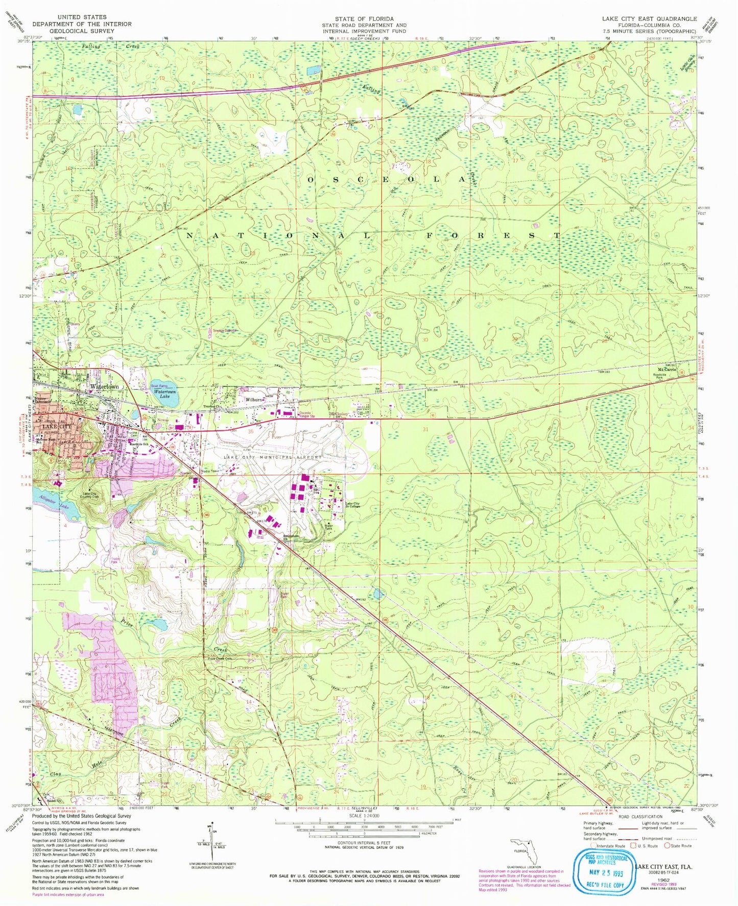
MyTopo
Classic USGS Lake City East Florida 7.5'x7.5' Topo Map
Couldn't load pickup availability
Historical USGS topographic quad map of Lake City East in the state of Florida. Map scale may vary for some years, but is generally around 1:24,000. Print size is approximately 24" x 27"
This quadrangle is in the following counties: Columbia.
The map contains contour lines, roads, rivers, towns, and lakes. Printed on high-quality waterproof paper with UV fade-resistant inks, and shipped rolled.
Contains the following named places: Alligator Lake, Bethel Church, Bethlehem Church, Church of God of Lake City, College Manor Chapel, Columbia Correctional Institution, Columbia Correctional Institution Annex, Columbia County, Columbia County Sheriff's Office, Columbia Fire Control Headquarters, Columbia High Adult Education School, Eastside Baptist Church, Eastside Elementary School, First Full Gospel Church, Fort White Adult Education School, Hideaway Mobile Home Park, Hill Landing Strip, Hudson Mobile Home Park, Lake City Community College, Lake City Correctional Facility, Lake City Country Club, Lake City Gateway Airport, Lantern Park Baptist Church, Luther Thomas Mobile Home Park, McColskey, Melrose Park Elementary School, Mount Carrie, Navair, Naval Air Station Lake City, New Mount Zion African Methodist Episcopal Church, Newco, Oakview Mobile Home Park, Osceola Ranger Station, Osceola Work Center, Price Creek, Price Creek Cemetery, Rossi Field, Salvation Holiness Church, Souls Harbor Church Of God In Christ, Tabernacle Baptist Church, Truevine Cemetery, Truvine Church, Victory Tabernacle, Watertown, Watertown Census Designated Place, Watertown Church, Watertown Lake, Wiggins Hunt Camp, Wilburn