MyTopo
Classic USGS Lake City Arkansas 7.5'x7.5' Topo Map
Couldn't load pickup availability
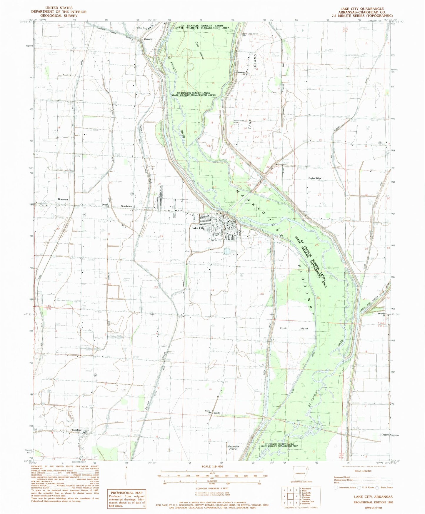
Historical USGS topographic quad map of Lake City in the state of Arkansas. Map scale may vary for some years, but is generally around 1:24,000. Print size is approximately 24" x 27"
This quadrangle is in the following counties: Craighead.
The map contains contour lines, roads, rivers, towns, and lakes. Printed on high-quality waterproof paper with UV fade-resistant inks, and shipped rolled.
Contains the following named places: Bethabara Baptist Church, Big Bay Ditch, Big Slough Ditch, Bowman, Bowman Baptist Church, Bowman Census Designated Place, Bowman School, Cane Island, Cane Island Slough Ditch, Cemmons Donick, City of Lake City, Claunch, Claunch School, Cothern Church, Cothran School, Craighead County Sheriff's Office East, Deglow, Ditch Number 10, Ditch Number 6, Ditch Number 7, Ditch Number 8, Forest Chapel, General Church, Gum Island, Ironwood Slough, Lake City, Lake City Cemetery, Lake City Fire Department, Lake City Police Department, Lake City Post Office, Lower Cane Island Cemetery, Lower Mangrum School, Lunsford, Lunsford Baptist Church, Lunsford School, Mangrum Cemetery, Mangrum Church, Marked Tree Floodway, Maumelle Prairie, Old Craddock Mill, Poplar Ridge, Poplar Ridge Chapel, Prairie Church, Prairie School, Refuge School, Riverside High School, Riverside West Elementary School, Rush Island, Saint Francis River Bridge, Saint Francis Sunken Lands State Wildlife Management Area, Sandy, Southland, Spicewood Slough, Taylors Ditch, Thompson Creek Ditch, Township of Lake City, Township of Prairie, Upper Cane Island Cemetery, Walnut Grove Church, ZIP Code: 72437