MyTopo
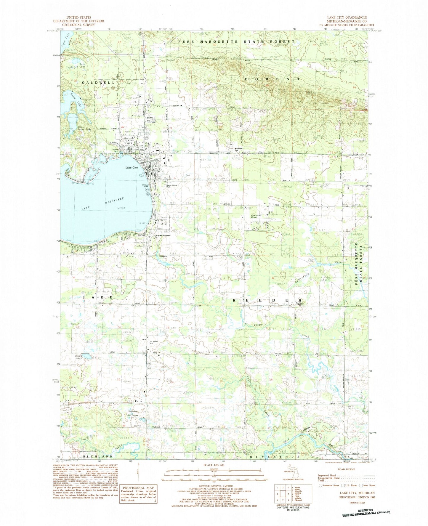
Classic USGS Lake City Michigan 7.5'x7.5' Topo Map
Couldn't load pickup availability
Historical USGS topographic quad map of Lake City in the state of Michigan. Typical map scale is 1:24,000, but may vary for certain years, if available. Print size: 24" x 27"
This quadrangle is in the following counties: Missaukee.
The map contains contour lines, roads, rivers, towns, and lakes. Printed on high-quality waterproof paper with UV fade-resistant inks, and shipped rolled.
Contains the following named places: Goose Lake, Lake City, Lake City Cemetery, Lakeside School, Little Goose Lake, Lake Missaukee, Saint Johns Church, Taylor Creek, Reeder Hill Lookout Tower, Home Acres Sky Ranch Airport, City of Lake City, Township of Reeder, Missaukee Golf Course, Blind Lake, Kingdom Hall, Miltner Park, Christian Reformed Church, Maple Grove Park, Rose Lake, Frey Station (historical), Frey Post Office (historical), Goose Lake State Forest Campground, Reeder Township Hall, Lake City Southern Baptist Church, Lake City Area Fire Department, Forest Township Hall, Calvary Baptist Church, Lake City Assembly of God Church, Lake City Station (historical), Lake City Seventh Day Adventist Church, Saint Stephens Catholic Church, United Methodist Church, First Presbyterian Church, Evangelical Presbyterian Church, Free Methodist Church, Missaukee District Library, Missaukee County Sheriff's Office, Missaukee County Courthouse, Lake City Post Office, Lake City Park, Missaukee County Park, Lake City Middle School, Lake City High School, Covenant Life Church, Northland Community Church, Stoney Creek Golf Course, Old Lake City Cemetery, Lake Missaukee Area Fire Department, Missaukee County Emergency Medical Services Lake City