MyTopo
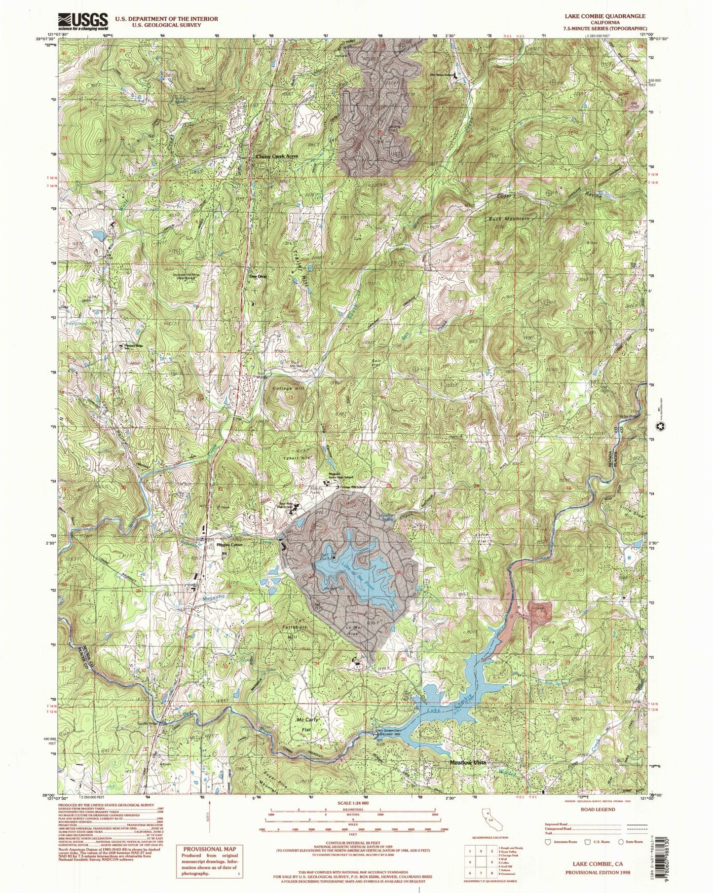
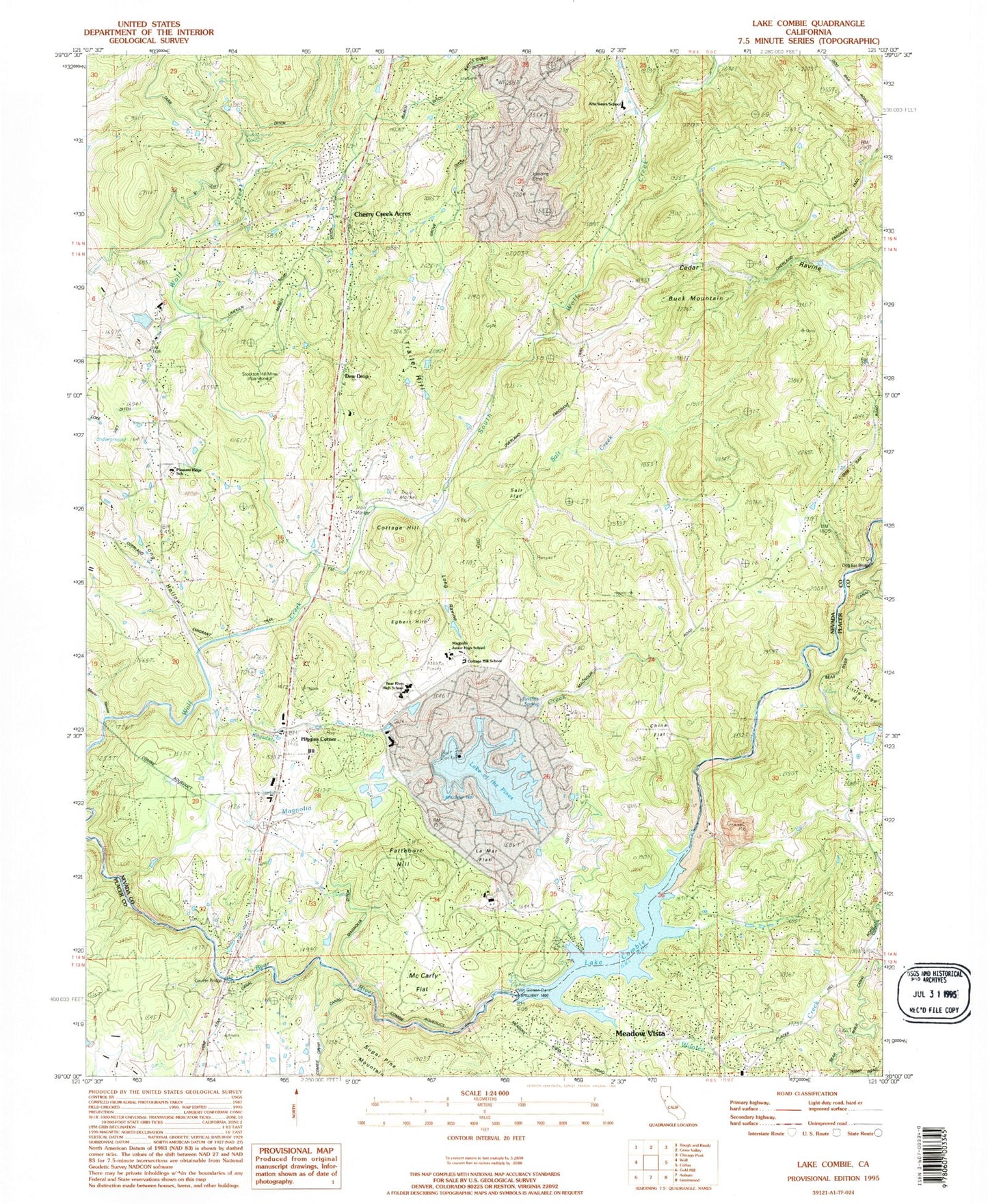
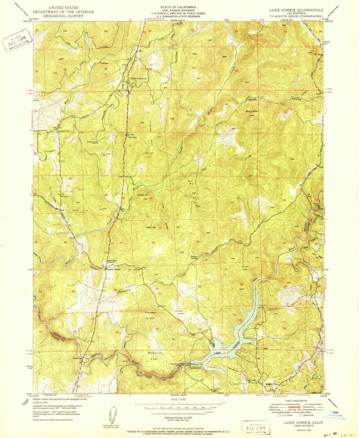
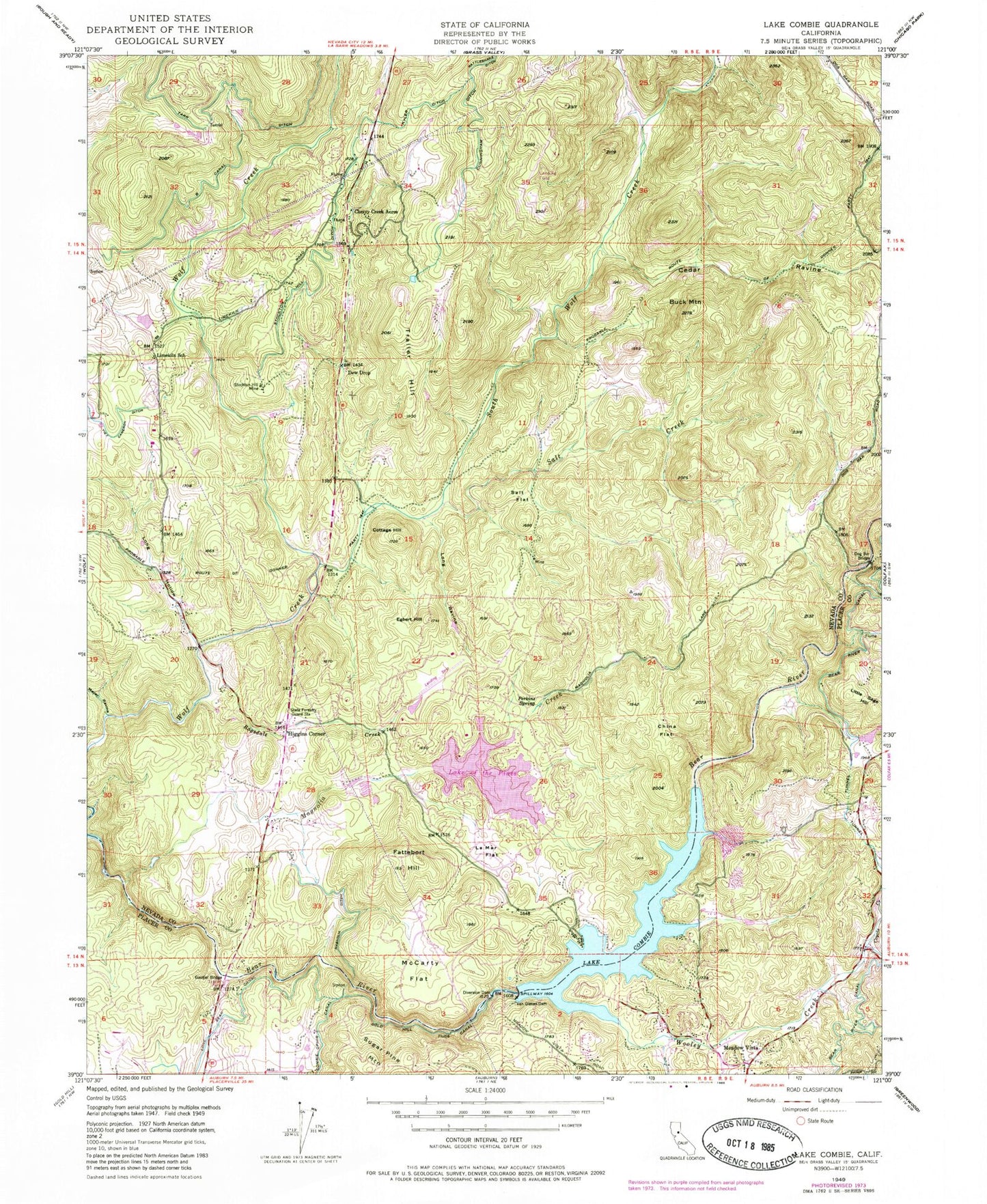
Classic USGS Lake Combie California 7.5'x7.5' Topo Map
Couldn't load pickup availability
Historical USGS topographic quad map of Lake Combie in the state of California. Map scale may vary for some years, but is generally around 1:24,000. Print size is approximately 24" x 27"
This quadrangle is in the following counties: Nevada, Placer.
The map contains contour lines, roads, rivers, towns, and lakes. Printed on high-quality waterproof paper with UV fade-resistant inks, and shipped rolled.
Contains the following named places: Alta Sierra Airport, Alta Sierra Census Designated Place, Alta Sierra Elementary School, Alta Sierra Estates, Alta Sierra Ranches, B Canal, Bear River High School, Buck Mountain, Cedar Ravine, Cherry Creek Acres, China Flat, Combie 61-009 Dam, Combie Crossing, Combie Ophir Canal, Cottage Hill, Cottage Hill Elementary School, Coyote Creek, Cunningham Ditch, Dew Drop, Dog Bar Bridge, Eden Valley, Egbert Hill, Fattebort Hill, Gautier Bridge, Higgins Area Fire Protection District, Higgins Corner, Kyler Ditch, La Mar Flat, Lake Combie, Lake Combie Pit, Lake of the Pines, Lake of the Pines Census Designated Place, Limekiln School, Little Sage Hill, Long Hollow, Long Ravine, Magnolia 1302 Dam, Magnolia Creek, Magnolia Ditch, McCarty Flat, Meadow Vista, Meadow Vista Census Designated Place, Meyer Ravine, Nevada County Consolidated Fire District Station 90, Nickerson Ranch, Perkins Spring, Placer County Fire Department Station 84 / Placer Hills Fire Department Station 1, Pleasant Ridge Charter School, Ragsdale Creek, Salt Creek, Salt Flat, Sierra Knoll Estates, South Wolf Creek, State Foresty Guard Station, Stockton Hill Ditch, Stockton Hill Mine, Trailer Hill, Van Giesen Dam, Viet Cameron Ditch, Willaura Estates, Wooley Creek, ZIP Code: 95722