MyTopo
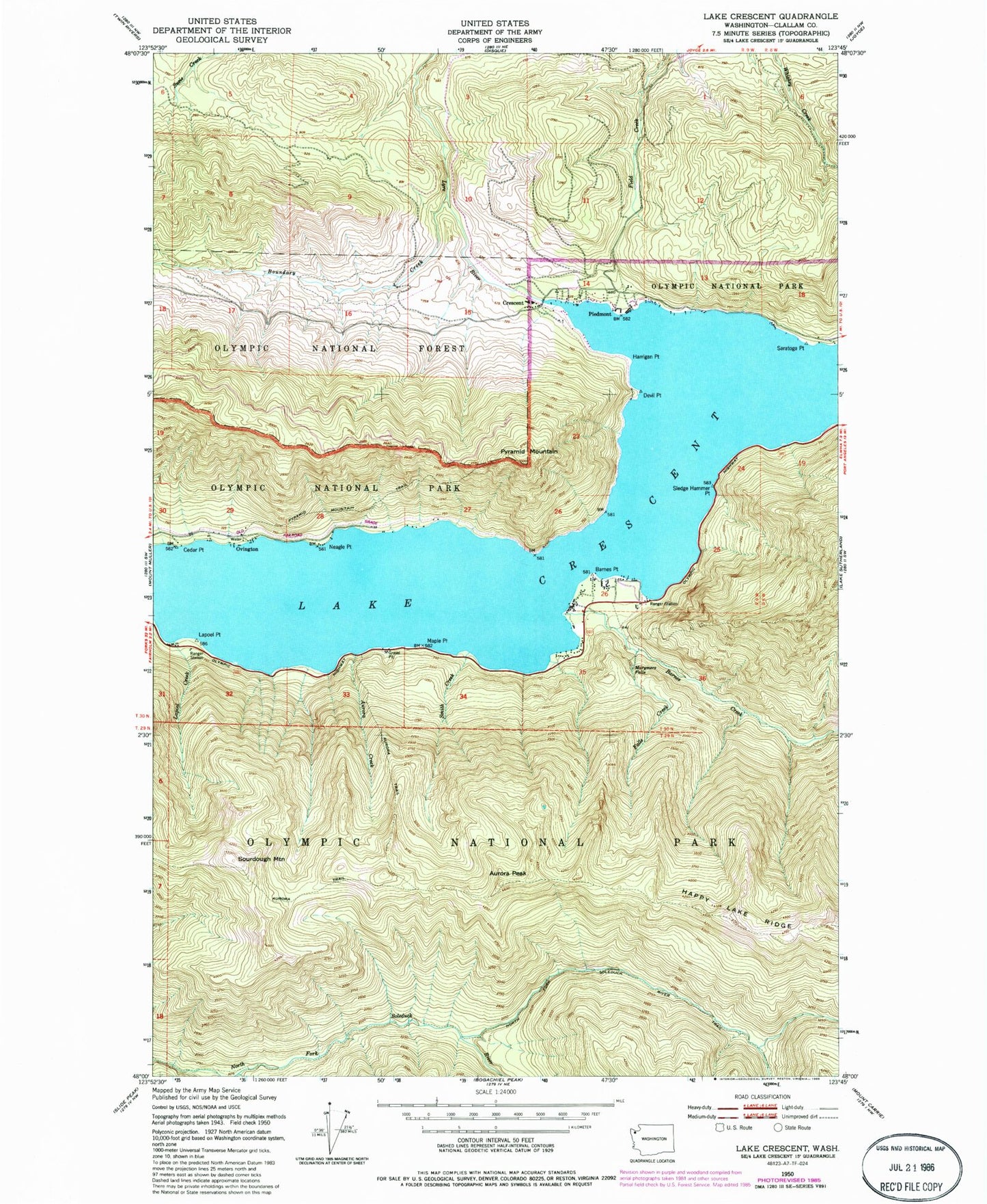
Classic USGS Lake Crescent Washington 7.5'x7.5' Topo Map
Couldn't load pickup availability
Historical USGS topographic quad map of Lake Crescent in the state of Washington. Map scale may vary for some years, but is generally around 1:24,000. Print size is approximately 24" x 27"
This quadrangle is in the following counties: Clallam.
The map contains contour lines, roads, rivers, towns, and lakes. Printed on high-quality waterproof paper with UV fade-resistant inks, and shipped rolled.
Contains the following named places: Aurora Creek, Aurora Peak, Barnes Creek, Barnes Point, Barnes Point Picnic Area, Boundary Creek, Cedar Point, Crescent, Crescent Division, Devil Point, Falls Creek, Harrigan Point, June Creek, La Poel Picnic Area, Lake Crescent, Lake Crescent Ranger Station, Lapoel Creek, Lapoel Point, Maple Point, Marymere Falls, Neagle Point, North Fork Soleduck River Trail, North Shore Picnic Area, Ovington, Piedmont, Pyramid Mountain, Pyramid Mountain Trail, Rosemary, Saratoga Point, Singers, Sledge Hammer Point, Smith Creek, Sourdough Mountain, ZIP Code: 98363