MyTopo
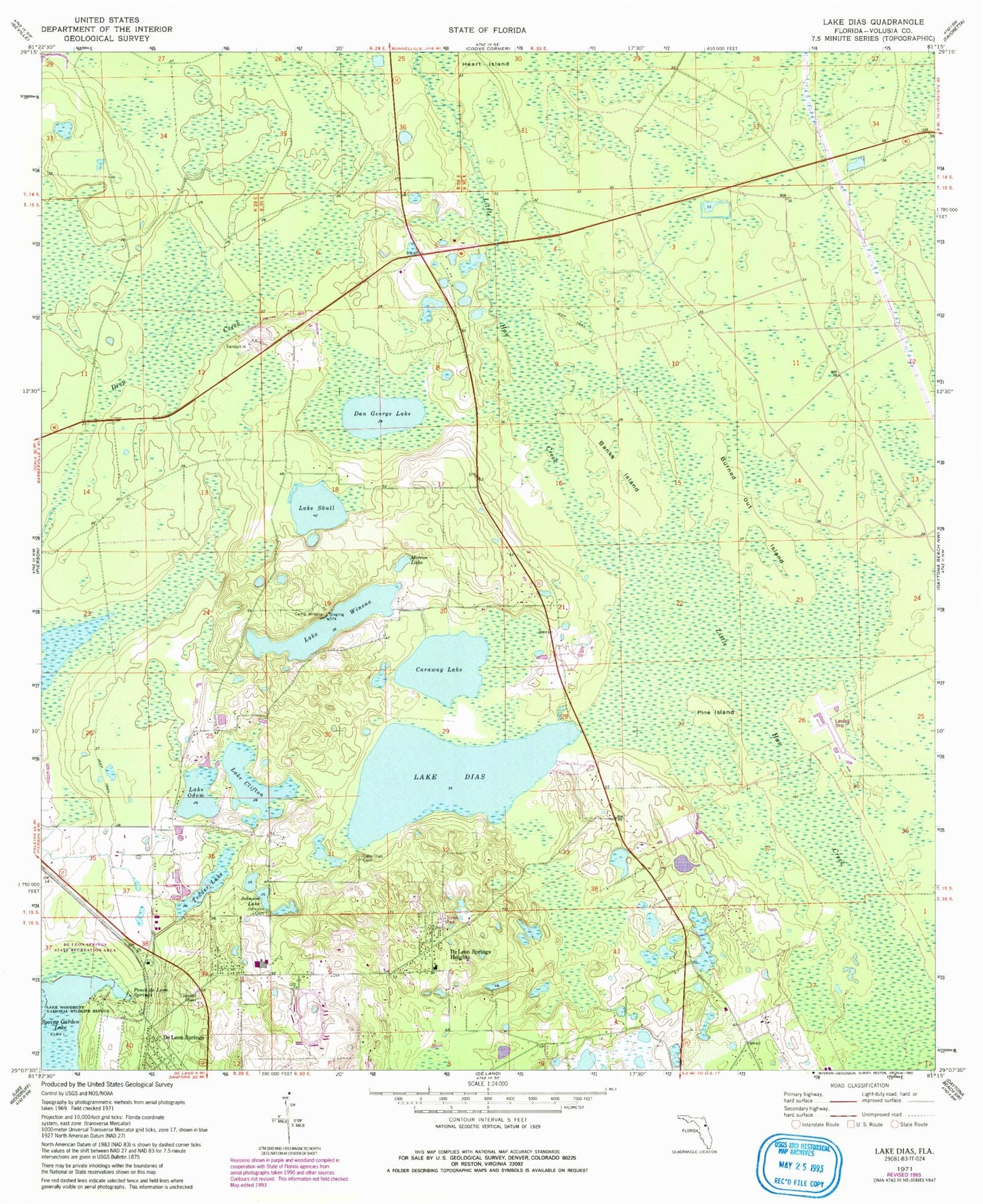
Classic USGS Lake Dias Florida 7.5'x7.5' Topo Map
Couldn't load pickup availability
Historical USGS topographic quad map of Lake Dias in the state of Florida. Map scale may vary for some years, but is generally around 1:24,000. Print size is approximately 24" x 27"
This quadrangle is in the following counties: Volusia.
The map contains contour lines, roads, rivers, towns, and lakes. Printed on high-quality waterproof paper with UV fade-resistant inks, and shipped rolled.
Contains the following named places: Banks Island, Burned Out Island, Camp Winona, Caraway Lake, Clifton Cemetery, Dan George Lake, De Leon Lookout Tower, De Leon Springs Heights, De Leon Springs State Park, F M Arredondo Grant, Heirs of Williams Grant, Johnson Cemetery, Johnson Lake, Lafayette Landings, Lake Clifton, Lake Dias, Lake Dias Cemetery, Lake Odom, Lake Skull, Lake Winona, M E Levy Grant, Mirror Lake, Moses E Levy Grant, Pine Island, Ponce de Leon Springs, Spring Garden Ranch Mobile Home Park, Tedder Lake, Thomas Forbes Grant, Tomoka Wildlife Management Area Union-Camp Tract, William Panton Grant, ZIP Code: 32130