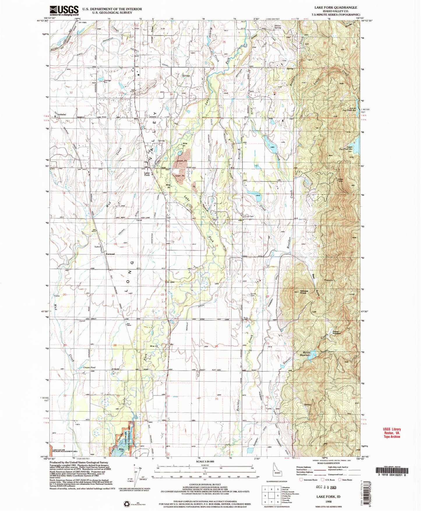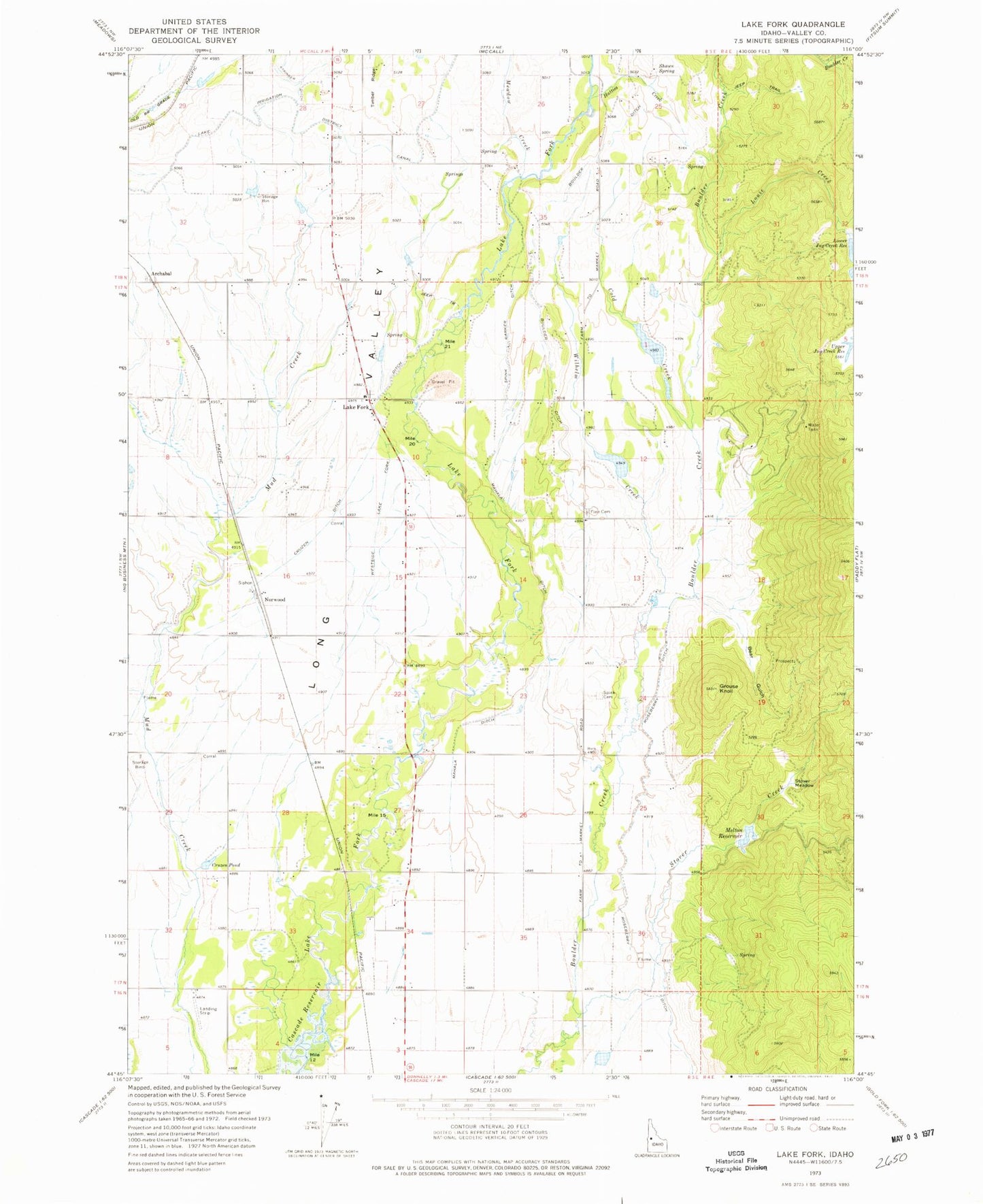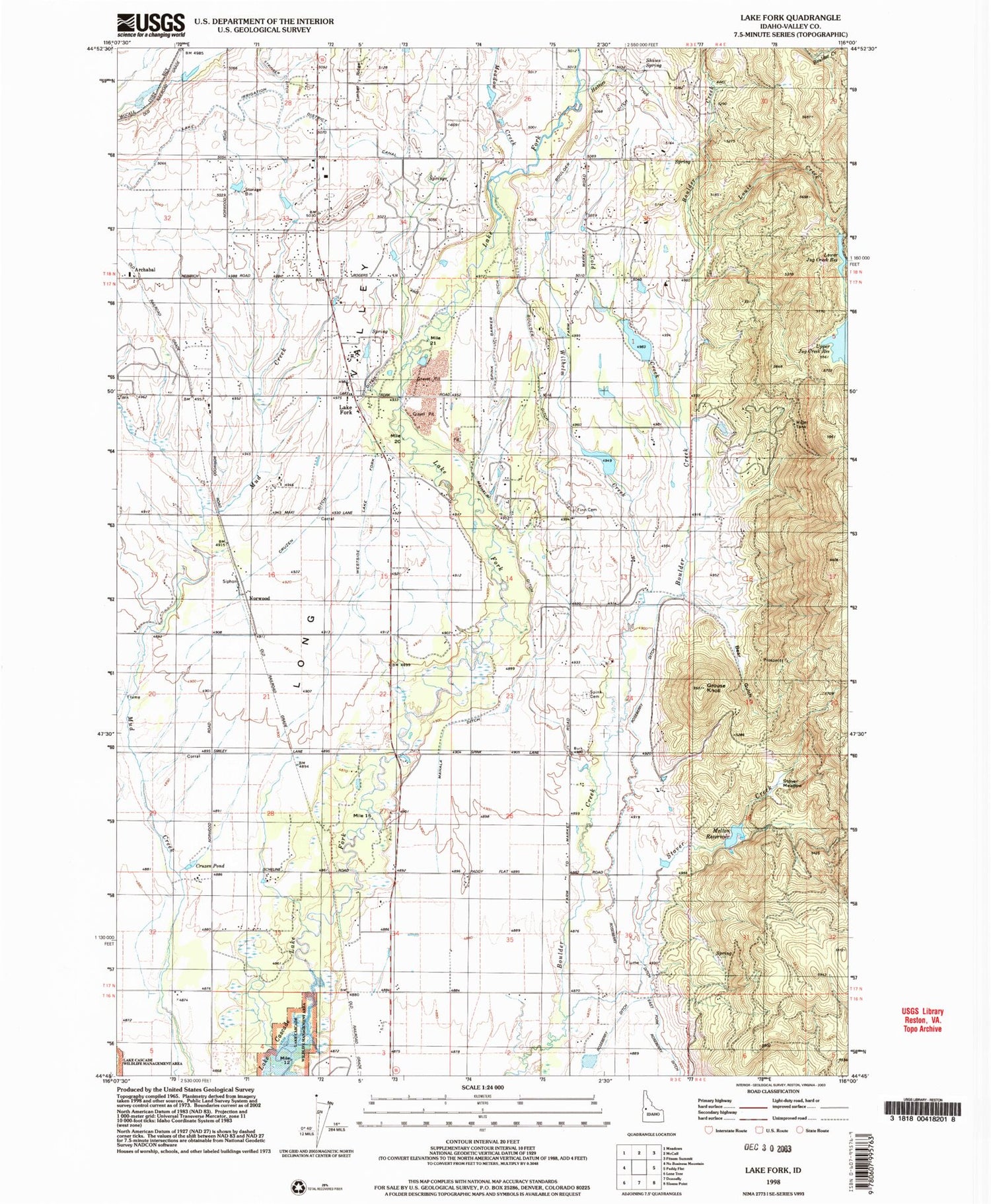
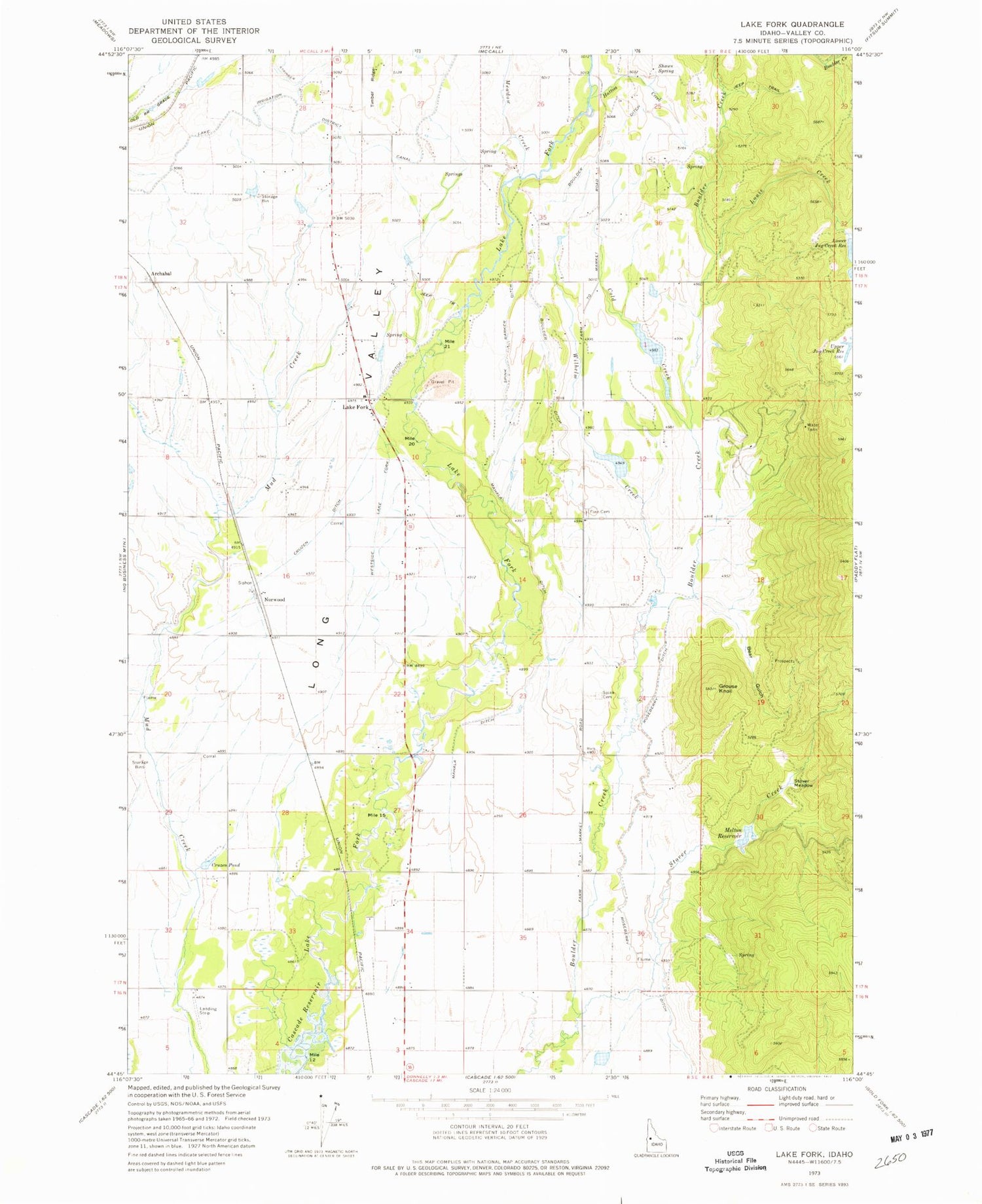
MyTopo
Classic USGS Lake Fork Idaho 7.5'x7.5' Topo Map
Couldn't load pickup availability
Historical USGS topographic quad map of Lake Fork in the state of Idaho. Map scale may vary for some years, but is generally around 1:24,000. Print size is approximately 24" x 27"
This quadrangle is in the following counties: Valley.
The map contains contour lines, roads, rivers, towns, and lakes. Printed on high-quality waterproof paper with UV fade-resistant inks, and shipped rolled.
Contains the following named places: Archabal, Bear Air Airport, Bear Gulch, Bell School, Boulder Ditch, Cold Creek, Cruzen Ditch, Cruzen Pond, Finn Cemetery, Flying A Ranch Airport, Grouse Knoll, Hatties Creek, Hollenbeak Dam, Hughes Dam, Jug Creek, Jug Creek Dam, Jussila-Bow Dam, Lake Fork, Lake Irrigation District Canal, Louie Creek, Lower Jug Creek Reservoir, Mahala Ditch, Meadow Creek, Melton Reservoir, Norwood, Poorman Creek, Poro Dam, Roseberry Ditch, Shaws Spring, Spink, Spink Barker Ditch, Spink Cemetery, Splan Airport, Stover Creek, Stover Meadow, Upper Jug Creek Reservoir, Westside Lake Fork Ditch, Wilhelm Creek