MyTopo
Classic USGS Lake Gordon Wisconsin 7.5'x7.5' Topo Map
Regular price
$16.95
Regular price
Sale price
$16.95
Unit price
per
Couldn't load pickup availability
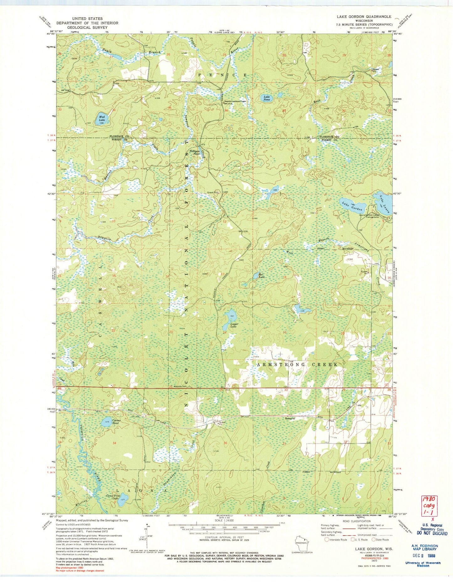
Historical USGS topographic quad map of Lake Gordon in the state of Wisconsin. Map scale may vary for some years, but is generally around 1:24,000. Print size is approximately 24" x 27"
This quadrangle is in the following counties: Florence, Forest.
The map contains contour lines, roads, rivers, towns, and lakes. Printed on high-quality waterproof paper with UV fade-resistant inks, and shipped rolled.
Contains the following named places: Bonneval, Camp Three Lake, Cavour Pond, Hanson Creek, Lake Gordon, Lake Laura, Lake Nona, Laura-Gordon Lakes Campground, Logger Lake, Mud Lake, Nelligan Pond, Newald Lookout Tower, Rat Lake, Simpson Creek, Town of Armstrong Creek, Whiting Creek, ZIP Code: 54103