MyTopo
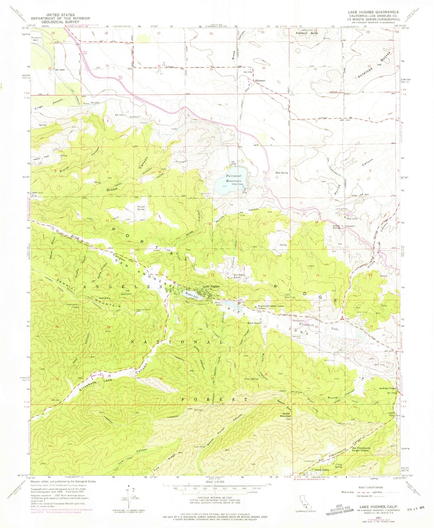
Classic USGS Lake Hughes California 7.5'x7.5' Topo Map
Couldn't load pickup availability
Historical USGS topographic quad map of Lake Hughes in the state of California. Map scale may vary for some years, but is generally around 1:24,000. Print size is approximately 24" x 27"
This quadrangle is in the following counties: Los Angeles.
The map contains contour lines, roads, rivers, towns, and lakes. Printed on high-quality waterproof paper with UV fade-resistant inks, and shipped rolled.
Contains the following named places: Abrams Canyon, Andrade Corner, Antelope Buttes, Antelope Valley California Poppy State Natural Reserve, Bleich Canyon, Burns Canyon, Burns Truck Trail, Canyon Meadows Church Camp, Clear Spring, Craig Spring, Deer Canyon, Edgewater Park, Elizabeth Lake, Elizabeth Lake Census Designated Place, Elizabeth Lake Picnic Area, Elizabeth Lake Ranch, Elizabeth Lake School, Elizabeth Tunnel, Fairmont, Fairmont 6-008 Dam, Fairmont Reservoir, Forsythe Canyon, Grass Mountain, Hiatt Canyon, Hughes - Elizabeth Lake School, Hughes Lake, Indian Spring, Juday Flat, Juday Truck Trail, Keeler Flats, Kings Canyon, Lake Hughes, Lake Hughes Census Designated Place, Lake Hughes Post Office, Lake Hughes Truck Trail, Los Angeles County Camp 7, Los Angeles County Fire Department Station 78, Lucky Canyon, Mud Spring, Munz Canyon, Munz Lakes, Munz Ranch, Myrick Cutoff, Myrick Siphon, Orr Spring Canyon, Pine Canyon, Pine Canyon County Patrol Station, Price Canyon, San Francisquito Campground, San Francisquito Ranger Station, Sawmill Liebre Firebreak Trail, Sheas Castle, Sky Haven Ranch, South Portal Elizabeth Tunnel, Spruce Draw, Steiner Canyon, Troedel Spring, Willow Siphon