MyTopo
Classic USGS Lake Huntington New York 7.5'x7.5' Topo Map
Couldn't load pickup availability
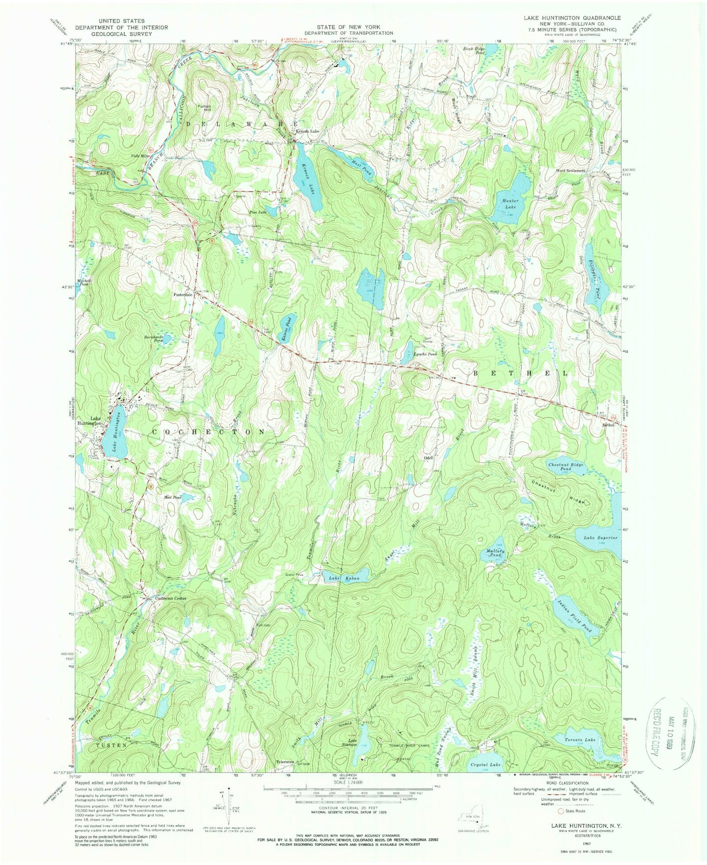
Historical USGS topographic quad map of Lake Huntington in the state of New York. Map scale may vary for some years, but is generally around 1:24,000. Print size is approximately 24" x 27"
This quadrangle is in the following counties: Sullivan.
The map contains contour lines, roads, rivers, towns, and lakes. Printed on high-quality waterproof paper with UV fade-resistant inks, and shipped rolled.
Contains the following named places: Angel Mill Brook, Barnhardt Pond, Bethel Post Office, Birch Ridge, Birch Ridge Brook, Birch Ridge Pond, Campanellis Poultry Farm, Chestnut Ridge, Chestnut Ridge Pond, Cochecton Center, Cochecton Volunteer Ambulance Corps, Falls Mills, Filippini Pond, Fosterdale, Fosterdale Cemetery, Fulton Hill, Hunter Lake, Hurd Brook, Hurd Settlement, Hust Pond, Indian Field Pond, Island Glen Country Club, Jaketown Creek, Johanson Farms, Jones Brook, Kazens Pond, Kenoza Lake, Kenoza Lake Cemetery, Kenoza Lake Post Office, Kenoza Lake Volunteer Fire Department, Lake Huntington, Lake Huntington Census Designated Place, Lake Huntington Volunteer Fire Company Station 1, Lake Huntington Volunteer Fire Company Station 2, Lake Kabau, Lake Nianque, Lake Superior, Laurel Cemetery, Lillies Pond, Lynchs Pond, Mallory Brook, Mallory Pond, Mud Pond, Mud Pond Swamp, Nearing Cemetery, Nebraska Brook, Odell, Perry Pond Brook, Pine Lake, Smith Mill Swamp, Sullivan West High School, Tenmile River Camps, Toronto Lake, Town of Cochecton, Tylertown, ZIP Codes: 12720, 12750, 12752