MyTopo
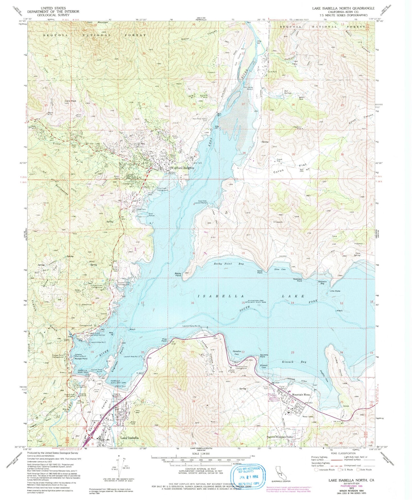
Classic USGS Lake Isabella North California 7.5'x7.5' Topo Map
Couldn't load pickup availability
Historical USGS topographic quad map of Lake Isabella North in the state of California. Map scale may vary for some years, but is generally around 1:24,000. Print size is approximately 24" x 27"
This quadrangle is in the following counties: Kern.
The map contains contour lines, roads, rivers, towns, and lakes. Printed on high-quality waterproof paper with UV fade-resistant inks, and shipped rolled.
Contains the following named places: Auxiliary Dam Campground, Big Blue Mill, Big Blue Mine, Boulder Gulch Campground, Caldwell Creek, Camp Nine, Cane Creek, Cane Peak, Cane Spring, Commonwealth Mine, Cyrus Canyon, Cyrus Flat, Doyle Ranch, East Side Camp Ground, East Side Launch Ramp, Engineer Point, Freear Park, French Gulch, French Gulch Lake Patrol Station, French Gulch Marina, Gautche Point, Grandad Mine, Hogeye Gulch, Hot Springs, Hungry Gulch Campground, Isabella, Isabella Auxiliary Dam, Isabella Lake, Isabella Main Dam, Isabella Marina Number Two, Isabella Point Boat Ramp, Joughin Cove, Kern County Airport, Kern County Sheriff's Office, Kern River Valley Cemetery, Kern Valley Airport, Kern Valley Hospital, Kern Valley Marina, Kernville, Kernville Heliport, Kissack Bay, Kissack Cove, Kissack Cove Boat Ramp, KVLI-AM (Lake Isabella), Lake Isabella Census Designated Place, Lake Isabella Post Office, Launch Area Number Nineteen, Launch Area Number Seventeen, Launch Area Number Two, Launch Ramp Number Sixteen, Lime Dyke, Lime Point, Live Oak Campground, Main Dam Campground, Mountain Mesa, Mountain Mesa Census Designated Place, Mountain Mesa Park, Nellie Dent Creek, North Fork Marina, Noyer Canyon, Paradise Cove, Paradise Cove Boat Ramp, Paradise Cove Campground, Pine Point, Pioneer Point, Pioneer Point Campground, Rattlesnake Creek, Raymond Mine, Regan Mine, Robinson Bay, Robinson Point, Rocky Point, Rocky Point Bay, Shirley Creek, Slippery Rock Picnic Area, South Fork Kern River, South Fork Picnic Area, Stine Cove, Stine Point, Tillie Creek, Tillie Creek Boat Ramp, Tillie Creek Campground, Willow Flat, Woffard Heights Post Office, Wofford Heights, Wofford Heights Census Designated Place, Wofford Heights Park, Woodford Ranch, Yankee Canyon, ZIP Code: 93238