
MyTopo
Classic USGS Lake Itasca Minnesota 7.5'x7.5' Topo Map
Couldn't load pickup availability
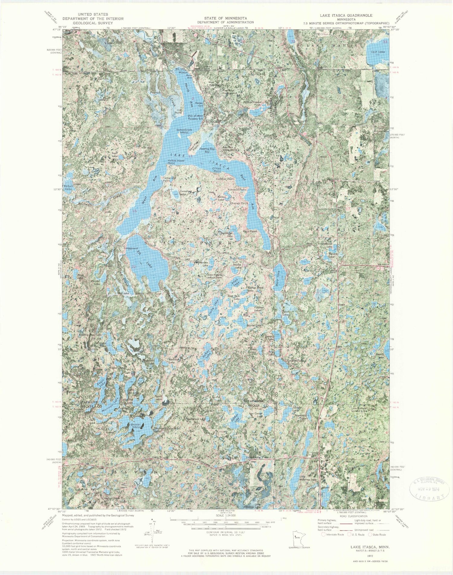
Historical USGS topographic quad map of Lake Itasca in the state of Minnesota. Typical map scale is 1:24,000, but may vary for certain years, if available. Print size: 24" x 27"
This quadrangle is in the following counties: Becker, Clearwater, Hubbard.
The map contains contour lines, roads, rivers, towns, and lakes. Printed on high-quality waterproof paper with UV fade-resistant inks, and shipped rolled.
Contains the following named places: Allen Lake, Arco Lake, Augusta Lake, Bear Paw Campground, Bear Paw Point, Bogus Lake, Bohall Lake, Boutwell Creek, Brower Island, Budd Lake, Chaney Point, Clarke Lake, Coffee Break Lake, Comber Island, Comber Point, Deer Park Lake, Deming Lake, Desoto Trail, Dorace Lake, Eagle Scout Trail, East Arm Lake Itasca, Elk Lake, Elk Pool, Fallstad Lake, Floating Bog Bay, Floating Moss Lake, Lake Frazier, French Creek, Ga-Gwa-Dosh Creek, Gilfillan Lake, Goodwin Lake, Green Lake, Grosilliers Lake, Hall Lake, Hays Lake, Hernando DeSoto Lake, Hill Point, Horn Lake, Iron Corner Lake, Itasca State Park, Lake Itasca, Jeanne Lake, Josephine Lake, Lake Alice Cemetery, Lashbrook Lake, Little Elk Lake, Lost Lake, Lyendecker Lake, Mary Lake, McKay Lake, Mikenna Lake, Morrison Lake, Myrtle Lake, Nicolet Creek, Nicolet Lake, Nicolet Trail, Niemada Lake, North Arm Lake Itasca, O'Neil Point, Picard Lakes, Pine Ridge Campground, Pioneer Cemetery, Radisson Lake, Rays Point, Schoolcraft Island, Sibilant Lake, Siegfried Creek, Snail Lake, Tamarack Lake, Tamarack Point, Triplet Lakes, Turnbull Point, Twin Lakes, University of Minnesota Forestry School, West Arm Lake Itasca, Wettersten Lake, Whipple Lake, Yellow Head Point, Alton Heights Lookout Tower, Little Mantrap Lookout Tower, Unorganized Territory of South Clearwater, Geology of Minnesota Geological Marker, Theodore and Johanna Wegmann Historical Marker, Old Northwest Territory Historical Marker, Search for the Mississippi's Source Historical Marker, Reverend Joseph A Gilfillan Historical Marker, Douglas Lodge Post Office (historical)


