MyTopo
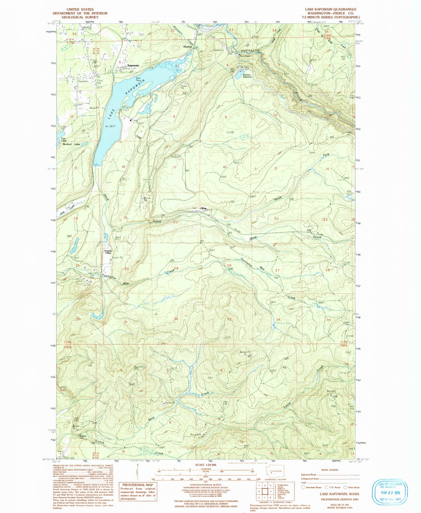
Classic USGS Lake Kapowsin Washington 7.5'x7.5' Topo Map
Couldn't load pickup availability
Historical USGS topographic quad map of Lake Kapowsin in the state of Washington. Typical map scale is 1:24,000, but may vary for certain years, if available. Print size: 24" x 27"
This quadrangle is in the following counties: Pierce.
The map contains contour lines, roads, rivers, towns, and lakes. Printed on high-quality waterproof paper with UV fade-resistant inks, and shipped rolled.
Contains the following named places: Berg Creek, Electron, Electron Reservoir, Kapowsin, Lake Kapowsin, Kings Creek, Neff Ranch, Ohop, Surprise Valley, Voss Resort, Wildcat Falls, North Fork Ohop Creek, Lindstrom Dam Number One, Lindstrom Dam Number Two, Electron Reservoir Dam, Kapowsin Census Designated Place, Pierce County Fire District 21 Graham Fire and Rescue Station 92, Kapowsin Post Office