
MyTopo
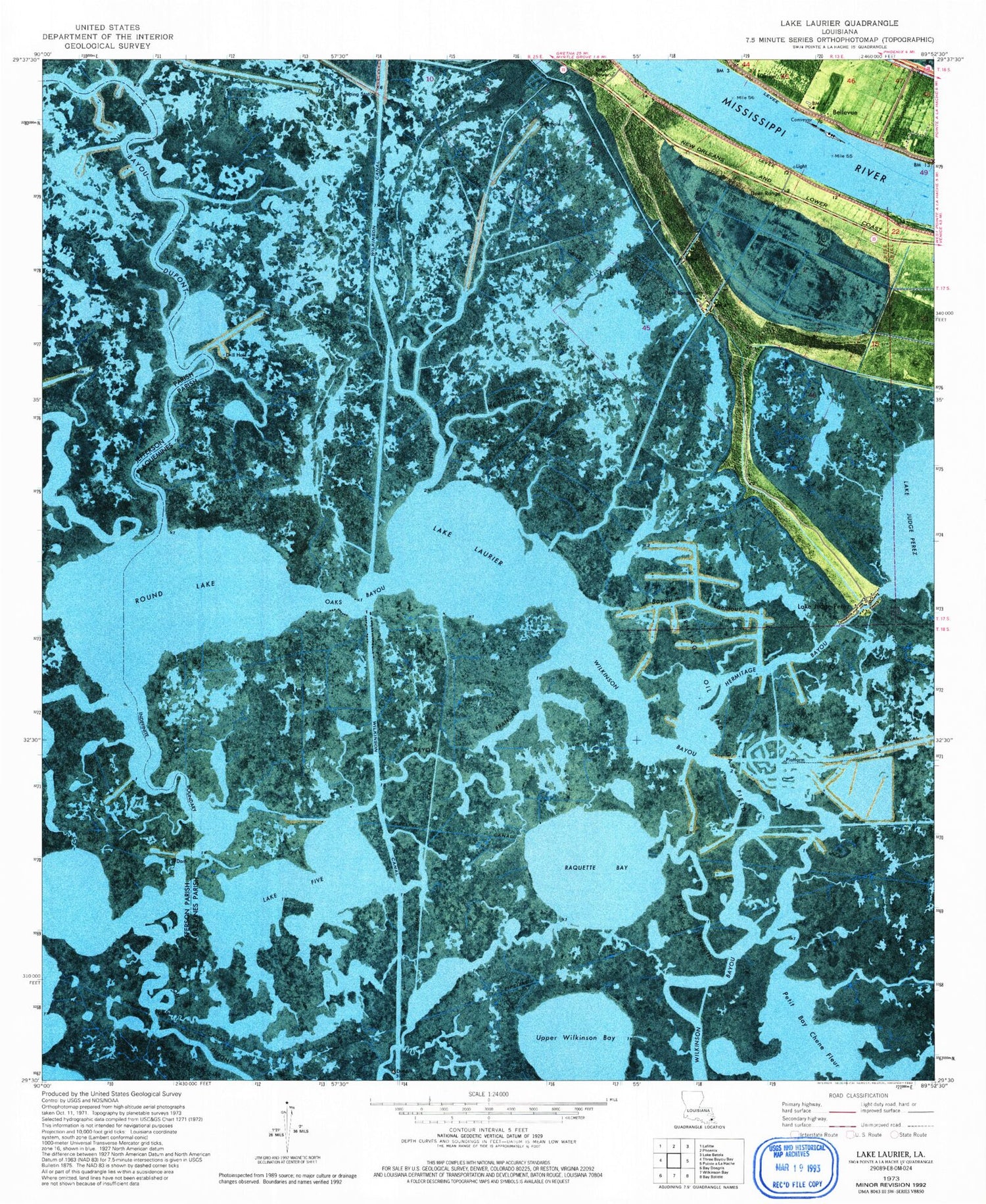
Classic USGS Lake Laurier Louisiana 7.5'x7.5' Topo Map
Couldn't load pickup availability
Historical USGS topographic quad map of Lake Laurier in the state of Louisiana. Map scale may vary for some years, but is generally around 1:24,000. Print size is approximately 24" x 27"
This quadrangle is in the following counties: Jefferson, Plaquemines.
The map contains contour lines, roads, rivers, towns, and lakes. Printed on high-quality waterproof paper with UV fade-resistant inks, and shipped rolled.
Contains the following named places: Bayou Dupont, Bayou Francais, Bayou McCutchen, Bayou Raquette, Bayou Tambour, Bellevue, Deer Range, Deer Range Canal, Deer Range Cemetery, Harlem, Hermitage Bayou, Jimmie Canal, Junior Revetment, L Bayou Mc Cutchen, Lafitte Oil and Gas Field, Lake Five, Lake Hermitage Oil and Gas Field, Lake Judge Perez, Lake Laurier, Oaks Bayou, Petit Bay Chene Fleur, Plaquemines Parish Fire District 6 Lake Hermitage Volunteer Fire Department, Raquette Bay, Round Lake, Upper Wilkinson Bay, Wilkinson Canal


