MyTopo
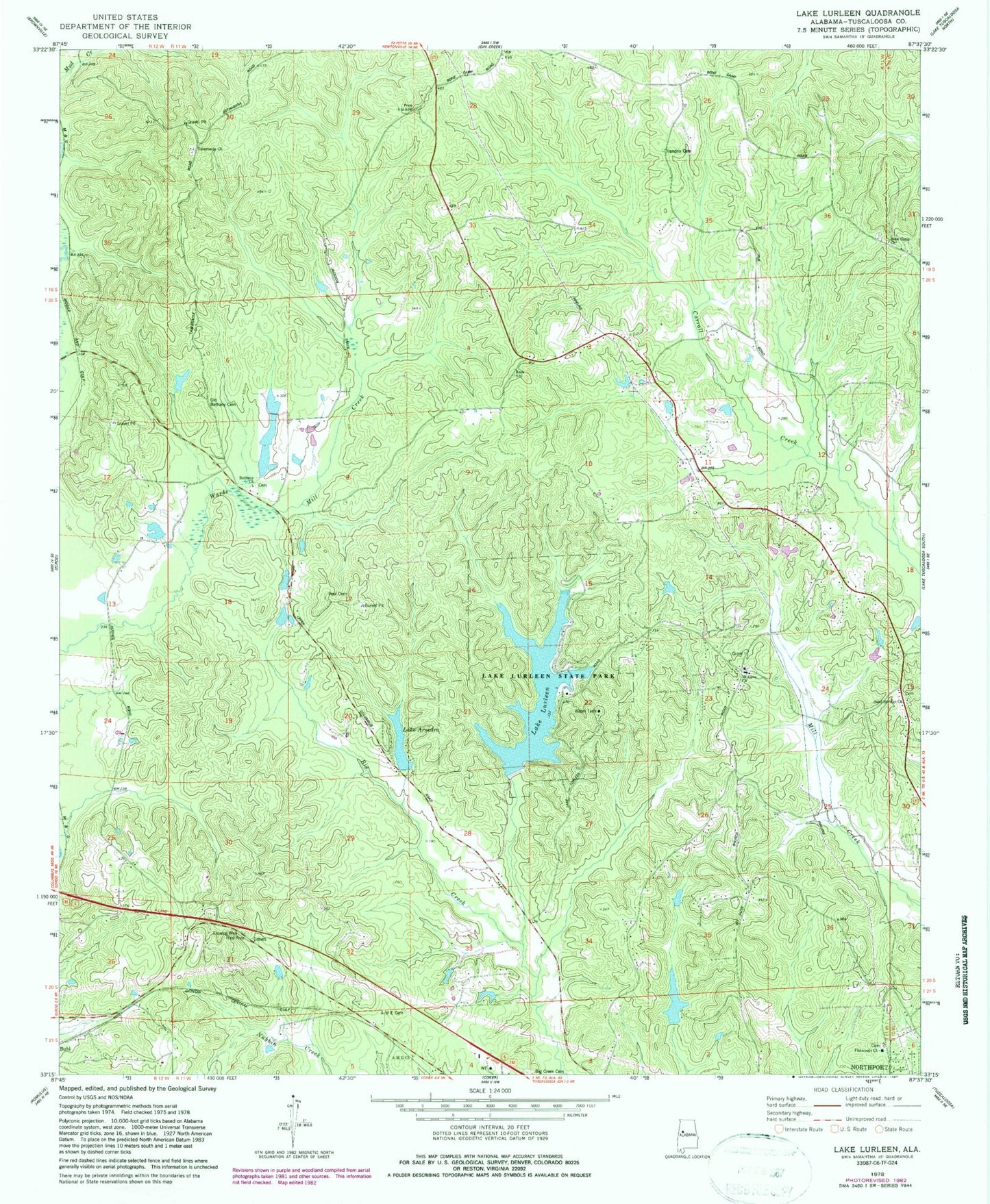
Classic USGS Lake Lurleen Alabama 7.5'x7.5' Topo Map
Couldn't load pickup availability
Historical USGS topographic quad map of Lake Lurleen in the state of Alabama. Map scale may vary for some years, but is generally around 1:24,000. Print size is approximately 24" x 27"
This quadrangle is in the following counties: Tuscaloosa.
The map contains contour lines, roads, rivers, towns, and lakes. Printed on high-quality waterproof paper with UV fade-resistant inks, and shipped rolled.
Contains the following named places: African Methodist Episcopal Church, African Methodist Episcopal Church Cemetery, Bel Air Estates, Bethabara School, Bethany, Bethany Baptist Church, Bethany Cemetery, Bethany School, Big Creek Cemetery, Bone Camp Cemetery, Bone Camp Church, Calvery School, Chapelwood, Cloverdale Estates, Elledge Lake, Elledge Lake Dam, Fellowship Church, Flatwoods Baptist Church, Flatwoods Cemetery, Gem, Guy Cemetery, Hendrix Cemetery, Highview, Hughes Mill, Hughes Mill Creek, Lake Anedna Dam, Lake Arnedra, Lake Lurleen, Lake Lurleen Dam, Lake Lurleen State Park, Mills Lake Dam Lower, Mills Lake Lower, Montgomery Volunteer Fire Department Station 2, Mount Olive, Mount Olive Baptist Church, Mount Olive Cemetery, Mount Olive Community Club, Mount Olive Fire Protection District, Mount Olive School, Northport Division, Old Bethany Cemetery, Pool Cemetery, Prices Store, Sand Springs Cemetery, Sand Springs Church, Saratoga Estates, Shirley, Tabernacle Church, Thorndale, Watkins Cemetery, Western Hills, Western Hills Estates, Westhill, ZIP Code: 35452