MyTopo
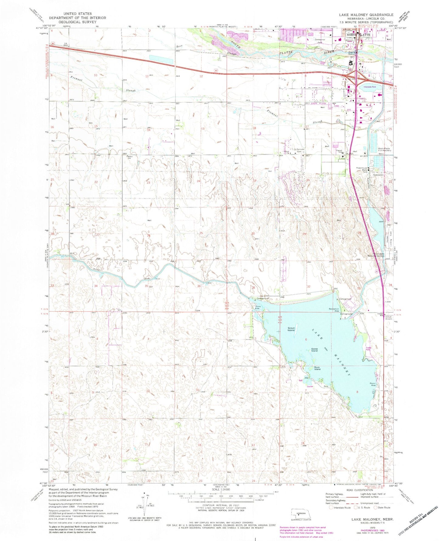
Classic USGS Lake Maloney Nebraska 7.5'x7.5' Topo Map
Couldn't load pickup availability
Historical USGS topographic quad map of Lake Maloney in the state of Nebraska. Map scale may vary for some years, but is generally around 1:24,000. Print size is approximately 24" x 27"
This quadrangle is in the following counties: Lincoln.
The map contains contour lines, roads, rivers, towns, and lakes. Printed on high-quality waterproof paper with UV fade-resistant inks, and shipped rolled.
Contains the following named places: Beer Slough, Centennial Park, Centennial Park Retirement Village, Center School, Church of Christ, D and N Event Center, Duck Island, Floral Lawns Memorial Gardens, Frontier Resort and RV Park, Goose Island, Grace Community Bible Church, Great Plains Health - Hospital, Holiday Trav-L-Park for Campers, Indian Meadows Golf Course, Interstate Park, Lake Maloney, Lake Maloney Golf Course, Lake Maloney State Recreation Area, McDonald Belton Campus Library, Mid Plains Community College, Miller Election Precinct, Miller School, Nebraska State Patrol Troop D, North Platte, North Platte Fish Hatchery, North Platte Recreation Center, Osgood Election Precinct, Osgood Elementary School, Saint Elizabeth Ann Seton Parish, Saint Patrick Catholic Cemetery, Scout Island, Seventh Day Adventist Church, The Mall, Two Tree Island, Valley Church, World Wide Church of God