MyTopo
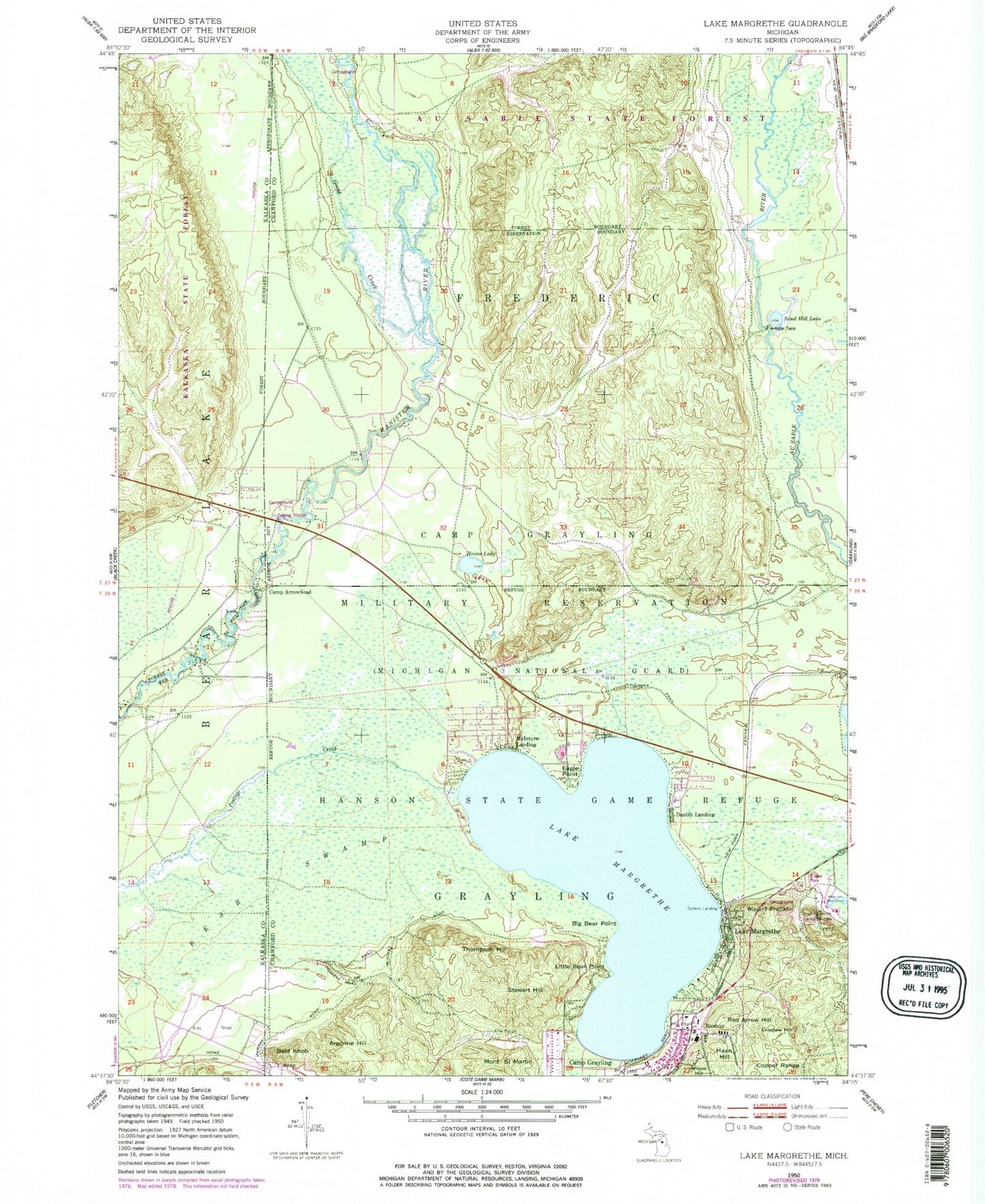
Classic USGS Lake Margrethe Michigan 7.5'x7.5' Topo Map
Couldn't load pickup availability
Historical USGS topographic quad map of Lake Margrethe in the state of Michigan. Typical map scale is 1:24,000, but may vary for certain years, if available. Print size: 24" x 27"
This quadrangle is in the following counties: Crawford, Kalkaska.
The map contains contour lines, roads, rivers, towns, and lakes. Printed on high-quality waterproof paper with UV fade-resistant inks, and shipped rolled.
Contains the following named places: Argonne Hill, Bald Knob, Bear Swamp, Big Bear Point, Camp Arrowhead, Camp Grayling, Croshaw Hill, Danish Landing, Eagle Point, Mount Franklin, Goose Creek, Grayling Winter Recreation Area, Haan Hill, Hanson State Game Refuge, Howes Lake, Little Bear Point, Lake Margrethe, Lake Margrethe, McIntyre Landing, Mont Saint Martin, Red Arrow Hill, Sand Hill Lake, Stewart Hill, Thompson Hill, Wilson Hill, Collens Landing, Rasmus, Lake Margrethe State Forest Campground, Manistee River Bridge State Forest Campground, Upper Manistee River State Forest Campground, United States Government Military Cemetery, Thirty-Second Red Arrow Division Historical Marker