MyTopo
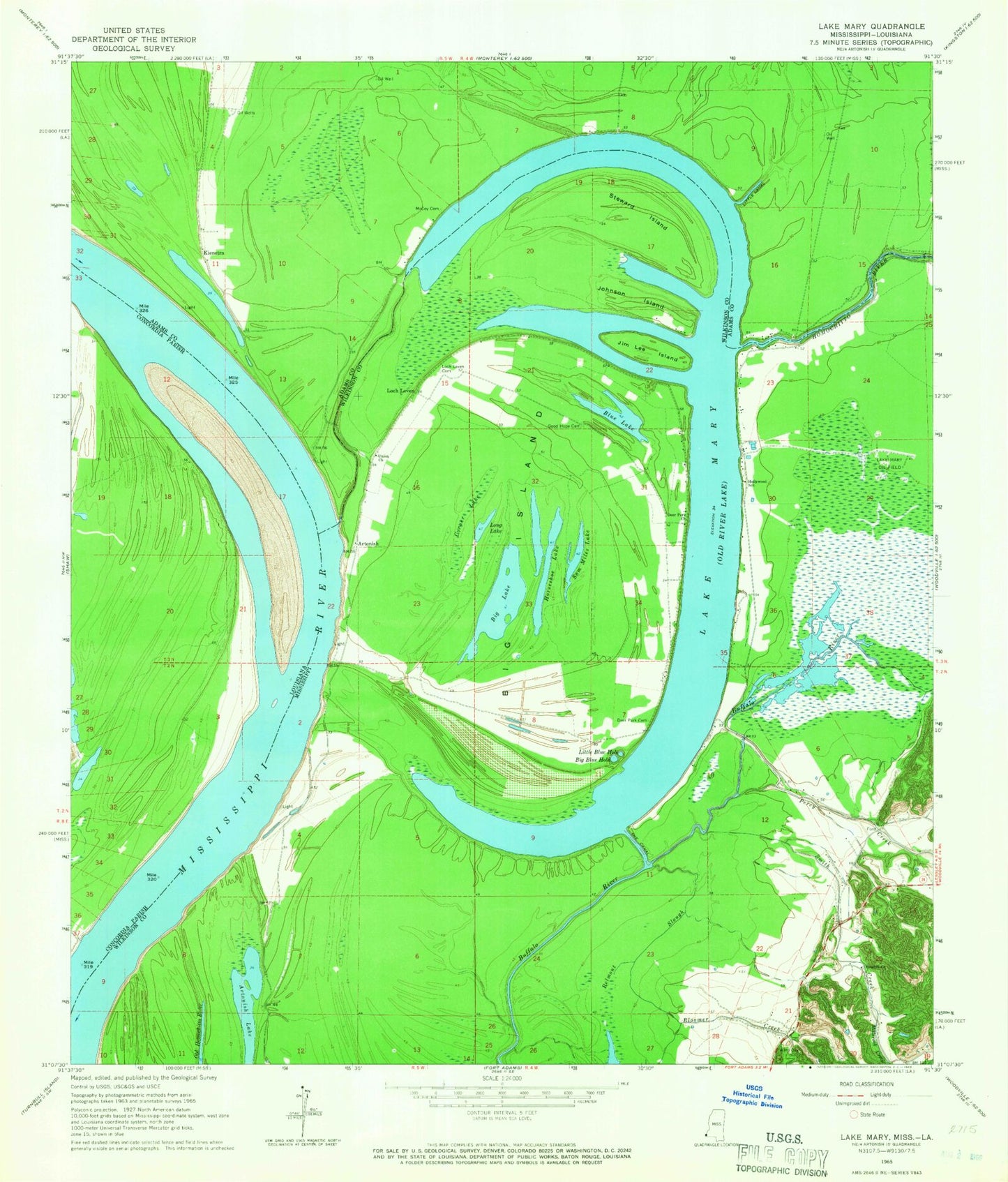
Classic USGS Lake Mary Mississippi 7.5'x7.5' Topo Map
Couldn't load pickup availability
Historical USGS topographic quad map of Lake Mary in the states of Mississippi, Louisiana. Map scale may vary for some years, but is generally around 1:24,000. Print size is approximately 24" x 27"
This quadrangle is in the following counties: Adams, Concordia, Wilkinson.
The map contains contour lines, roads, rivers, towns, and lakes. Printed on high-quality waterproof paper with UV fade-resistant inks, and shipped rolled.
Contains the following named places: Alloway Oil Field, Arnot Oil Field, Artonish, Artonish Lake, Artonish Landing, Artonish Oil Field, Artonish Plantation, Artonish School, Belmont Slough, Beneral School, Big Blue Hole, Big Island, Big Lake, Black Hawk Landing, Black Hawk Point, Bloomer Creek, Blue Lake, Corner Lake, Deer Park Cemetery, Deer Park Church, Deer Park Plantation, Fort Adams Volunteer Fire Department, Foster Lake, Good Hope Cemetery, Hollywood Church, Hollywood Plantation, Hollywood School, Homochitto Cutoff, Homochitto River, Horseshoe Lake, Jim Lee Island, Johnson Island, Kienstra, Kienstra Landing, Kienstra School, Lake Mary, Lake Mary Oil Field, Lake Mary Plantation, Little Blue Hole, Little Canal, Loch Leven, Loch Leven Cemetery, Lochdale Plantation, Long Lake, McCoy Cemetery, Millbrook Creek, Millbrook Plantation, Millbrook School, Morrisana Plantation, North Lake Mary Oil Field, Old Homochitto River, Old River Oil Field, Palmetto Bend, Palmetto Bend Revetment, Pandella Landing, Percy Creek, Rosehill Church, Saint Mary School, Sam Miles Lake, Singleton Cemetery, Singleton Chapel, Smith Creek, Steward Island, The Canal, The Narrows, Union Church, Union Point Landing, Ward Cemetery