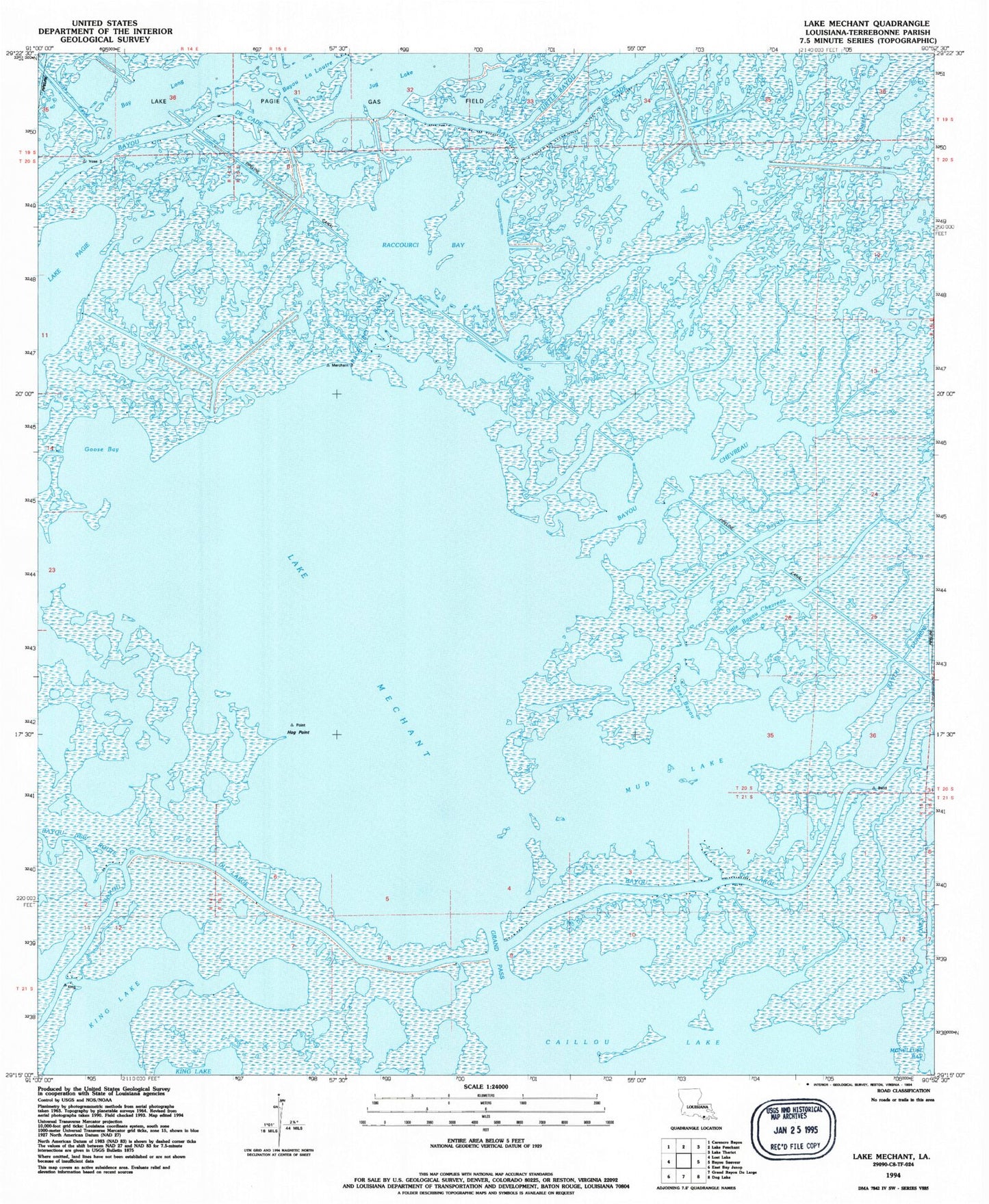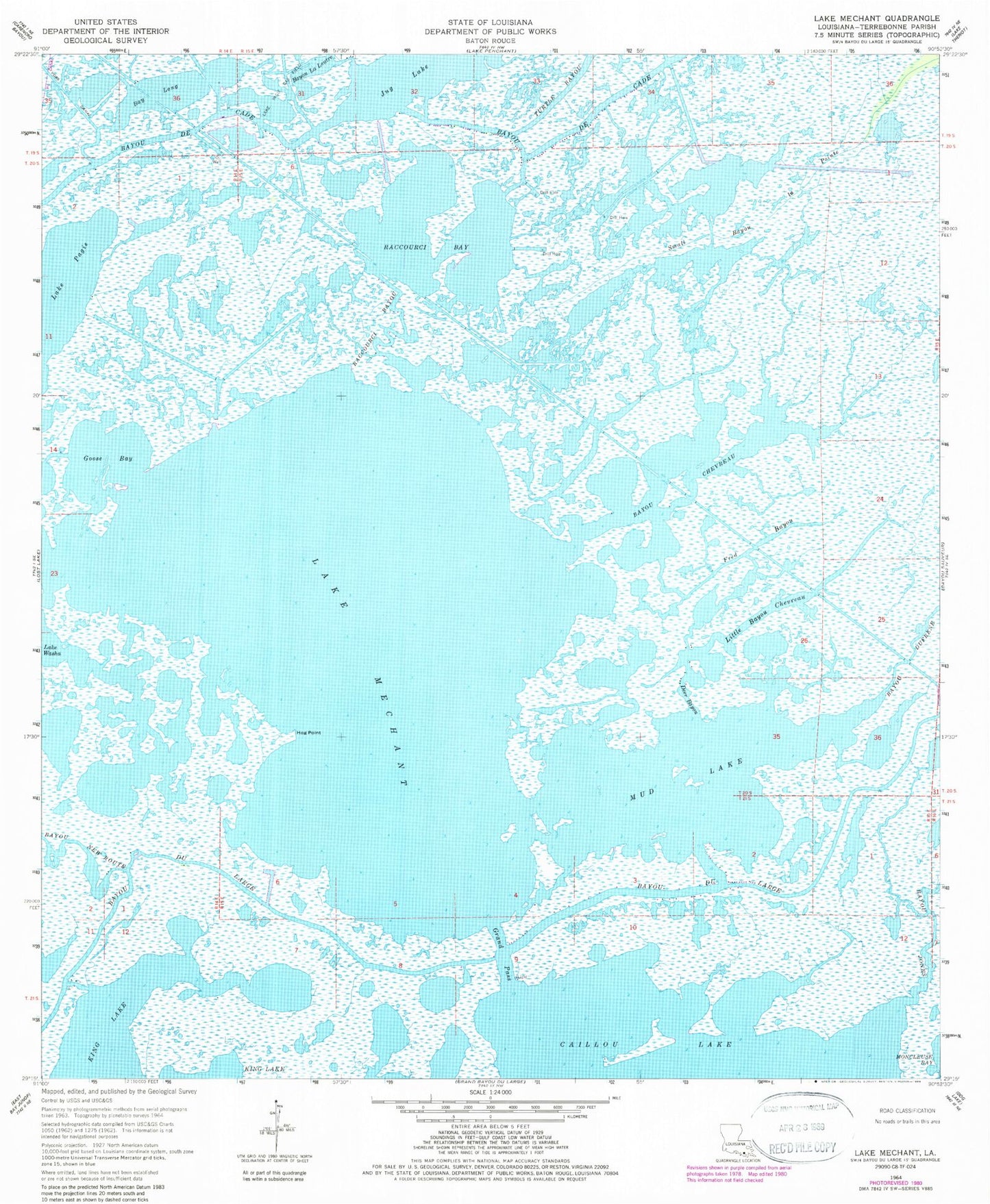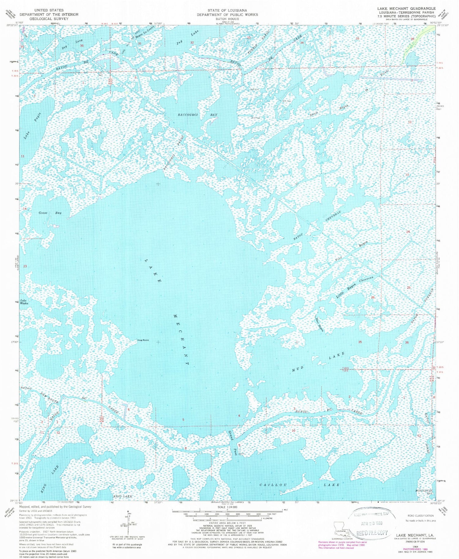
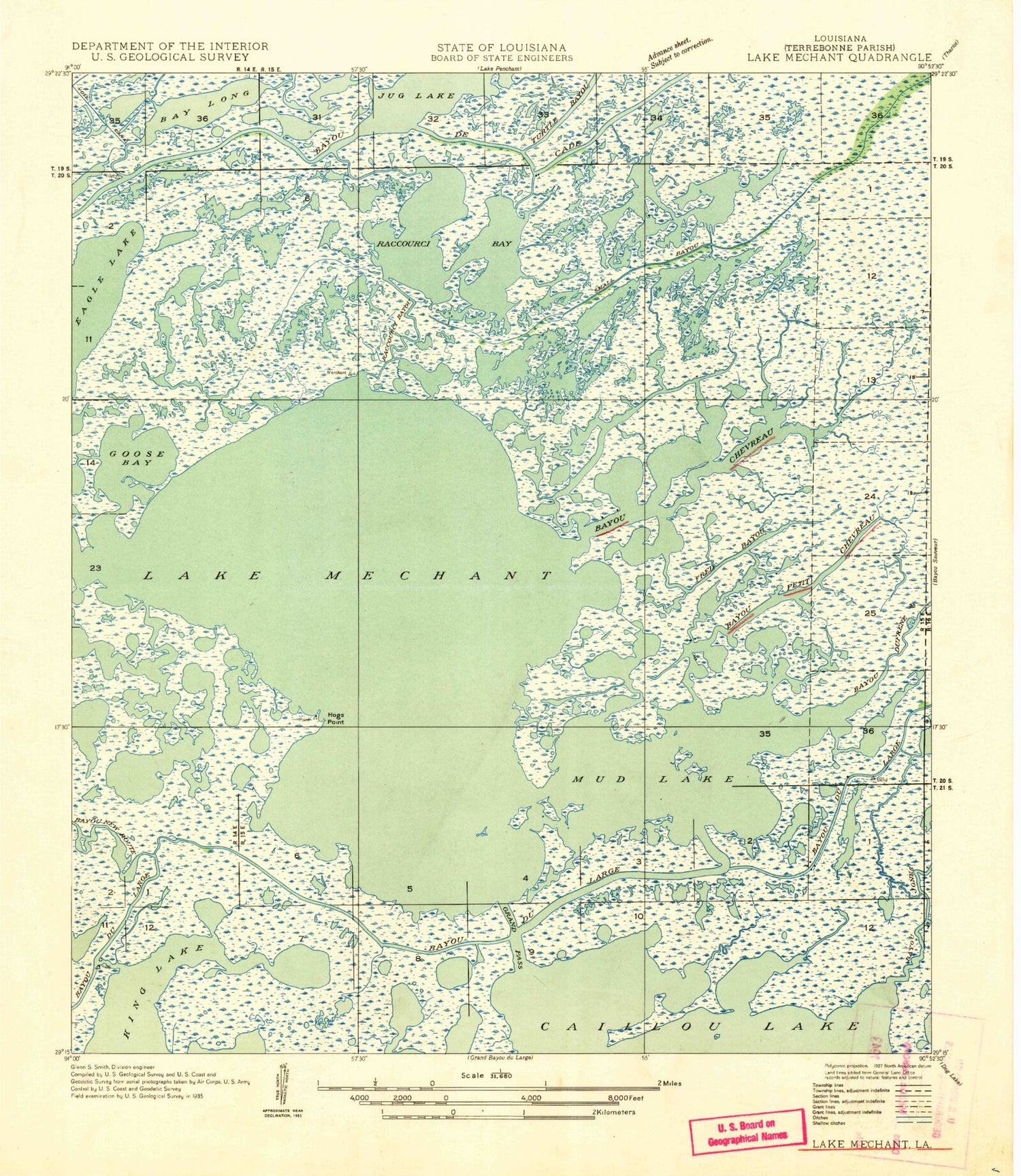
MyTopo
Classic USGS Lake Mechant Louisiana 7.5'x7.5' Topo Map
Couldn't load pickup availability
Historical USGS topographic quad map of Lake Mechant in the state of Louisiana. Map scale may vary for some years, but is generally around 1:24,000. Print size is approximately 24" x 27"
This quadrangle is in the following counties: Terrebonne.
The map contains contour lines, roads, rivers, towns, and lakes. Printed on high-quality waterproof paper with UV fade-resistant inks, and shipped rolled.
Contains the following named places: Bay Long, Bayou Chevreau, Bayou De Cade, Bayou du Large, Bayou Dufrene, Bayou la Loutre, Deer Bayou, Dominick Bayou, Fred Bayou, Goose Bay, Grand Pass, Hog Point, Jug Lake, Lake Mechant, Lake Pagie, Lake Washa, Little Bayou Chevreau, Mud Lake, Parish Governing Authority District 7, Parish Governing Authority District I, Raccourci Bay, Raccourci Bayou, Small Bayou La Pointe, Voss Canal