MyTopo
Classic USGS Lake Michie North Carolina 7.5'x7.5' Topo Map
Couldn't load pickup availability
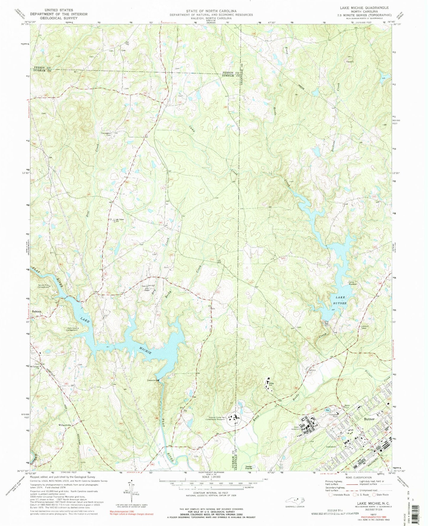
Historical USGS topographic quad map of Lake Michie in the state of North Carolina. Map scale may vary for some years, but is generally around 1:24,000. Print size is approximately 24" x 27"
This quadrangle is in the following counties: Durham, Granville, Person.
The map contains contour lines, roads, rivers, towns, and lakes. Printed on high-quality waterproof paper with UV fade-resistant inks, and shipped rolled.
Contains the following named places: Bahama Volunteer Fire Department Station 1, Butner, Butner Census Designated Place, Butner Post Office, Butner Public Safety Fire and Emergency Services, Butner-Stem Central School, Camp Butner Wildlife Management Area, Camp Creek, Camp Murdock, Carrington Cemetery, Dial Creek, Dickens Creek, Dillon School, Dry Creek, Ellis Chapel, Gantt Lake Dam, Hampton, Hester Lake, Hester Lake Number One Dam, Holly Grove Campground, John Umstead Hospital, Knap of Reeds, Lake Butner, Lake Butner Water Supply Dam, Lake Michie Dam, Mangum Store, Mount Calvert Church, Mount Tabor Church, Picture Creek, Polk Correctional Institution, Pyrophyllite Mine Lake Dam, Rocky Creek, Spruce Pine Campground, Town of Butner, Township of Mangum, Willardville