
MyTopo
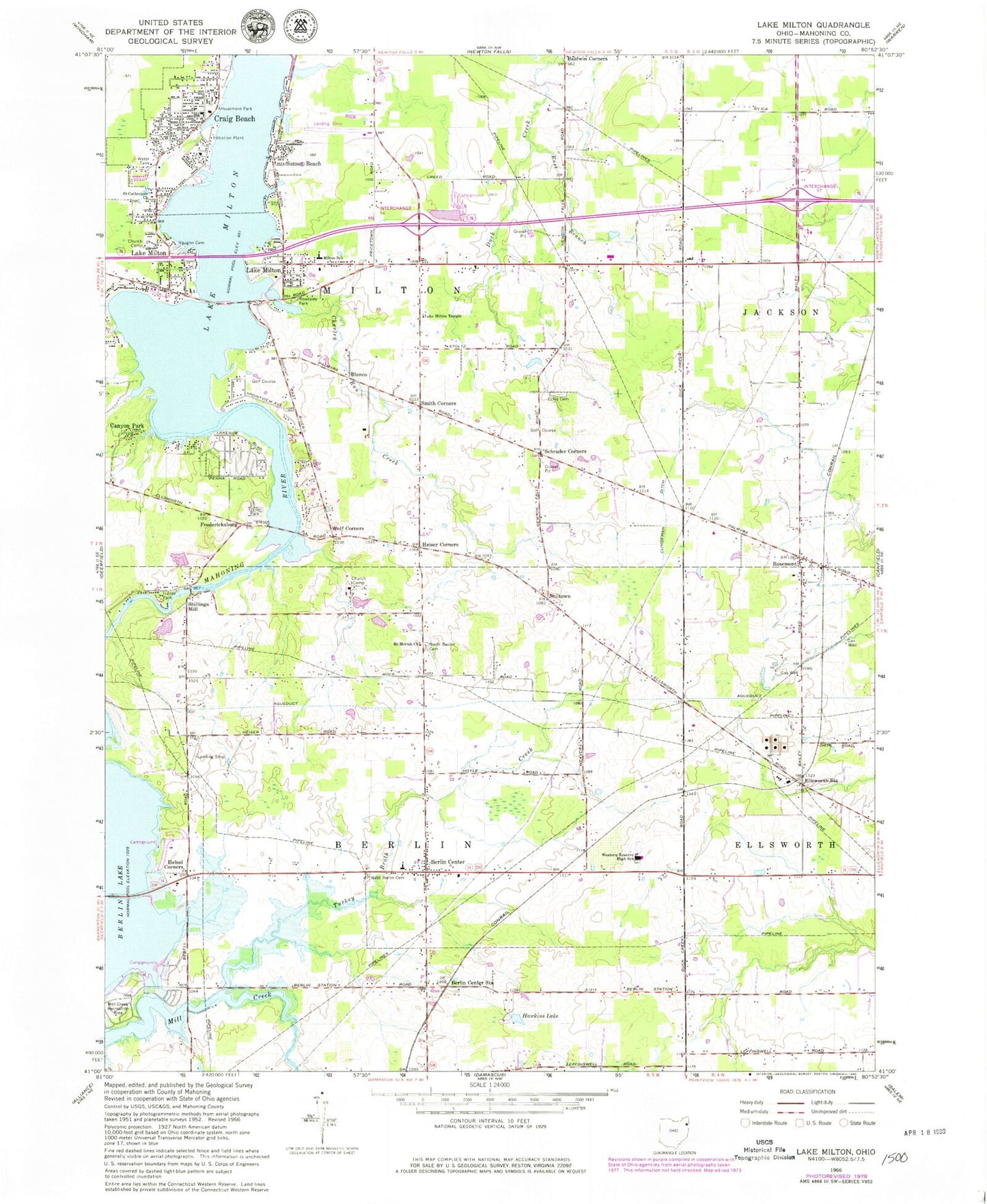
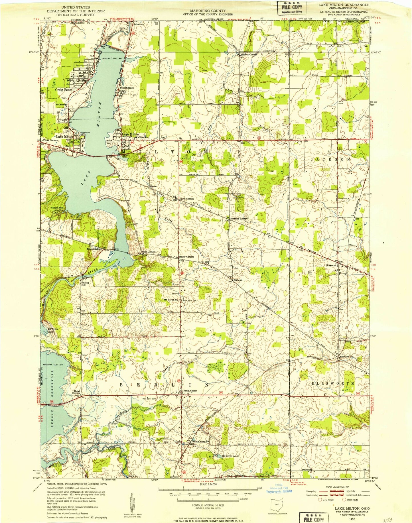
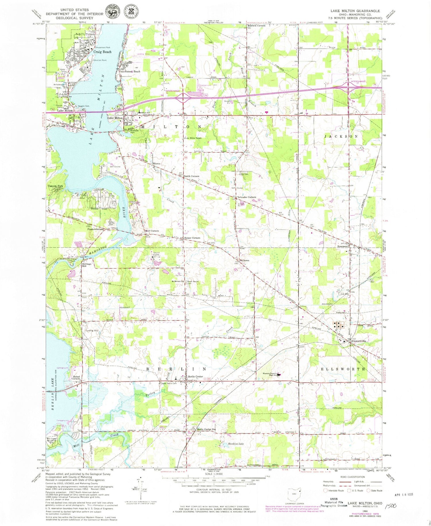
Classic USGS Lake Milton Ohio 7.5'x7.5' Topo Map
Couldn't load pickup availability
Historical USGS topographic quad map of Lake Milton in the state of Ohio. Typical map scale is 1:24,000, but may vary for certain years, if available. Print size: 24" x 27"
This quadrangle is in the following counties: Mahoning, Portage.
The map contains contour lines, roads, rivers, towns, and lakes. Printed on high-quality waterproof paper with UV fade-resistant inks, and shipped rolled.
Contains the following named places: East Branch, Eckis Cemetery, Ellsworth Station, Hawkins Lake, Helsel Corners, Mill Creek Recreation Area, Lake Milton, Mount Moriah Lutheran Church, North Berlin Cemetery, Saint Catherines Church, Sunset Beach, Turkey Broth Creek, Vaughn Cemetery, West Berlin Cemetery, Western Reserve High School, Canyon Park, Craig Beach, Lake Milton, Western Reserve Middle School, Berlin Center, Heiser Corners, Schrader Corners, Smith Corners, Wolf Corners, Lake Milton Temple, Blanco, Rosemont, Shillings Mill, Berlin Center Station, Fredericksburg, Shiltown, Charley Run Creek, Lake Milton Elementary School, Circle C Airport, Township of Berlin, Township of Milton, Craig Beach Post Office (historical), Rosemont Post Office (historical), Blanco Post Office (historical), Lake Milton Post Office, Village of Craig Beach, Lake Milton Mobile Home Park, Berlin Township Fire Department, Milton Township Volunteer Fire Department, Lake Milton Census Designated Place, Sandy Knoll Horse Farm, Lake Milton Rescue Squad, Berlin Center Post Office