MyTopo
Classic USGS Lake Mongoulois Louisiana 7.5'x7.5' Topo Map
Couldn't load pickup availability
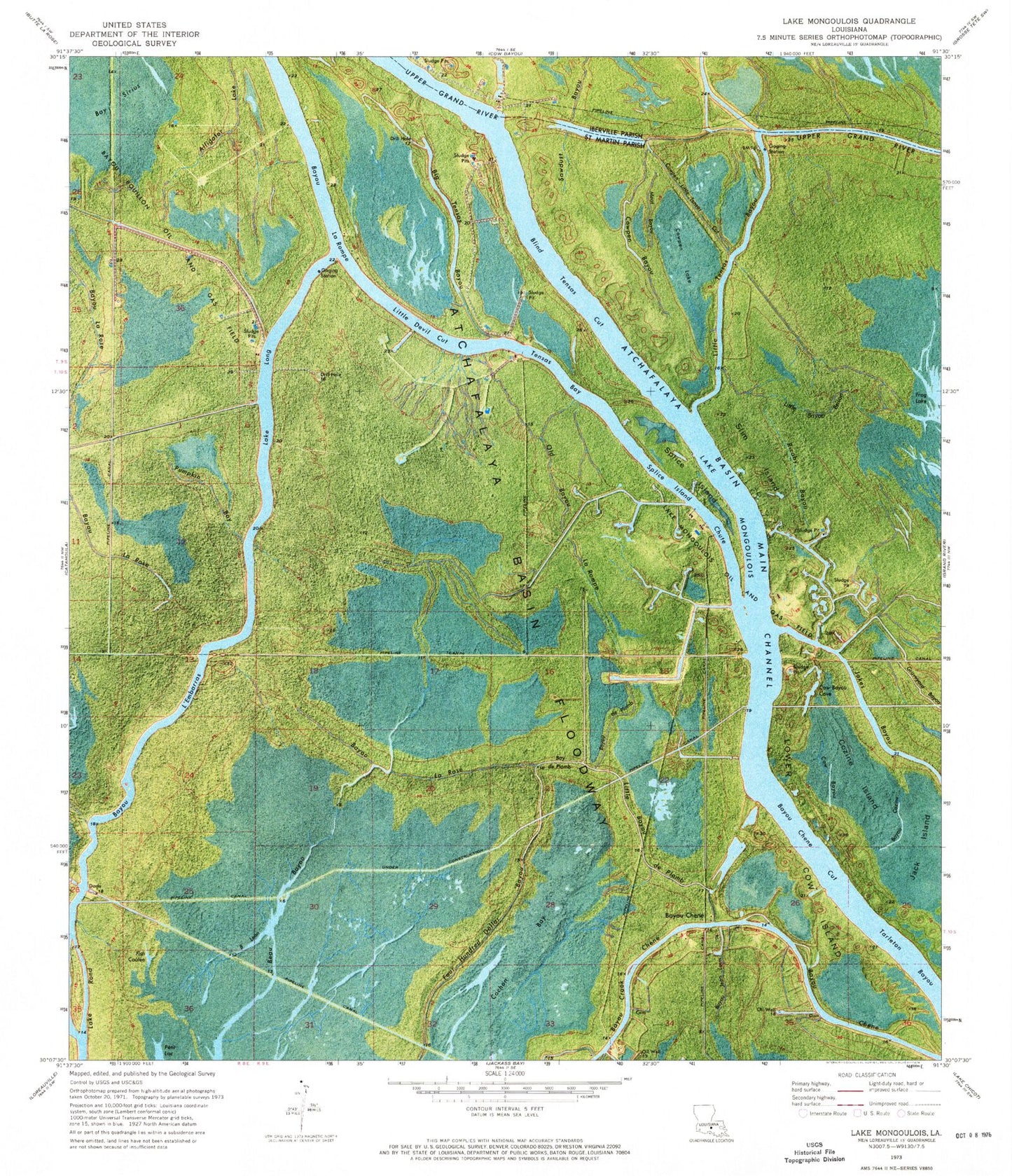
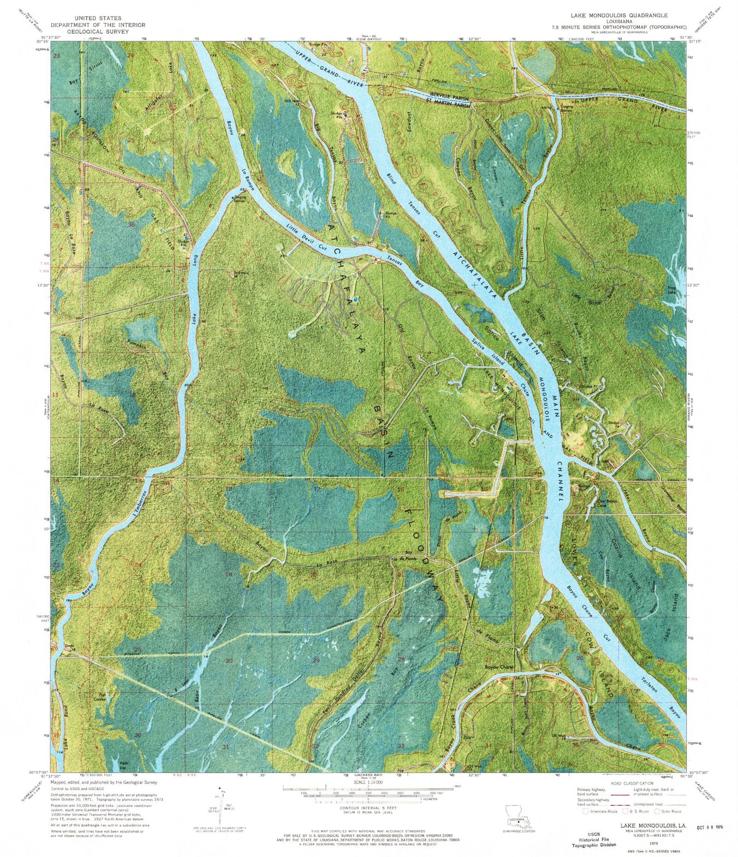
Historical USGS topographic quad map of Lake Mongoulois in the state of Louisiana. Map scale may vary for some years, but is generally around 1:24,000. Print size is approximately 24" x 27"
This quadrangle is in the following counties: Iberville, St. Martin.
The map contains contour lines, roads, rivers, towns, and lakes. Printed on high-quality waterproof paper with UV fade-resistant inks, and shipped rolled.
Contains the following named places: Alligator Lake, Atchafalaya Basin Floodway, Atchafalaya Basin Main Channel, Bay De Plomb, Bayou Bouillon Oil and Gas Field, Bayou Chene, Bayou Chene Cut, Bayou Chene Oil Field, Bayou Crook Chene Oil Field, Bayou De Plomb, Bayou L' Embarras, Bayou La Rompe, Bayou La Rose, Bayou Leon, Beau Bayou, Big Tensas Bayou, Blind Tensas Cut, Cochon Bay, Cow Bayou, Cow Bayou Cove, Cow Island, Cowpen Bayou, Cowpen Lake, Cowpen Little Tensas, Cozine Bayou, Cozine Island, Fish Coulee, Frog Lake, Frog Lake Gas Field, Graveyard Bayou, Jack Island, Lake Mongoulois, Lake Mongoulois Oil and Gas Field, Little Bayou Brison, Little Bayou De Plomb, Little Devil Cut, Little Tensas Bayou, Logan Chute, Long Lake, Meat Bayou, Old Bayou La Rompe, Poison Lake, Pumpkin Bay, Ricaby Bayou, Saint Martin Parish, Slim Island, Splice Island, Splice Island Chute, Tensas Bay