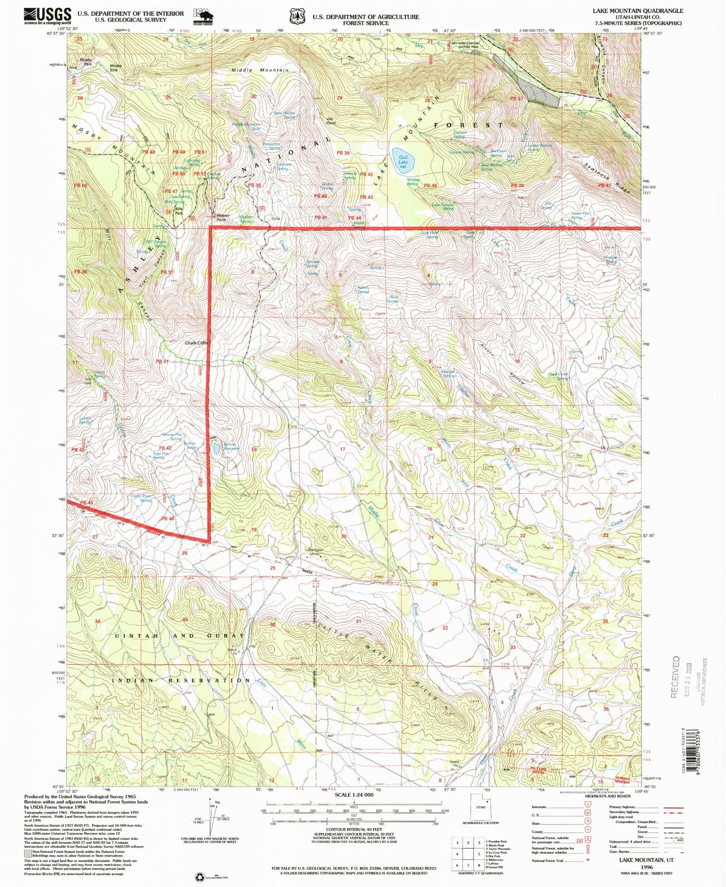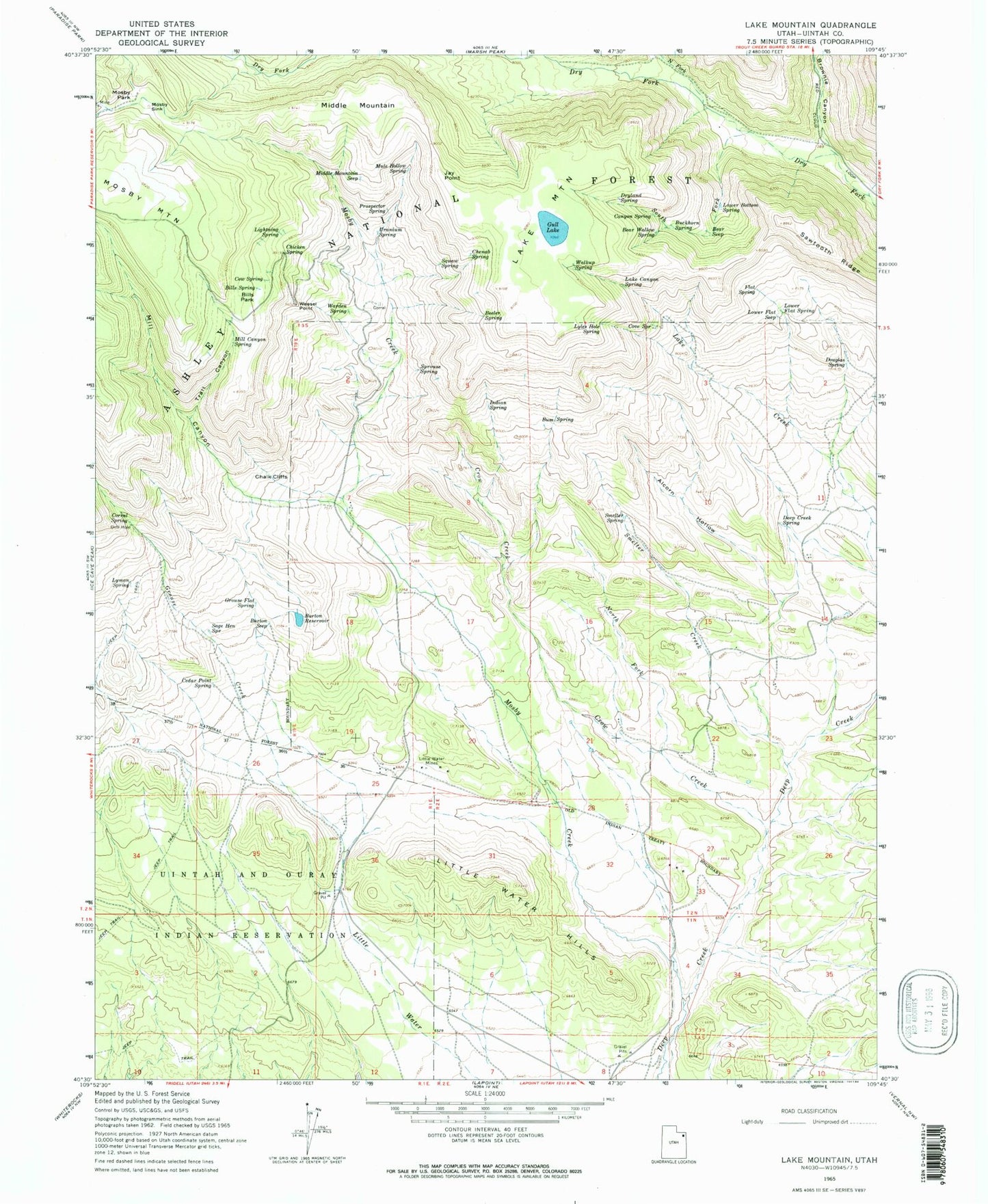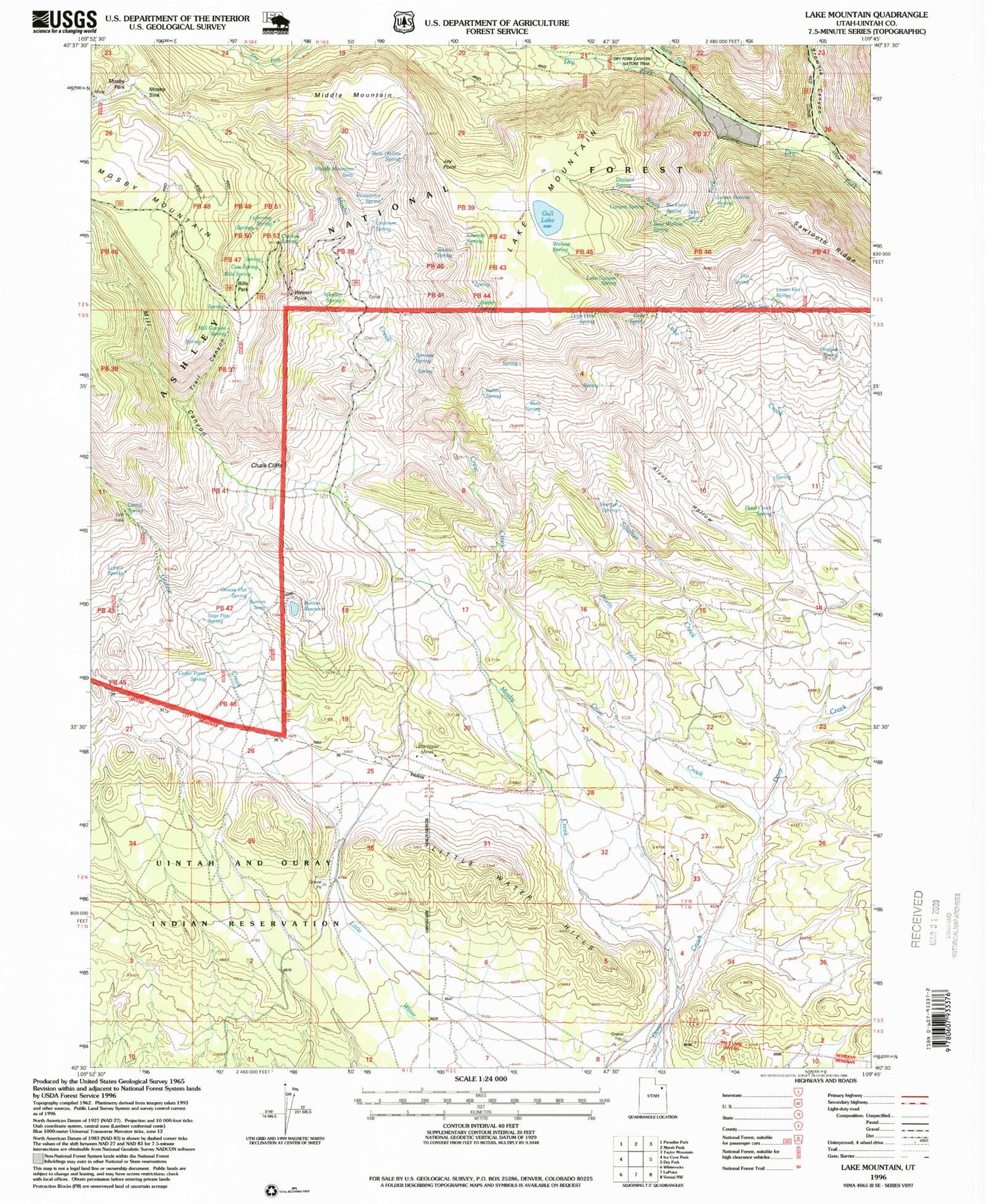

MyTopo
Classic USGS Lake Mountain Utah 7.5'x7.5' Topo Map
Couldn't load pickup availability
Historical USGS topographic quad map of Lake Mountain in the state of Utah. Typical map scale is 1:24,000, but may vary for certain years, if available. Print size: 24" x 27"
This quadrangle is in the following counties: Uintah.
The map contains contour lines, roads, rivers, towns, and lakes. Printed on high-quality waterproof paper with UV fade-resistant inks, and shipped rolled.
Contains the following named places: Alcorn Hollow, Bear Seep, Bear Wallow Spring, Beeler Spring, Bills Park, Bills Spring, Brownie Canyon, Buckhorn Spring, Bum Spring, Burton Reservoir, Burton Seep, Canyon Spring, Cedar Point Spring, Chalk Cliffs, Chenab Spring, Chicken Spring, Corral Spring, Cove Spring, Cow Spring, Crow Creek, Deep Creek Spring, Douglas Spring, Dryland Spring, Flat Spring, Grouse Creek, Grouse Flat Spring, Gull Lake, Indian Spring, Jay Point, Lake Canyon Spring, Lake Creek, Lake Mountain, Lightning Spring, Little Water Hills, Little Water Mines, Lower Bottom Spring, Lower Flat Seep, Lower Flat Spring, Lyles Hole Spring, Lyman Spring, Middle Mountain, Middle Mountain Seep, Mill Canyon, Mill Canyon Spring, Mosby Creek, Mosby Park, Mosby Sink, Mule Hollow Spring, North Fork Crow Creek, North Fork Dry Fork, Prospector Spring, Sage Hen Spring, Sawtooth Ridge, Smelter Creek, Smelter Spring, South Fork Dry Fork, Sprouse Spring, Squaw Spring, Trail Canyon, Uranium Spring, Walkup Spring, Warden Spring, Weasel Point, Chokecherry Flat Reservoir, Knoll Spring, Lower Grouse Reservoir, Mosby Mountain Game Exclosure, North Point Seep