MyTopo
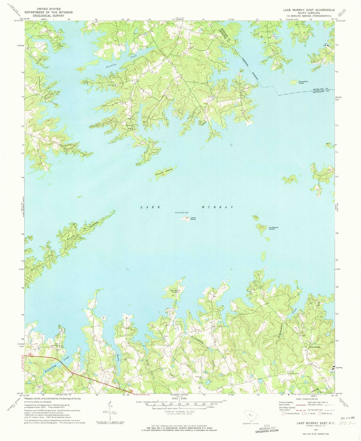
Classic USGS Lake Murray East South Carolina 7.5'x7.5' Topo Map
Couldn't load pickup availability
Historical USGS topographic quad map of Lake Murray East in the state of South Carolina. Typical map scale is 1:24,000, but may vary for certain years, if available. Print size: 24" x 27"
This quadrangle is in the following counties: Lexington, Richland.
The map contains contour lines, roads, rivers, towns, and lakes. Printed on high-quality waterproof paper with UV fade-resistant inks, and shipped rolled.
Contains the following named places: Beaverdam Creek, Beech Creek, Bundrick Island, Clemons Branch, Counts Island, Eighteenmile Creek, Jim Spence Islands, Lunch Island, Mount Horeb Church, Rocky Creek, Saint Johns Church, Saint Peters Church, Shull Island, Susie Ebert Island, Twentymile Creek, Providence, South Carolina Noname 32087 D-1714 Dam, Bickleys Pond, Dutchman Shores, Hallmark Shores, Harbor Side, Lake Point, Lands End, Newberg School (historical), Newberg School (historical), Peters, Pine Point, Providence Church, Providence School (historical), Rollingwood, Saint Johns School (historical), Saint Thomas Cemetery, Shady Acres, Countsville Church, Saint Thomas Lutheran Church, Stinking Creek, Lake Murray of Richland Census Designated Place, Lexington County Fire Service Crossroads Station 23