MyTopo
Classic USGS Lake Murray West South Carolina 7.5'x7.5' Topo Map
Couldn't load pickup availability
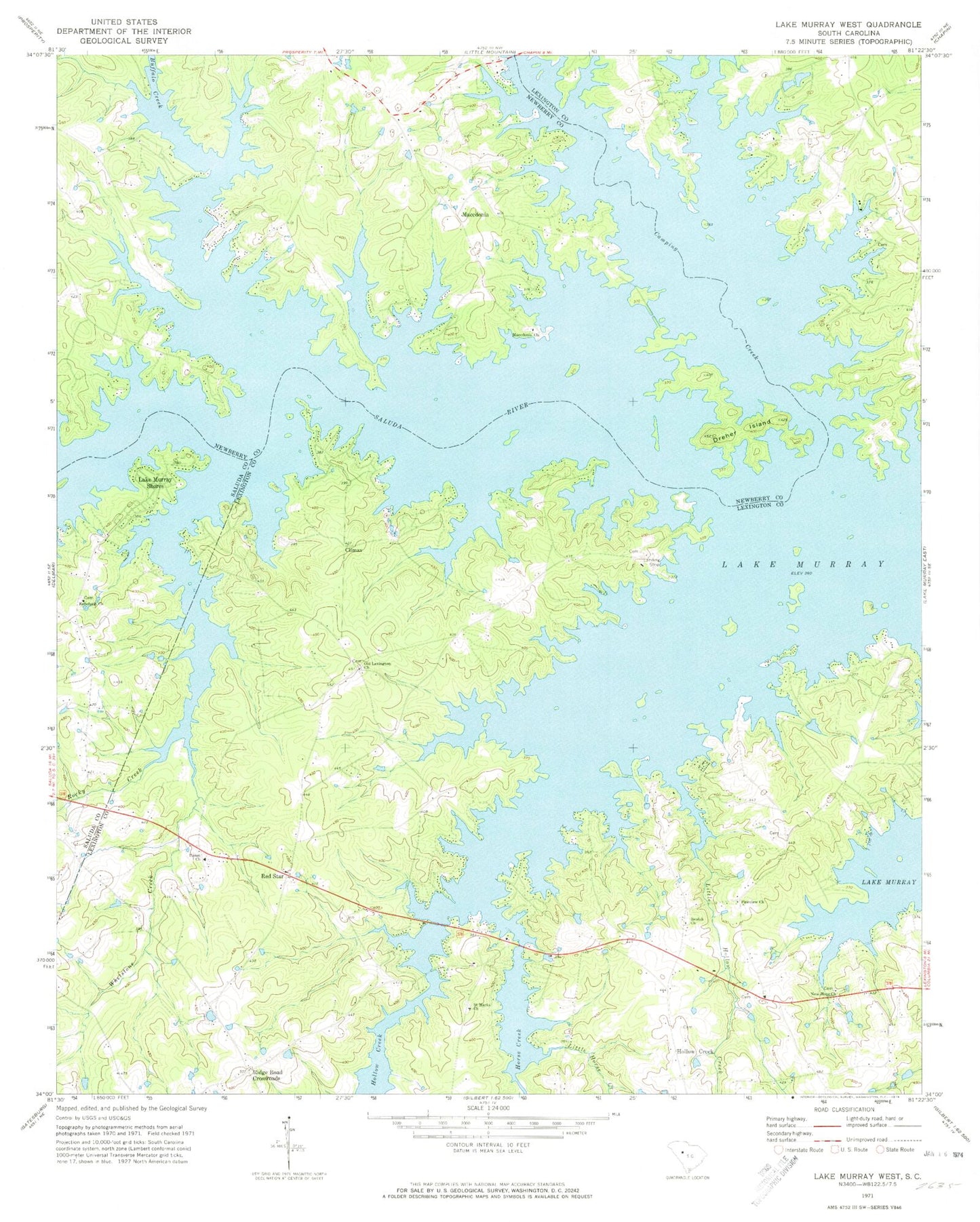
Historical USGS topographic quad map of Lake Murray West in the state of South Carolina. Typical map scale is 1:24,000, but may vary for certain years, if available. Print size: 24" x 27"
This quadrangle is in the following counties: Lexington, Newberry, Saluda.
The map contains contour lines, roads, rivers, towns, and lakes. Printed on high-quality waterproof paper with UV fade-resistant inks, and shipped rolled.
Contains the following named places: Buffalo Creek, Camping Creek, Dreher Island, Horse Creek, Little Hollow Creek, Little Horse Creek, Lake Murray, New Hope Church, Pineview Church, Rocky Creek, Climax, Ridge Road Crossroads, Billy Dreher Island State Park, Hollys Ferry (historical), Jug Hole, Living Inn, Lominick Point, Lowmans Crossroads (historical), Macedonia Cemetery, Hollow Creek, Lake Murray Shores, Macedonia, Red Star, Acapulco, Amicks Ferry (historical), Climax School (historical), Ella, Good Hope Church (historical), Hendrix Cemetery, Hollow Creek Community Center, Hollow Creek School (historical), Lake Village, Lazy Day Acres, Longview Plant, Mallard Bay, Milmont Shores, Old Lexington Cemetery, Oswald Park, Red Star School (historical), Sease Cemetery, Snug Harbor, Hollow Creek, Macedonia Lutheran Church, Beulah Church, Old Lexington Church, Rehoboth Church, Saint Marks Church, Union Lutheran Church, Whetstone Creek, Shealy Airport, Lexington County Fire Service Hollow Creek Station 2, Lexington County Fire Service Cedar Grove Station 29