
MyTopo
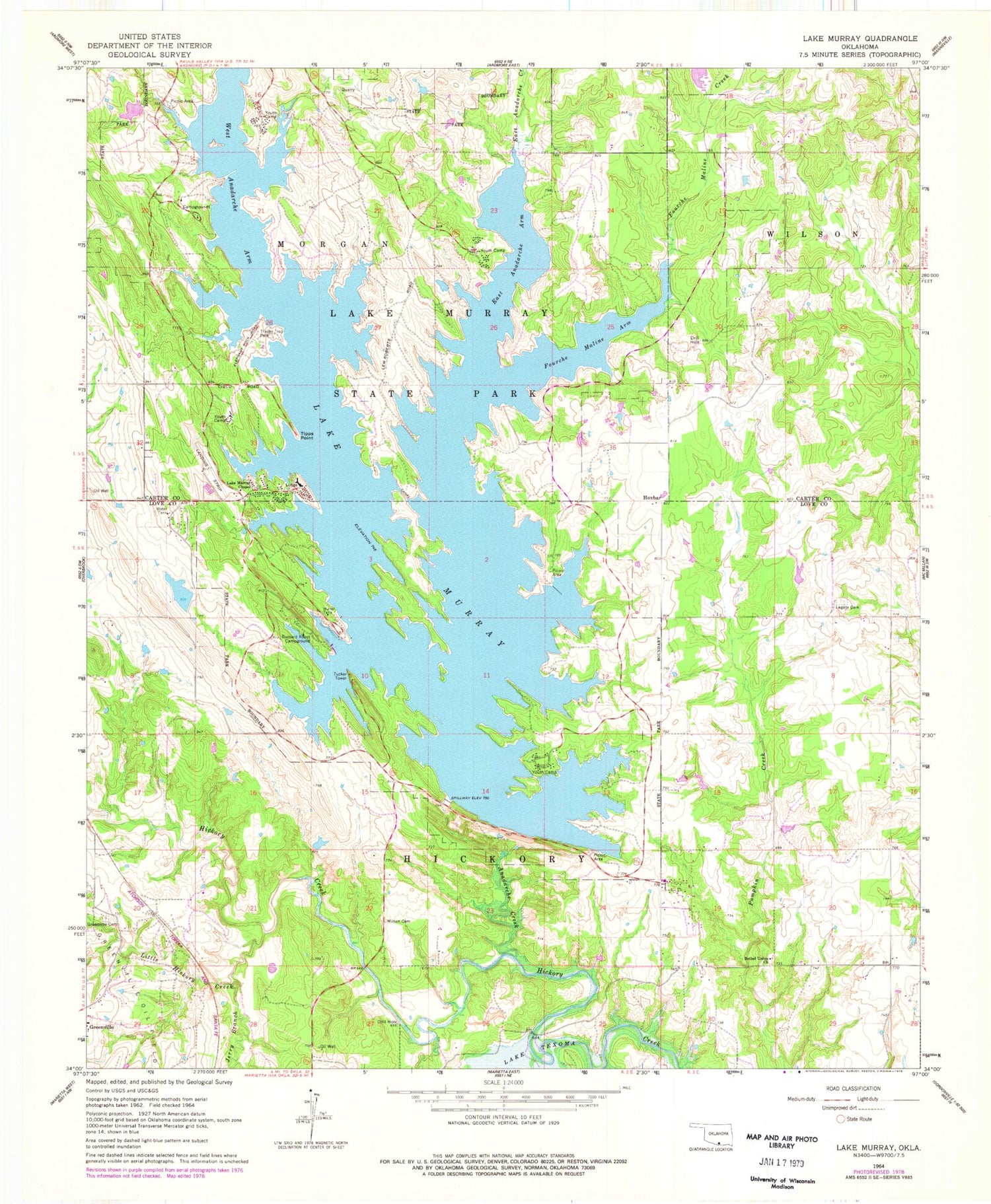
Classic USGS Lake Murray Oklahoma 7.5'x7.5' Topo Map
Couldn't load pickup availability
Historical USGS topographic quad map of Lake Murray in the state of Oklahoma. Typical map scale is 1:24,000, but may vary for certain years, if available. Print size: 24" x 27"
This quadrangle is in the following counties: Carter, Love.
The map contains contour lines, roads, rivers, towns, and lakes. Printed on high-quality waterproof paper with UV fade-resistant inks, and shipped rolled.
Contains the following named places: Anadarche Creek, Bethel Union Church, Buzzard Roost Campground, East Anadarche Arm, East Anadarche Creek, Fourche Maline Arm, Fourche Maline Creek, Greenville Cemetery, Jerry Branch, Lake Murray Chapel, Lake Murray State Park, Legate Cemetery, Little Hickory Creek, Lake Murray, Tipps Point, Tucker Tower, West Anadarche Arm, Wilson Cemetery, Hoxbar, Lake Murray State Park Airport (historical), Lake Murray Dam, Oknoname 085001 Dam, Oknoname 085001 Reservoir, H T Hicks 1 Dam, H T Hicks Reservoir, Greenville Census Designated Place, Lake Murray Village Volunteer Fire Department, Eastside Fire Department, Ran Cemetery


