MyTopo
Classic USGS Lake Murvaul Texas 7.5'x7.5' Topo Map
Couldn't load pickup availability
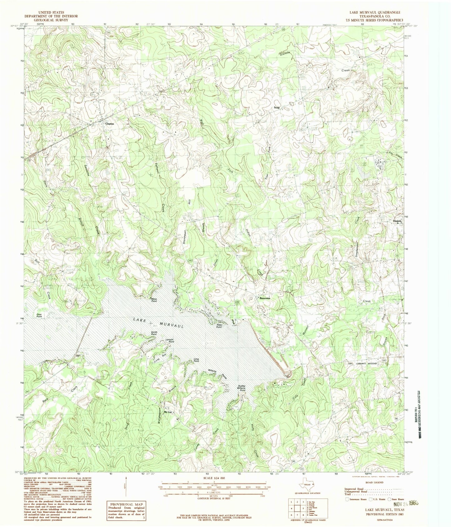
Historical USGS topographic quad map of Lake Murvaul in the state of Texas. Map scale may vary for some years, but is generally around 1:24,000. Print size is approximately 24" x 27"
This quadrangle is in the following counties: Panola.
The map contains contour lines, roads, rivers, towns, and lakes. Printed on high-quality waterproof paper with UV fade-resistant inks, and shipped rolled.
Contains the following named places: Beck Creek, Bethlehem Church, Boy Scouts of America Camp, Bull Creek, Buncome, Caney Creek, Carrico Cemetery, Clayton, Clayton Post Office, Clayton Volunteer Fire Department, Colo Creek, Daniels, Daniels Ditch, Davis Branch, Dudley Williams Point, East Fork Indian Creek, Fallwell Creek, First Baptist Church, Freewill Church, Gray Point, Heath Long Cemetery, Holly Creek, Holton - Lindsey Cemetery, Indian Creek, Jones Branch, Lake Murvaul, Lampin Point, Long Bay, Long Point, McCoy Church, Miller Cemetery, Moss Point, Mount Bethel Church, Murvaul Bayou Dam, Murvaul Bayou Reservoir, Page Cemetery, Panola Lake, Panola Lake Dam, Pleasant Grove Church, Ritter Point, Ross - Etheridge Cemetery, Sand Creek, Sessums Creek, Smith Point, Snap, Snap Cemetery, Stephenson Creek, Stonewall Hill, Thomas Cemetery, Union Murvaul Cemetery, West Fork Indian Creek, Williams Point, Witherspoon Branch