MyTopo
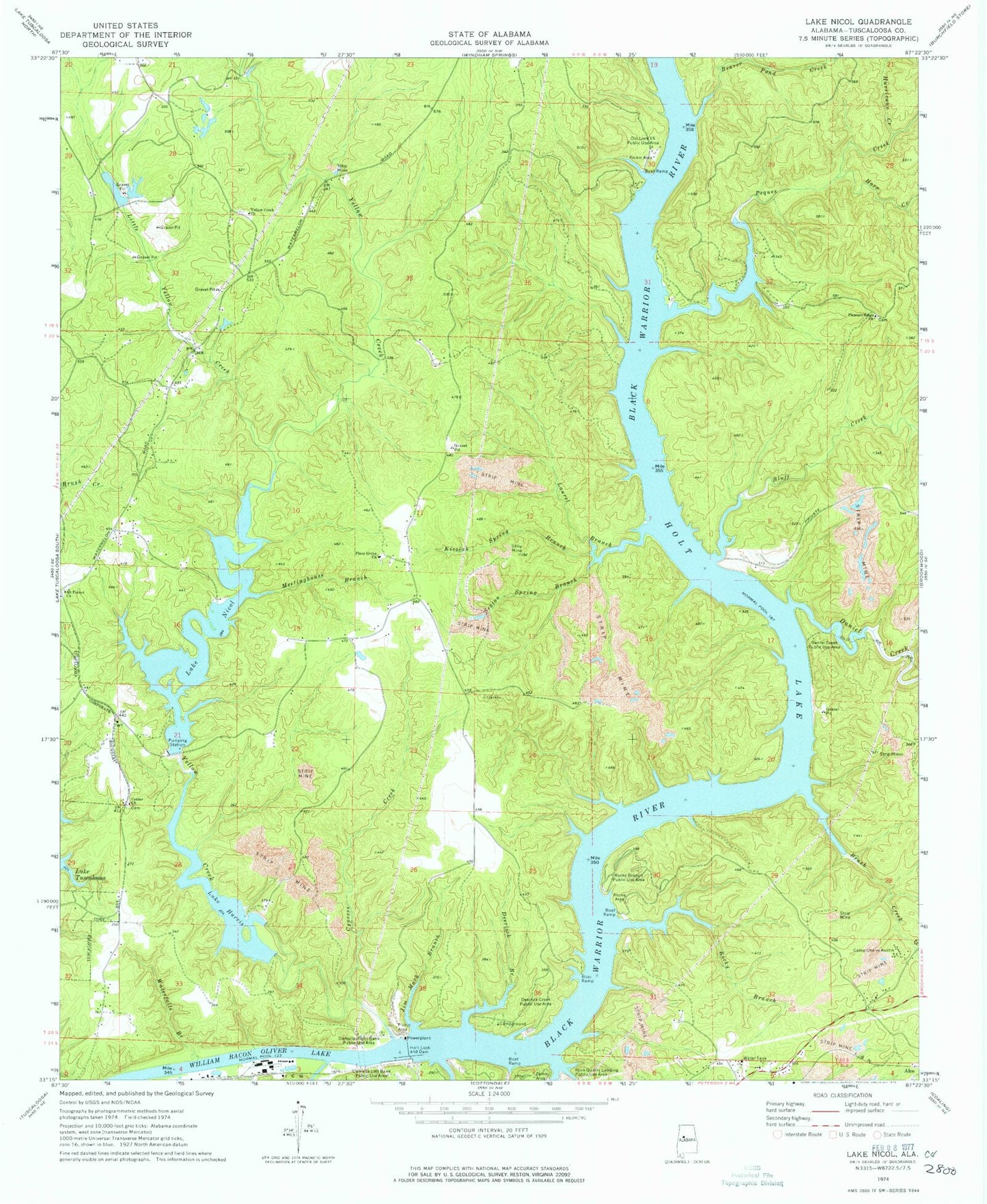
Classic USGS Lake Nicol Alabama 7.5'x7.5' Topo Map
Couldn't load pickup availability
Historical USGS topographic quad map of Lake Nicol in the state of Alabama. Map scale may vary for some years, but is generally around 1:24,000. Print size is approximately 24" x 27"
This quadrangle is in the following counties: Tuscaloosa.
The map contains contour lines, roads, rivers, towns, and lakes. Printed on high-quality waterproof paper with UV fade-resistant inks, and shipped rolled.
Contains the following named places: Arnolds Shoal, Bakers Mill, Beaver Pond Creek, Blackburns Mill, Bluff Creek, Brush Creek, Camp Cherry Austin, Cedar Tree, Center Cemetery, Center Church, Community Church, Cunningham Number 1 Dam, Cypress Creek, Damsite Left Bank Recreation Area, Daniel Creek, Daniel Creek Public Use Area, Deerlick Branch, Deerlick Creek Public Use Area, Douthys Spring Branch, Fleetwood Church, Flemons Shoal, Flint Ridge School, Fox, Gilmore, Hog Shoals, Hollis Ferry, Holt Damsite-Left Bank Public Use Area, Holt Damsite-Right Bank Public Use Area, Holt Lake, Holt Lock and Dam, Holy Bible Church, Hope School, Horn Creek, Howells Camp, Howse Camp, Hurricane Creek, Jim Mack Branch, Kizziah Spring Branch, Lake Harris, Lake Harris Dam, Lake Nicol, Lake Nicol Dam, Lakeridge, Langstons Shoal, Laurel Branch, Lexington Downs, Lick Branch, Little Star Church, Little Yellow Creek, Lock Number Fifteen, Lock Number Five, Lock Number Fourteen, Lock Number Six, Lock Number Thirteen, Meetinghouse Branch, Mossy Shoal, Mount Parron Church, Nicol Fire Department, Old Lock 15 Public Use Area, Peques Creek, Piney Grove Baptist Church, Piney Grove Cemetery, Pleasant Ridge Cemetery, Pleasant Ridge Church, Rock Island, Rock Quarry Landing Public Use Area, Rocky Branch, Rocky Branch Public Use Area, Rose Shoal, Scales, Scales Cemetery, Scales Lake, Sellers Shoal, Sexton Spring Branch, Sniders Shoal, Tidewater, Tuscaloosa Fire Rescue Station 10, Wallace Ferry, Wards Shoal, Waterfalls Branch, Yacht Club Bay Dam Number 15, Yacht Club Bay Lake Number 15, Yellow Creek, Yellow Creek Cemetery, Yellow Creek Church, Yellow Creek Volunteer Fire Department, ZIP Code: 35406