MyTopo
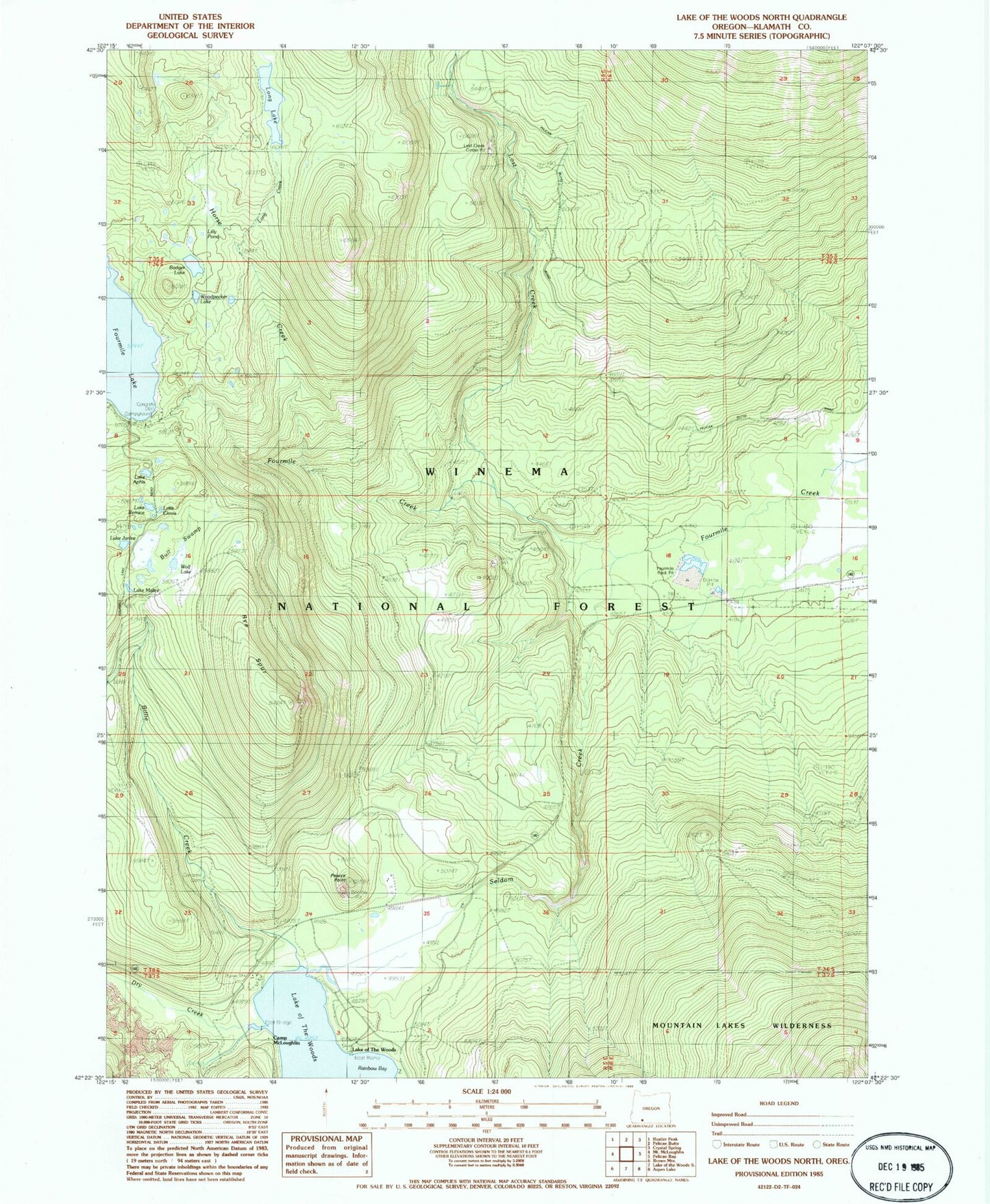
Classic USGS Lake of the Woods North Oregon 7.5'x7.5' Topo Map
Couldn't load pickup availability
Historical USGS topographic quad map of Lake of the Woods North in the state of Oregon. Typical map scale is 1:24,000, but may vary for certain years, if available. Print size: 24" x 27"
This quadrangle is in the following counties: Klamath.
The map contains contour lines, roads, rivers, towns, and lakes. Printed on high-quality waterproof paper with UV fade-resistant inks, and shipped rolled.
Contains the following named places: Billie Creek, Lake Aphis, Lake Bernice, Badger Lake, Bull Swamp, Camp McLoughlin, Cascade Canal, Lake Clovis, Dry Creek, Greylock Mountain Trail, Horse Creek, Lilly Pond, Long Creek, Long Lake, Long Lake Camp, Lost Creek, Lost Peak Trail, Lake Malice, Pearce Point, Rye Spur, Seldom Creek, Wolf Lake, Woodpecker Lake, Fourmile Lake Dam, Fourmile Flat Quarry, Great Meadows Recreation Site, Four Mile Lake Trail, Rye Spur Trail, Lake of the Woods Resort, Lost Creek Cinder Pit, Cottonwood Camp, Lake Janice, Lake of the Woods, Aspen Point Recreation Site, White Pine Campground (historical), Rainbow Bay Recreation Site, Fourmile Lake Recreation Site, Fourmile Rock Pit, Lake of the Woods Post Office (historical), Lake of the Woods Resort Marina, Rainbow Bay Boat Launch, Aspen Point Campground Boat Ramp, Fourmile Lake Boat Ramp