
MyTopo
Classic USGS Lake Park Georgia 7.5'x7.5' Topo Map
Couldn't load pickup availability
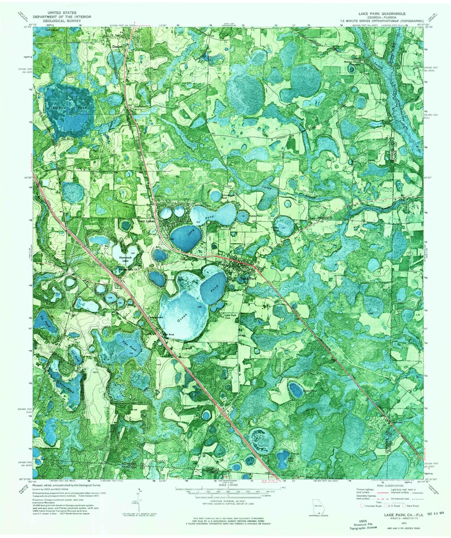
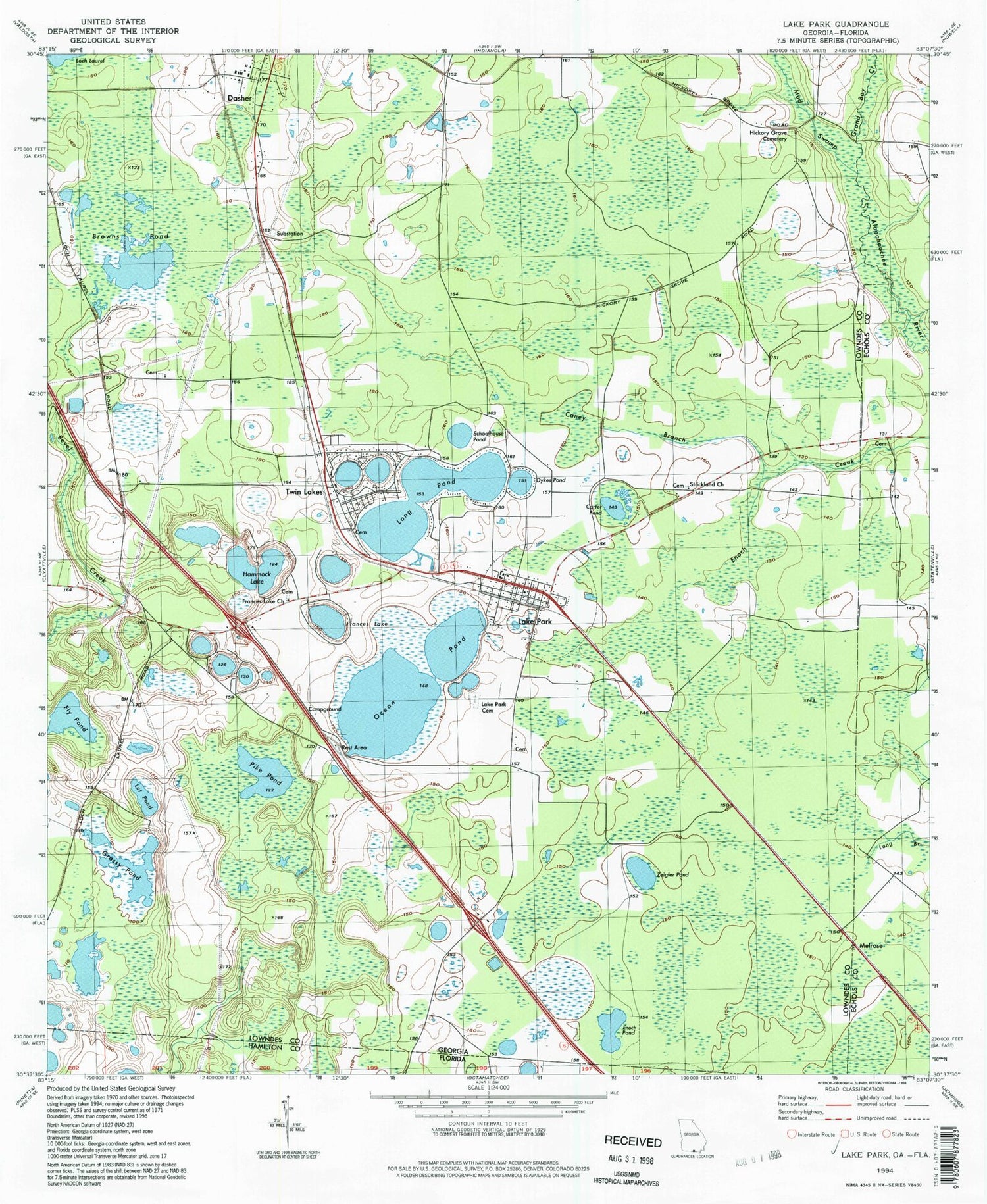
Historical USGS topographic quad map of Lake Park in the state of Georgia. Map scale may vary for some years, but is generally around 1:24,000. Print size is approximately 24" x 27"
This quadrangle is in the following counties: Echols, Hamilton, Lowndes.
The map contains contour lines, roads, rivers, towns, and lakes. Printed on high-quality waterproof paper with UV fade-resistant inks, and shipped rolled.
Contains the following named places: Bonet Lake, Boyd Pond, Bradford Mill, Browns Pond, Caney Branch, Carrolls Pond, Carter Pond, City of Lake Park, Clayton Lake, Concord School, Corinth Church, County Line School, Cypress Pond, Dasher, Dykes Pond, Enoch Pond, Fly Pond, Frances Lake, Frances Lake Church, Grand Bay Creek, Grassy Pond, Hammock Lake, Herring, Hickory Grove Cemetery, Horselot Lake, Indian Lake, Lake Hammock Dam East, Lake Hammock Dam West, Lake Hammock East, Lake Hammock West, Lake Park, Lake Park Cemetery, Lake Park Division, Lake Park Elementary School, Lake Park Police Department, Lake Park Post Office, Lake Park Volunteer Fire Department, Long Pond, Lot Pond, Melrose, Mill Store Plaza Shopping Center, Mud Swamp, Nasty Pond, Ocean Pond, Pike Pond, Saddle Bags Pond, Schoolhouse Pond, Strickland Church, Toms Pond, Town of Dasher, Twin Lakes, Twin Lakes Church, Twin Lakes Volunteer Fire Department, Weisenbaker School, Zeigler Pond