MyTopo
Classic USGS Lake Pillsbury California 7.5'x7.5' Topo Map
Couldn't load pickup availability
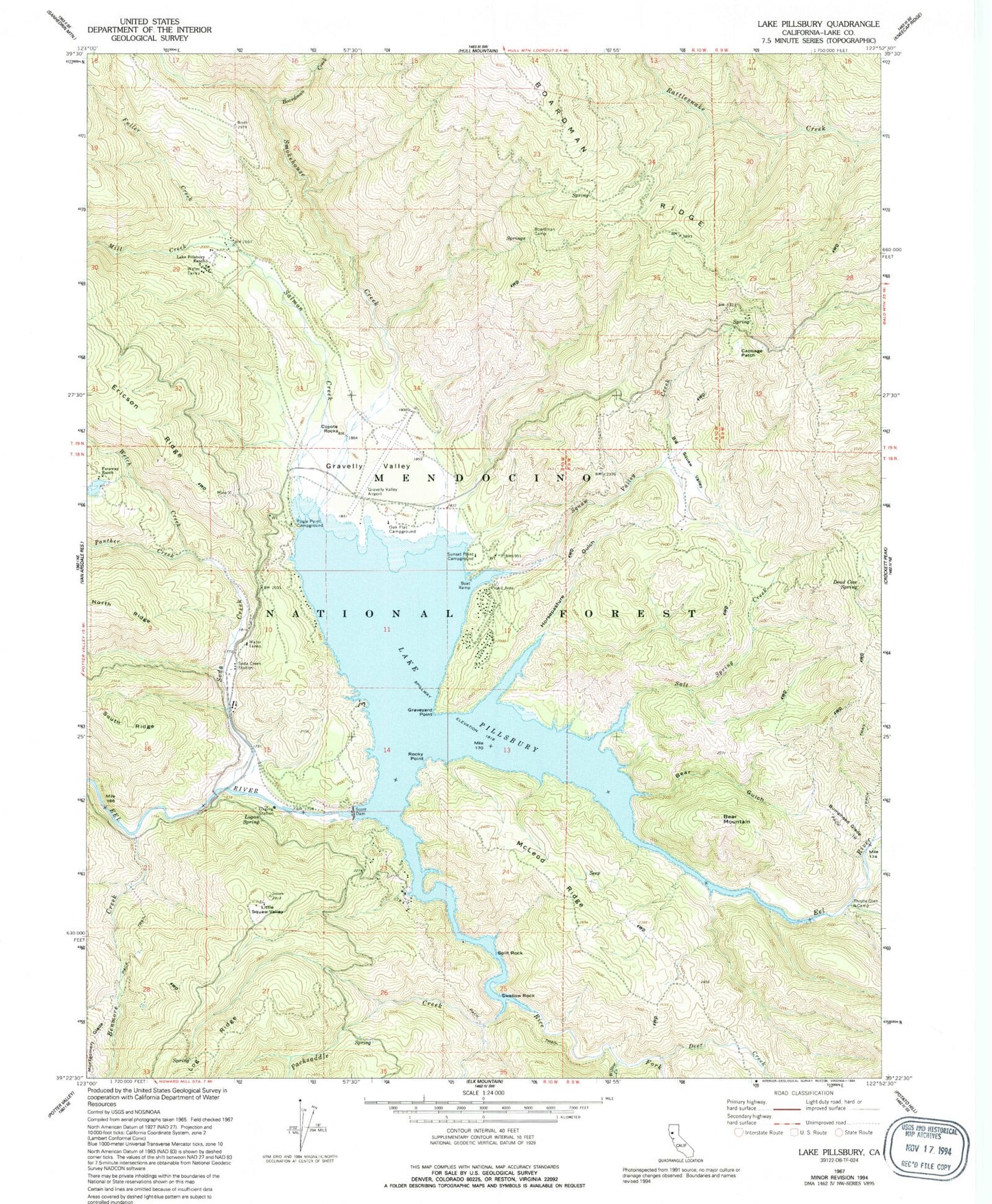
Historical USGS topographic quad map of Lake Pillsbury in the state of California. Typical map scale is 1:24,000, but may vary for certain years, if available. Print size: 24" x 27"
This quadrangle is in the following counties: Lake.
The map contains contour lines, roads, rivers, towns, and lakes. Printed on high-quality waterproof paper with UV fade-resistant inks, and shipped rolled.
Contains the following named places: Bear Gulch, Bear Mountain, Big Squaw Valley, Boardman Camp, Bumphead Glade, Cabbage Patch, Dead Cow Spring, Faraway Ranch, Gravelly Valley, Graveyard Point, Horsepasture Gulch, Lake Pillsbury Ranch, Little Squaw Valley, Logan Spring, McLeod Ridge, Rocky Point, Salmon Creek, Salt Spring Creek, Scott Dam, Lake Pillsbury, Soda Creek, Split Rock, Squaw Valley Creek, Swallow Rock, Thistle Glenn Camp, Benmore Creek, Boardman Creek, Deer Creek, Fuller Creek, Mill Creek, Montgomery Glade, North Ridge, Packsaddle Creek, Panther Creek, Rice Fork, Smokehouse Creek, Thistle Glade Creek, Welch Creek, Willow Creek, Soda Creek Resort, Lake Pillsbury Resort, Rice Fork Summer Homes, Gravelly Valley Work Center, Lake Pillsbury Pines Resort, Gravelly Valley Airport, Oak Flat Campground, Pogie Point Campground, Soda Creek Station, Sunset Point Campground, Coyote Rocks, Fuller Ranch, Lake Pillsbury Fire Protection District