MyTopo
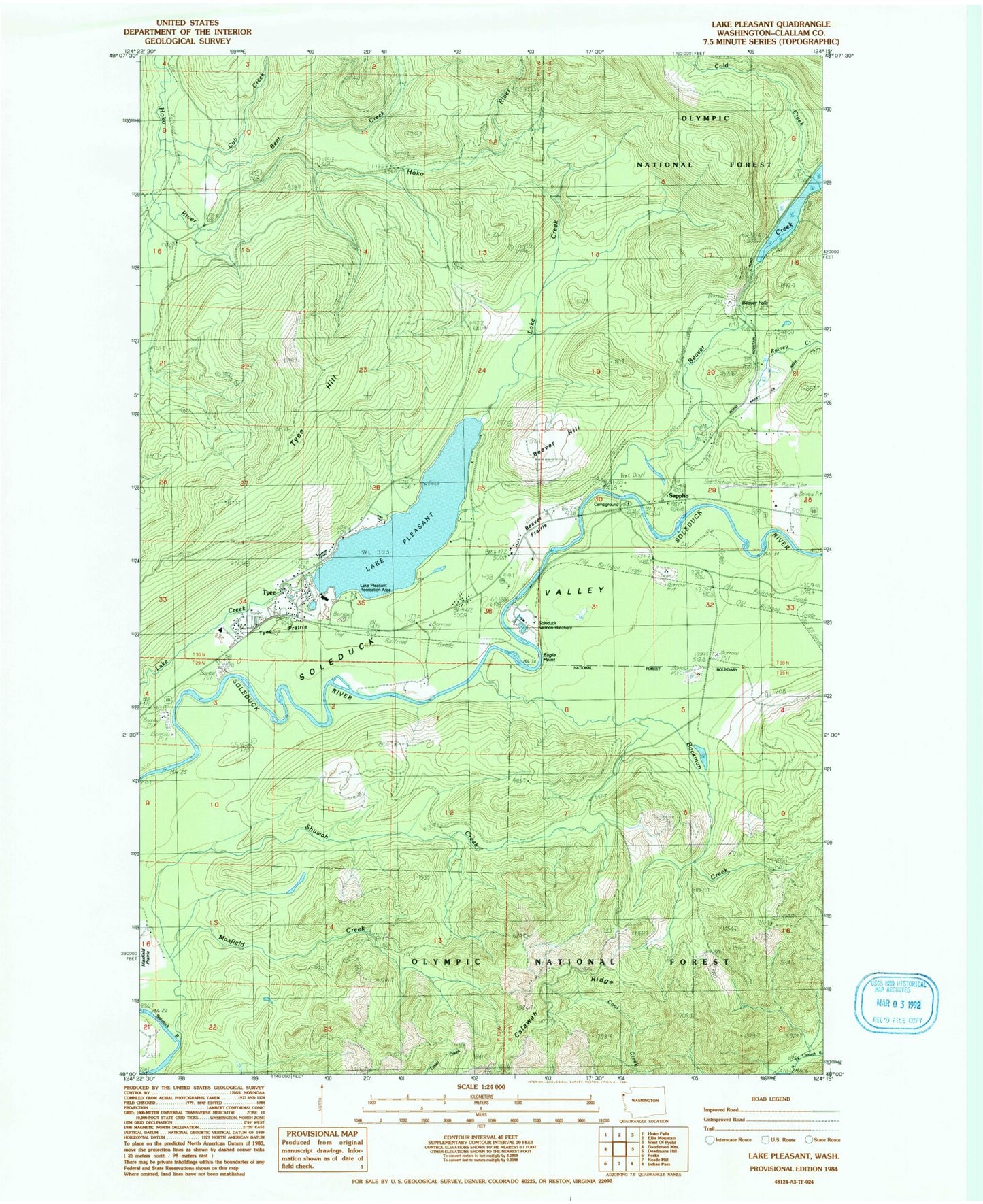
Classic USGS Lake Pleasant Washington 7.5'x7.5' Topo Map
Couldn't load pickup availability
Historical USGS topographic quad map of Lake Pleasant in the state of Washington. Map scale may vary for some years, but is generally around 1:24,000. Print size is approximately 24" x 27"
This quadrangle is in the following counties: Clallam.
The map contains contour lines, roads, rivers, towns, and lakes. Printed on high-quality waterproof paper with UV fade-resistant inks, and shipped rolled.
Contains the following named places: Bear Creek, Beaver, Beaver Creek, Beaver Falls, Beaver Fire Department, Beaver Hill, Beaver Post Office, Beaver Prairie, Beaver Sand and Gravel Quarry, Beaver School, Bockman Creek, Calawah Ridge, Cold Creek, Cub Creek, Eagle Point, Forks Division, Lake Pleasant, Lake Pleasant Boat Launch Ramp, Lake Pleasant Mobile Home, Lake Pleasant Recreation Area, Lake Pleasant Recreational Vehicle Park, Loop Tavern Quarry, Mary Clark Quarry, Maxfield Creek, Rainey Creek, Sappho, Sappho Quarry, Shuwah Creek, Soleduck Salmon Hatchery, Tumbling Rapids Recreation Area, Tyee Hill, Tyee Prairie