MyTopo
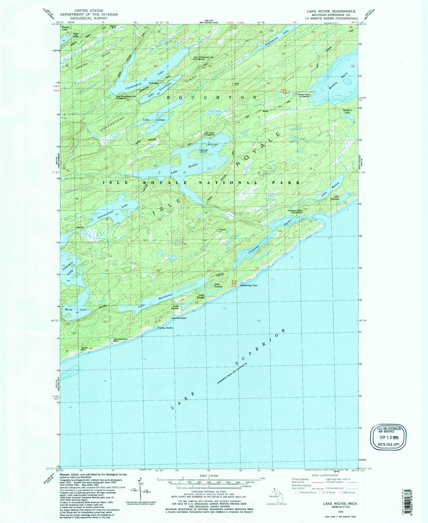
Classic USGS Lake Richie Michigan 7.5'x7.5' Topo Map
Couldn't load pickup availability
Historical USGS topographic quad map of Lake Richie in the state of Michigan. Typical map scale is 1:24,000, but may vary for certain years, if available. Print size: 24" x 27"
This quadrangle is in the following counties: Keweenaw.
The map contains contour lines, roads, rivers, towns, and lakes. Printed on high-quality waterproof paper with UV fade-resistant inks, and shipped rolled.
Contains the following named places: Birch Isle, Blueberry Cove, Chickenbone Lake, Chippewa Harbor, Chippewa Harbor Campground, Datolite Mine, Lake Dustin, Lake George, Greenstone Beach, Hastings Island, Indian Portage Trail, Intermediate Lake, Lake Richie Trail, LeSage Lake, Little Greenstone Beach, Lake Livermore, Lake Mason, Moskey Basin, Moskey Basin Campground, Lake Richie, Lake Scholts, Lake Theresa, Vodrey Harbor, Wallace Lake, Lake Whittlesey, Wood Lake, Lake Richie Campground, East Chickenbone Lake Campground, West Chickenbone Lake Campground