MyTopo
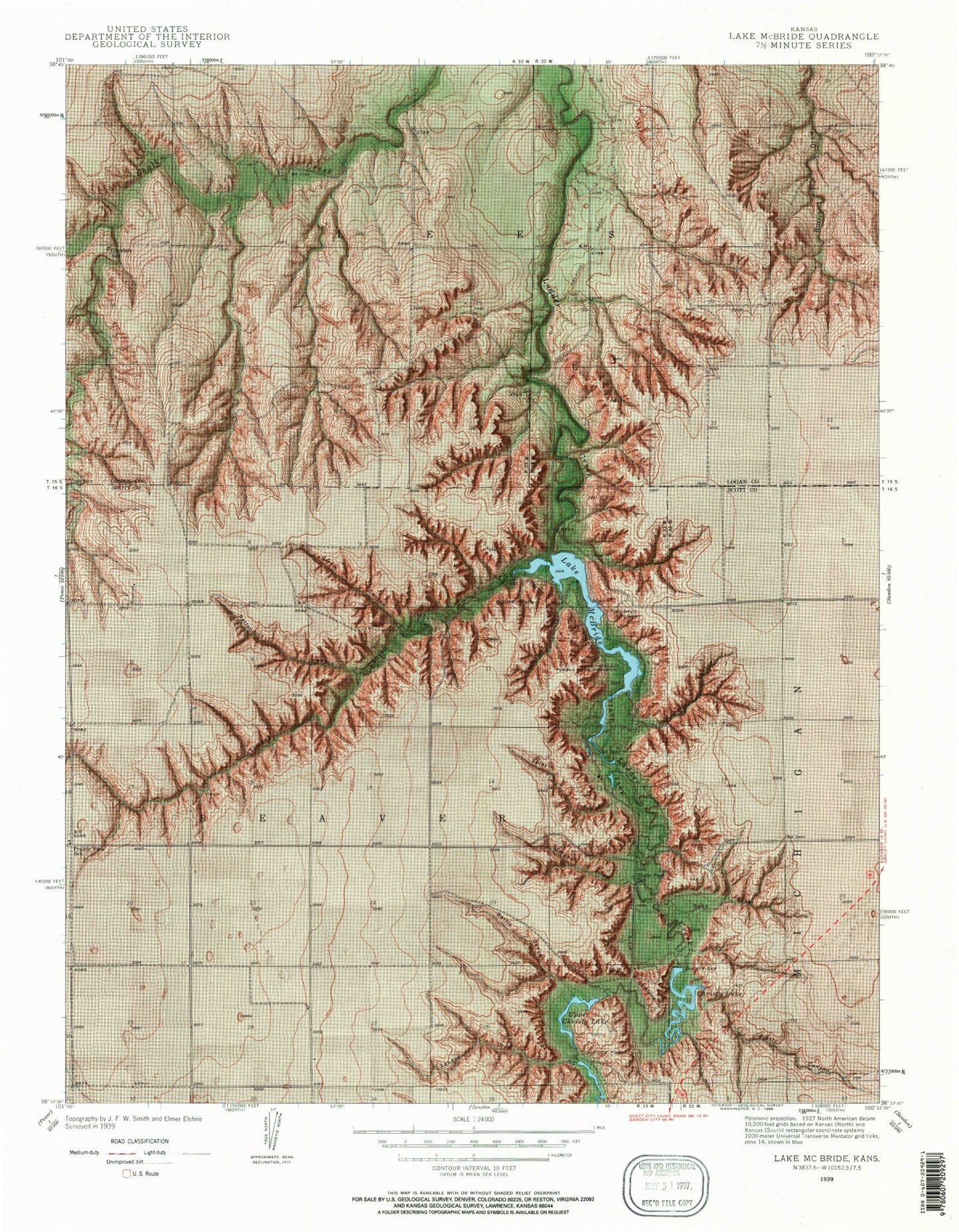
Classic USGS Lake Scott Kansas 7.5'x7.5' Topo Map
Couldn't load pickup availability
Historical USGS topographic quad map of Lake Scott in the state of Kansas. Map scale may vary for some years, but is generally around 1:24,000. Print size is approximately 24" x 27"
This quadrangle is in the following counties: Logan, Scott.
The map contains contour lines, roads, rivers, towns, and lakes. Printed on high-quality waterproof paper with UV fade-resistant inks, and shipped rolled.
Contains the following named places: Barrel Springs, Barrel Springs Trout Pond, Battendorf Canyon, Battle Canyon, Camp Christy, Camp Lakeside, Carpenter Chapel, Christy Canyon, Christy Dam, Christy Lake, Circle Drive Campground, Devils Backbone, El Cuartelejo Ruins, Elm Camping Area, Epler Canyon, Garvin Canyon, Glendale School, Horsethief Canyon, Lake Scott, Lake Scott State Park, Lake View Campground, Lakeside Campground, Landon Draw, McBride Monument, Morgan Draw, Prairie View School, Sand Draw, Scott County State Lake, Scott County State Park Dam, Scott State Game Management Area, Scott State Park Bull Canyon South Campground, Scott State Park Lakebank Drive Campground, Scott State Park Timber Canyon Campground, Shafer Canyon, Squaws Den Battleground, Squaws Den Monument, State Park School, Steele Homestead Museum, Steele Monument, Suicide Bluffs, Timber Canyon, Township of Lees, Upper Christy Lake, White Woman's Grave