MyTopo
Classic USGS Lake Shannon Washington 7.5'x7.5' Topo Map
Couldn't load pickup availability
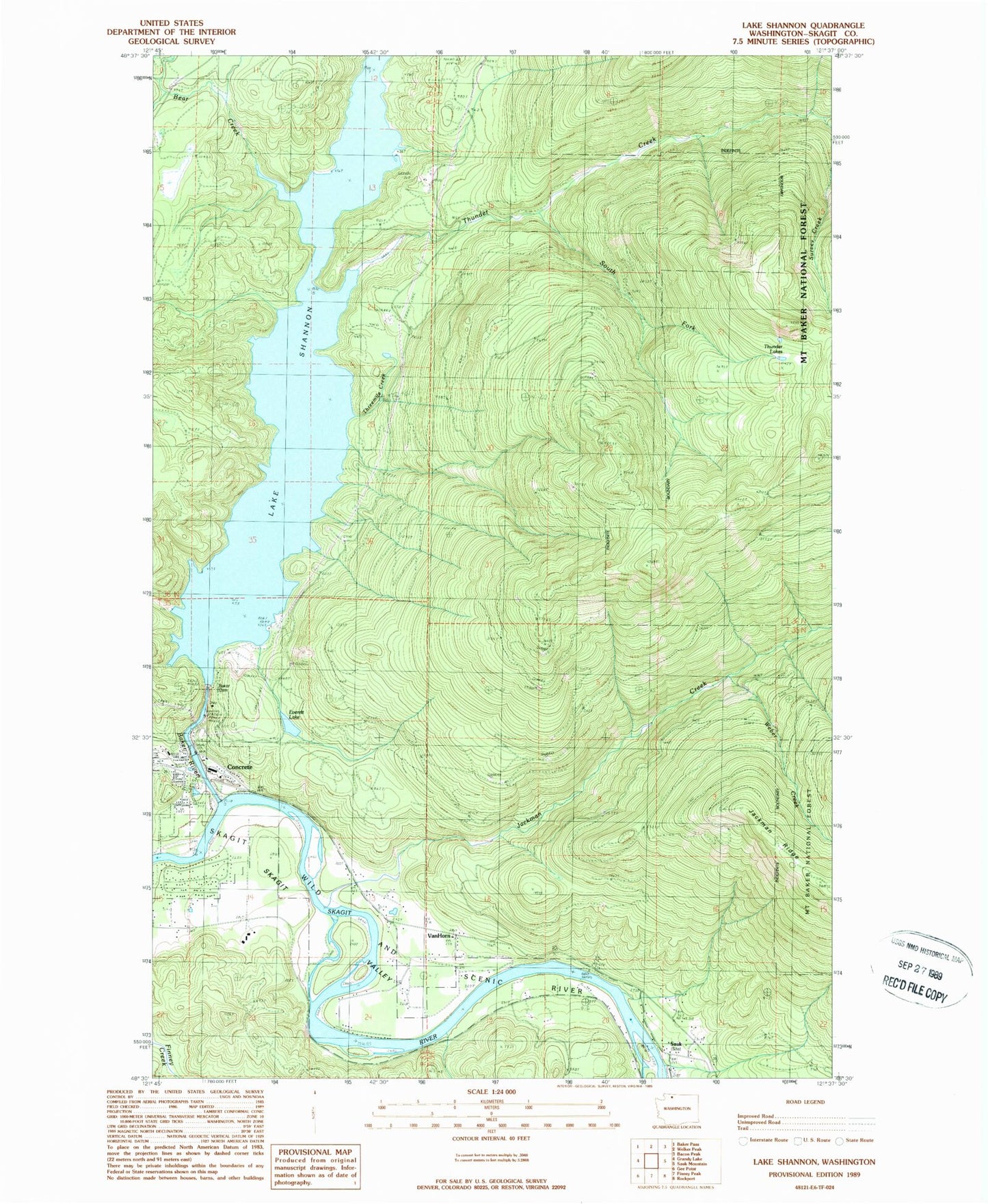
Historical USGS topographic quad map of Lake Shannon in the state of Washington. Map scale may vary for some years, but is generally around 1:24,000. Print size is approximately 24" x 27"
This quadrangle is in the following counties: Skagit.
The map contains contour lines, roads, rivers, towns, and lakes. Printed on high-quality waterproof paper with UV fade-resistant inks, and shipped rolled.
Contains the following named places: Aero - Skagit Emergency Services, Baker Dam, Bear Creek, Bear Creek Dam, Bear Creek Powerhouse, Concrete, Concrete Fire Department, Concrete Sewage Treatment Plant, Cooper Creek, Everett Lake, Faber Ferry, Jackman Creek, Jackman Ridge, Kingdom Hall of Jehovahs Witnesses, Lake Shannon, Mountview, Nestos, South Fork Thunder Creek, Survey Creek, Threemile Creek, Thunder Creek, Thunder Lakes, Upper Skagit Garden Club Park, Upper Skagit Library, Van Horn, Weber Creek