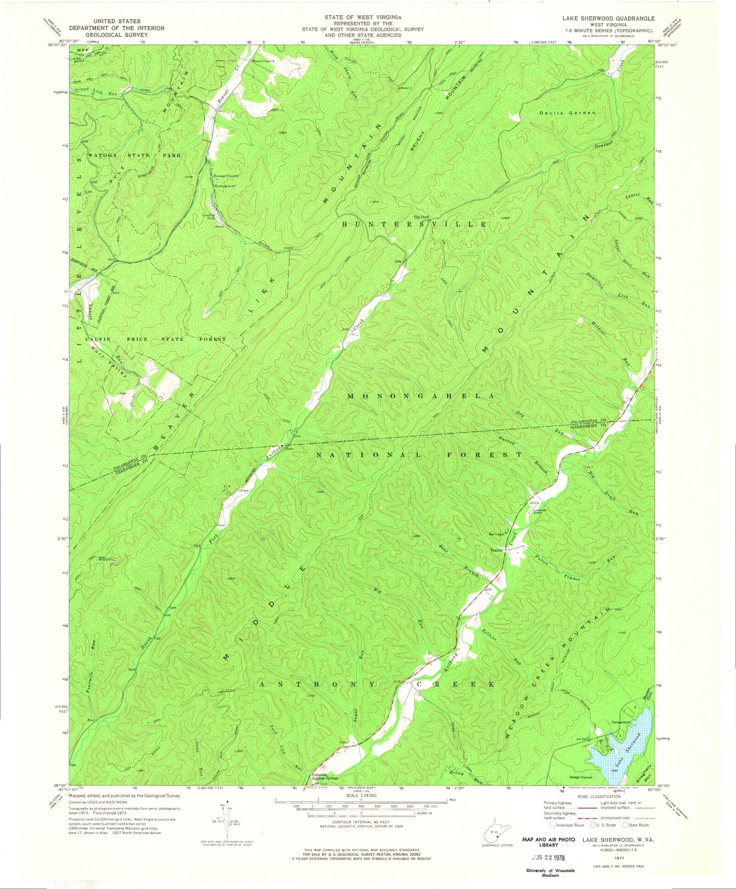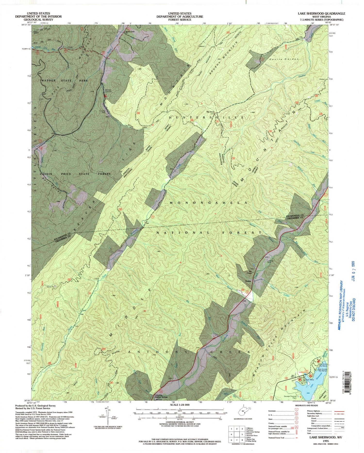
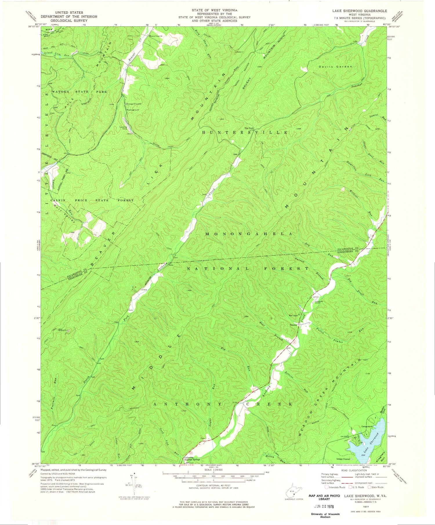
MyTopo
Classic USGS Lake Sherwood West Virginia 7.5'x7.5' Topo Map
Couldn't load pickup availability
Historical USGS topographic quad map of Lake Sherwood in the state of West Virginia. Typical map scale is 1:24,000, but may vary for certain years, if available. Print size: 24" x 27"
This quadrangle is in the following counties: Greenbrier, Pocahontas.
The map contains contour lines, roads, rivers, towns, and lakes. Printed on high-quality waterproof paper with UV fade-resistant inks, and shipped rolled.
Contains the following named places: Bear Branch, Beaver Creek Church, Beaver Creek Trail, Beaver Lick Mountain, Beaver Trail, Big Draft Run, Big Run, Burr Valley, Columbia Sulphur Springs, Devils Garden, Dilley Run, Dry Run, Fallen Timber Run, Fourmile Run, Honey Moon Trail, Lake Sherwood, Lake Sherwood Recreation Area, Laurel Run, Laurel Trail, May Chapel, Meadow Creek Mountain Trail, Middle Mountain, Middle Mountain Trail, Narrow Branch, Rider Trail, Robbins Run, Sugar Run, The Dock, Upper Meadow Trail, Wildcat Run, The Dock Trail, Trainer, May Hollow, Pine Grove School (historical), Lake Sherwood Dam, Lake Sherwood, Watoga Lake Dam, Beaver Creek School (historical), Burr, Burr School (historical), North Fork School (historical), Trainer School (historical), White Rocks, White Rocks Fire Tower (historical)