MyTopo
Classic USGS Lake Theriot Louisiana 7.5'x7.5' Topo Map
Couldn't load pickup availability
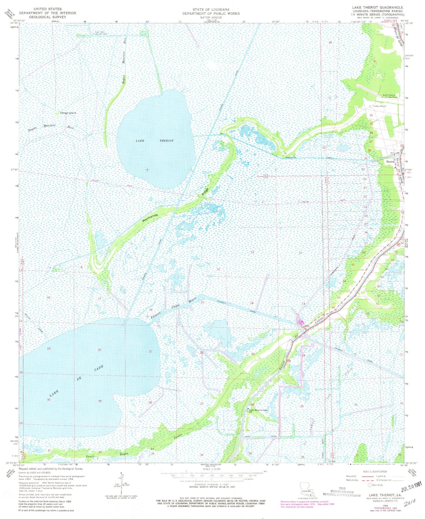
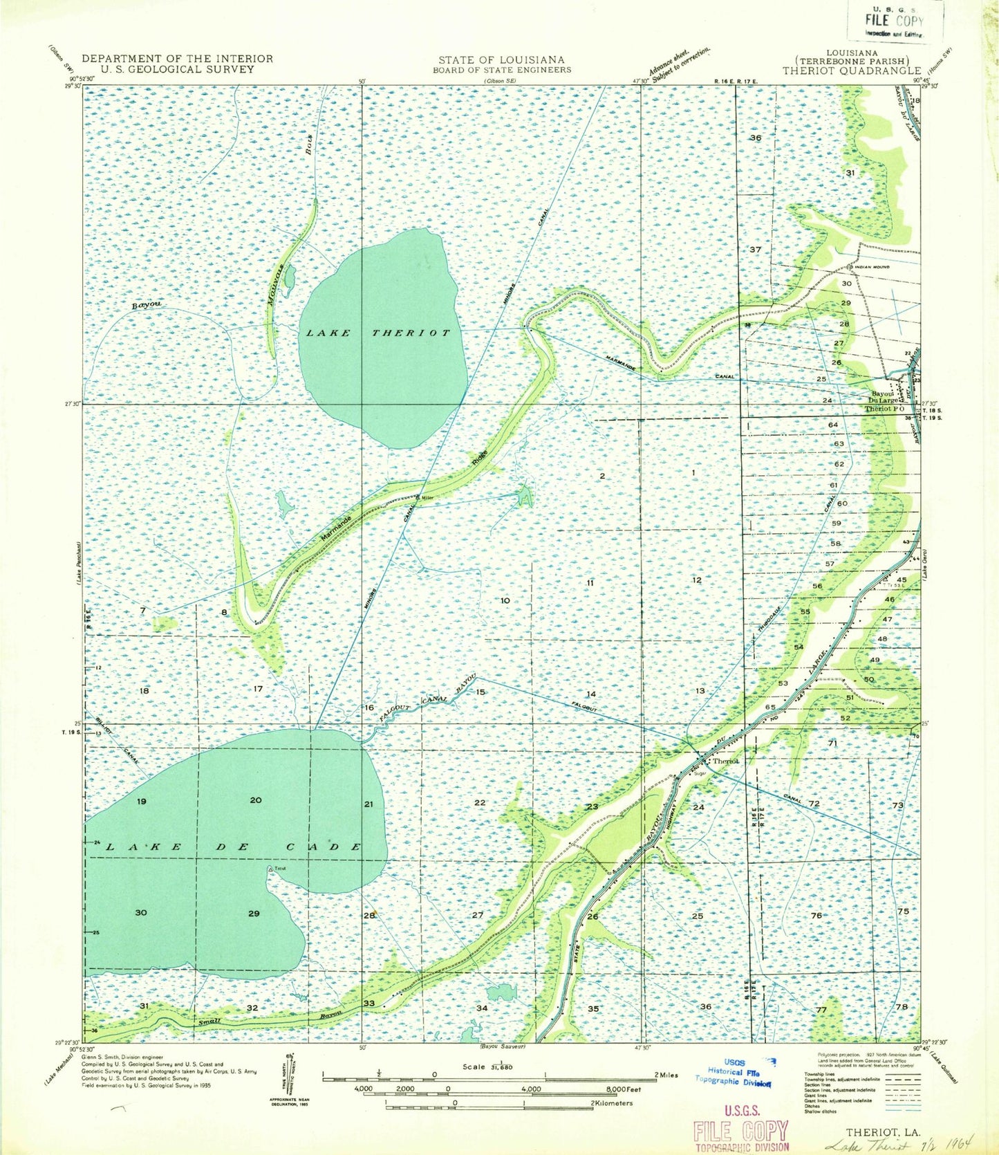
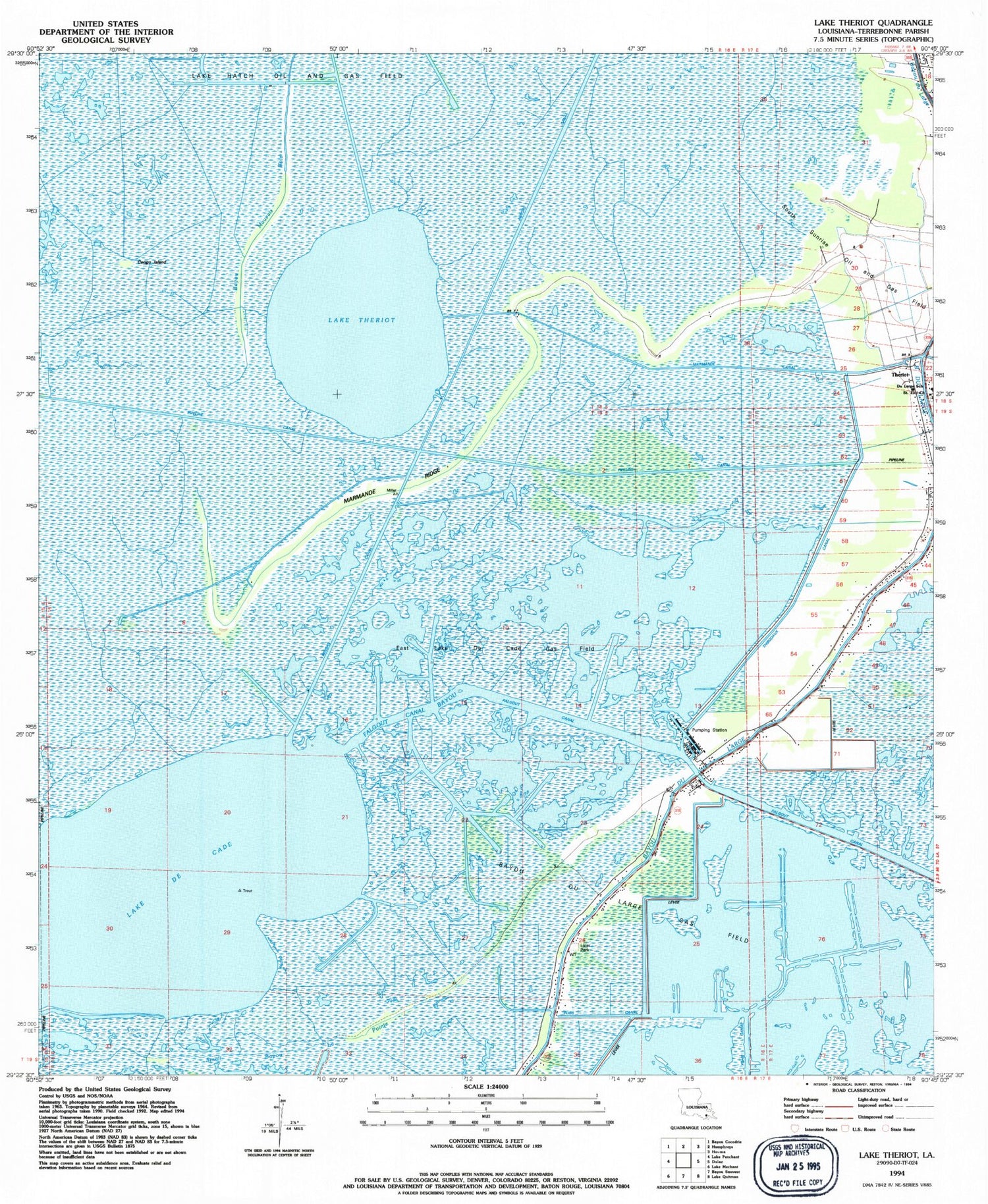
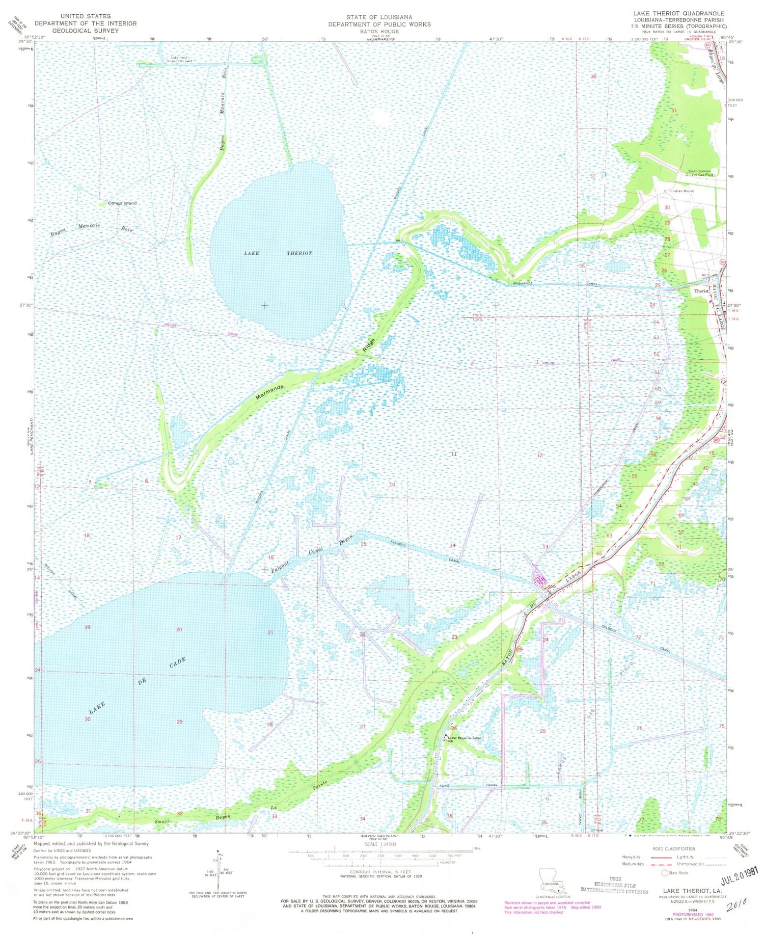
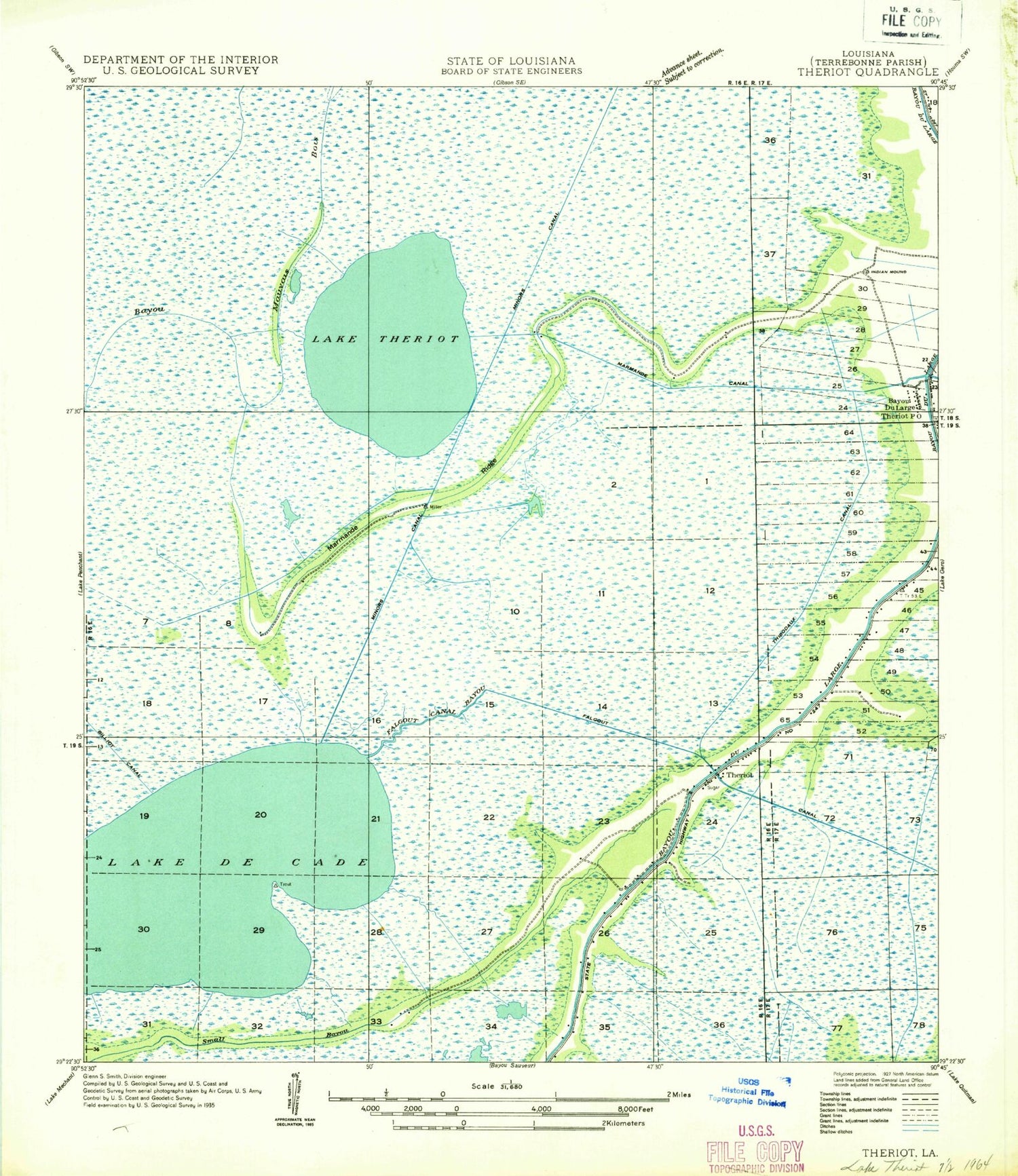
Historical USGS topographic quad map of Lake Theriot in the state of Louisiana. Map scale may vary for some years, but is generally around 1:24,000. Print size is approximately 24" x 27"
This quadrangle is in the following counties: Terrebonne.
The map contains contour lines, roads, rivers, towns, and lakes. Printed on high-quality waterproof paper with UV fade-resistant inks, and shipped rolled.
Contains the following named places: Bayou Dularge Fire Department, Congo Island, Du Large Gas Field, East Lake De Cade Gas Field, Falgout Canal, Falgout Canal Bayou, Falgout Canal Marina, Lake De Cade, Lake Theriot, Lower Bayou du Large School, Marmande Canal, Marmande Ridge, Minors Canal, South Sunrise Oil and Gas Field, Southdown Primary Elementary School, Theriot, Ward Ten, ZIP Code: 70397