MyTopo
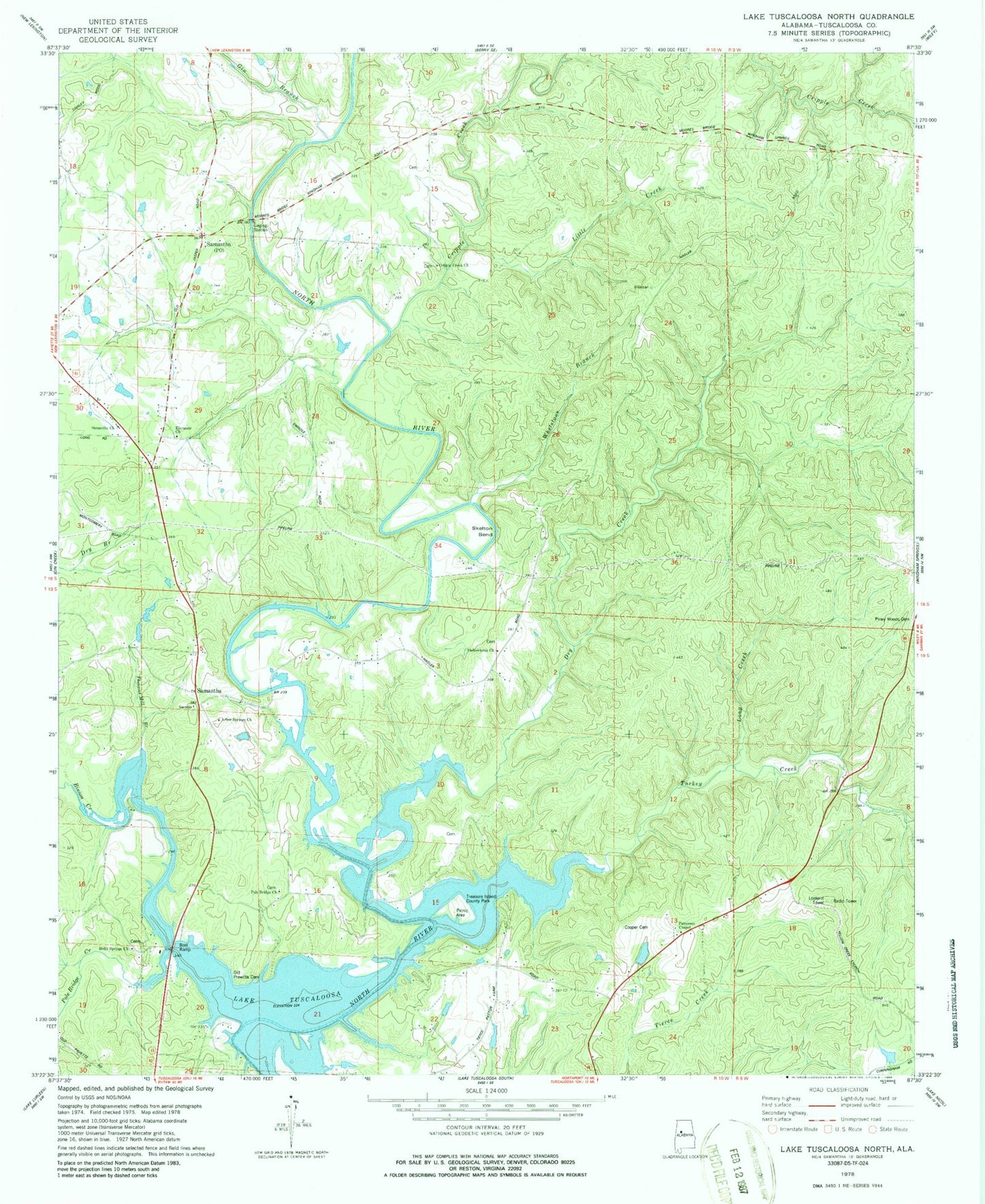
Classic USGS Lake Tuscaloosa North Alabama 7.5'x7.5' Topo Map
Couldn't load pickup availability
Historical USGS topographic quad map of Lake Tuscaloosa North in the state of Alabama. Map scale may vary for some years, but is generally around 1:24,000. Print size is approximately 24" x 27"
This quadrangle is in the following counties: Tuscaloosa.
The map contains contour lines, roads, rivers, towns, and lakes. Printed on high-quality waterproof paper with UV fade-resistant inks, and shipped rolled.
Contains the following named places: Arbor Springs Baptist Church, Arbor Springs Cemetery, Bell City, Binion Creek, Binion Creek Landing Park, Binion Heights, Cooper Cemetery, Cripple Creek, Cripple Creek Cemetery, Cripple Creek Church, Dry Creek, Ebenezer Cemetery, Ebenezer Church, Ebenezer School, Gin Branch, Glenn, Glenn School, Hagler Mill Estates, Haglers Mill, Harkey Cemetery, Holiday Shores, Holly Springs Baptist Church, Holly Springs Cemetery, Little Creek, Long Creek, Marcumville, McGuire Cemetery, North River Shores, North Riviera, Northside Gas Field, Old Prewett Slave Cemetery, Oregonia School, Patterson Chapel Methodist Church, Philadelphia, Philadelphia Baptist Church, Philadelphia Cemetery, Piney Woods Cemetery, Pole Bridge Cemetery, Pole Bridge Church, Pole Bridge Creek, Pole Bridge School, Prewitt Hagler Cemetery, Samantha, Samantha Church, Searcy Farms, Simpson - Cain Cemetery, Skelton Bend, Skelton Bend Estates, Thomas Mill Branch, Treasure Island County Park, Turkey Creek, Tuscaloosa Sailing Club, Wagon Wheel Lake, Wagon Wheel Lake Dam, Walton Cemetery, Waltons Mill, Whetstone Branch, Widow Jones Spring, Winters Cemetery, ZIP Code: 35475