MyTopo
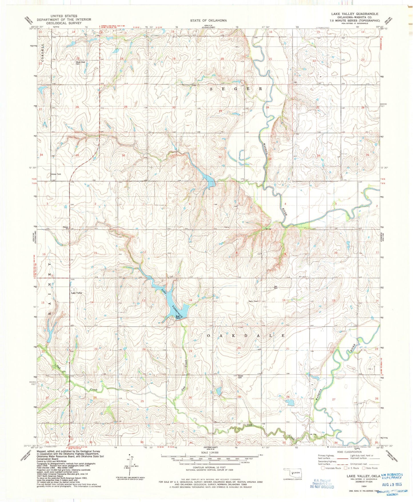
Classic USGS Lake Valley Oklahoma 7.5'x7.5' Topo Map
Couldn't load pickup availability
Historical USGS topographic quad map of Lake Valley in the state of Oklahoma. Map scale may vary for some years, but is generally around 1:24,000. Print size is approximately 24" x 27"
This quadrangle is in the following counties: Washita.
The map contains contour lines, roads, rivers, towns, and lakes. Printed on high-quality waterproof paper with UV fade-resistant inks, and shipped rolled.
Contains the following named places: Cloud Chief Cemetery, Fesser Cemetery, Gyp Creek, Indian Village, Lake Valley, Lake Vanderwork, Oak Creek, Oak Creek Site 4 Dam, Oak Creek Site 4 Reservoir, Oak Creek Site 5 Dam, Oak Creek Site 5 Reservoir, Oak Creek Site 7 Dam, Oak Creek Site 7 Reservoir, Oak Creek Site 8 Dam, Oak Creek Site 8 Reservoir, Oak Creek Site 9 Dam, Oak Creek Site 9 Reservoir, Oknoname 149007 Dam, Oknoname 149007 Reservoir, Sharon Cemetery, Sharon Church, Southeast Washita Division