MyTopo
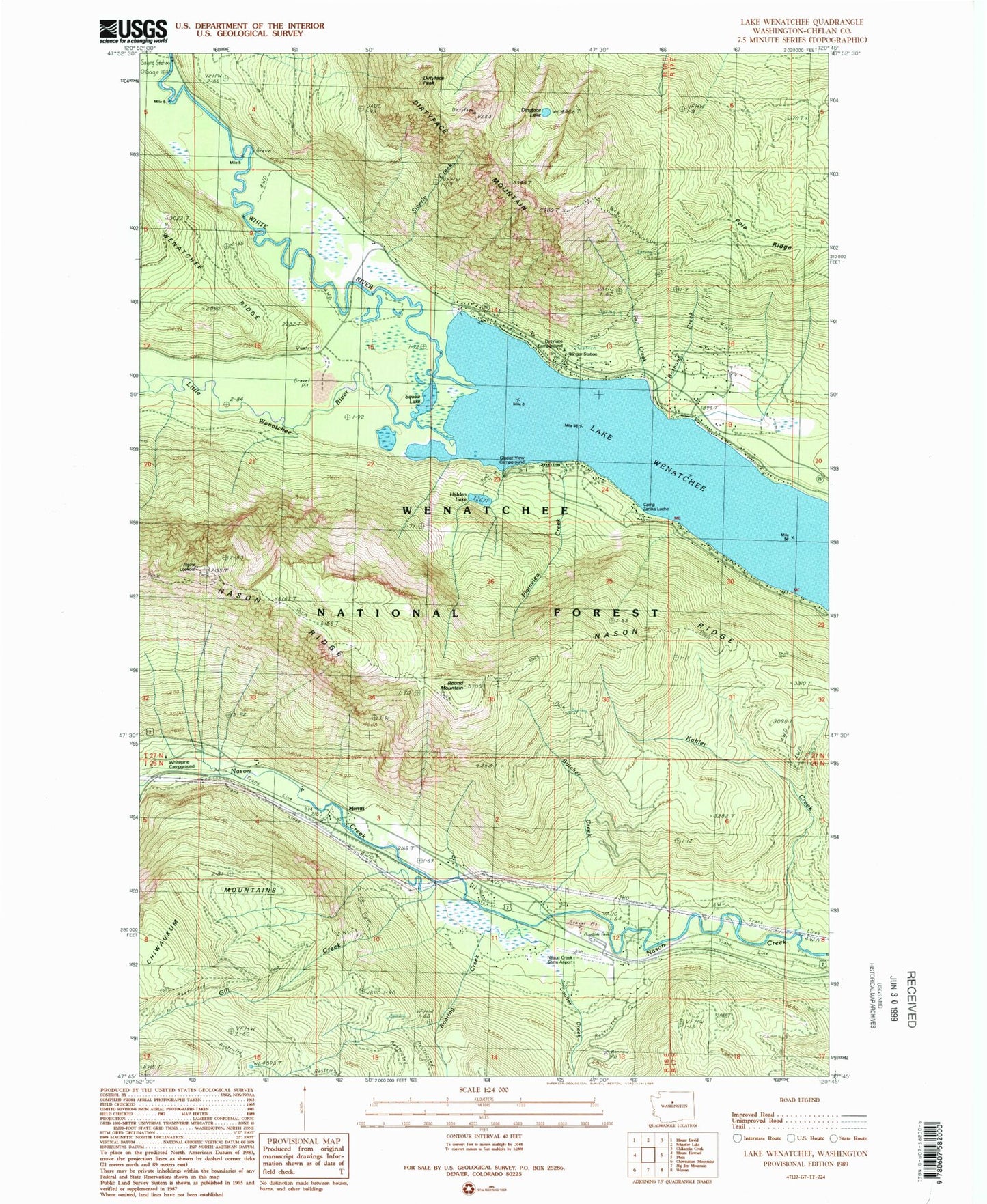
Classic USGS Lake Wenatchee Washington 7.5'x7.5' Topo Map
Couldn't load pickup availability
Historical USGS topographic quad map of Lake Wenatchee in the state of Washington. Map scale may vary for some years, but is generally around 1:24,000. Print size is approximately 24" x 27"
This quadrangle is in the following counties: Chelan.
The map contains contour lines, roads, rivers, towns, and lakes. Printed on high-quality waterproof paper with UV fade-resistant inks, and shipped rolled.
Contains the following named places: Alpine Lookout, Barnard Creek, Butcher Creek, Camp Zanika Lache, Coulter Creek, Dirtyface Campground, Dirtyface Lake, Dirtyface Lookout, Dirtyface Mountain, Dirtyface Peak, Fall Creek, Gill Creek, Glacier View Campground, Hidden Lake, Kahler Creek, Lake Wenatchee, Lake Wenatchee Campground, Leavenworth Ranger District, Leavenworth-Lake Wenatchee Division, Little Wenatchee River, Merritt, Nason Creek, Nason Creek Rest Area, Nason Creek State Airport, Plainview Creek, Pole Ridge, Roaring Creek, Round Mountain, Silverly Creek, Squaw Lake, Telma, Wenatchee Ridge Viewpoint, Wenatchee River Ranger District-Lake Wenatchee Office, White Pine Campground, White River, White River Viewpoint, ZIP Code: 98826