MyTopo
Classic USGS Lake Weohyakapka Florida 7.5'x7.5' Topo Map
Couldn't load pickup availability
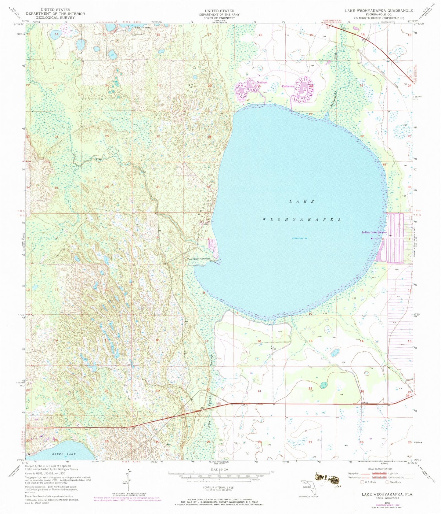
Historical USGS topographic quad map of Lake Weohyakapka in the state of Florida. Map scale may vary for some years, but is generally around 1:24,000. Print size is approximately 24" x 27"
This quadrangle is in the following counties: Polk.
The map contains contour lines, roads, rivers, towns, and lakes. Printed on high-quality waterproof paper with UV fade-resistant inks, and shipped rolled.
Contains the following named places: Fedhaven, Flyjivefly Airport, Indian Lake Estates, Lake Andrea, Lake Wales Division, Lake Weohyakapka, Nalcrest, Polk County Emergency Medical Services Station 6 Nalcrest, Polk County Fire Department Station 9 Fedhaven, Tiger Creek, Tiger Creek Hammock, Walden Shores Mobile Home Park, ZIP Codes: 33854, 33856