MyTopo
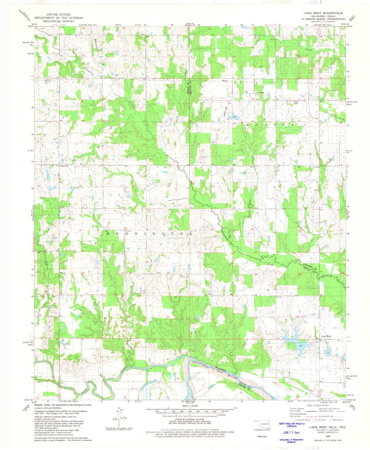
Classic USGS Lake West Oklahoma 7.5'x7.5' Topo Map
Couldn't load pickup availability
Historical USGS topographic quad map of Lake West in the state of Oklahoma. Map scale may vary for some years, but is generally around 1:24,000. Print size is approximately 24" x 27"
This quadrangle is in the following counties: Bryan, Choctaw, Fannin.
The map contains contour lines, roads, rivers, towns, and lakes. Printed on high-quality waterproof paper with UV fade-resistant inks, and shipped rolled.
Contains the following named places: Belvin School, Blue River, Dill Cemetery, Frazier Creek, Good Springs Cemetery, Good Springs Church, Jackson Cemetery, Jackson School, Lake West, Lake West School, Lewis Eastwood Dam, Lewis Eastwood Reservoir, Oknoname 013005 Dam, Oknoname 013005 Reservoir, Oknoname 013006 Dam, Oknoname 013006 Reservoir, Oknoname 013009 Dam, Oknoname 013009 Reservoir, Oknoname 013021 Dam, Oknoname 013021 Reservoir, Page Lake, Patsy Spring, Shady Grove School, Siby Spring, Slash Creek, Teal Lake, Teal Lake Dam, Whitesand Creek, Wilson School, Winters Creek