MyTopo
Classic USGS Lake Whatcom Washington 7.5'x7.5' Topo Map
Couldn't load pickup availability
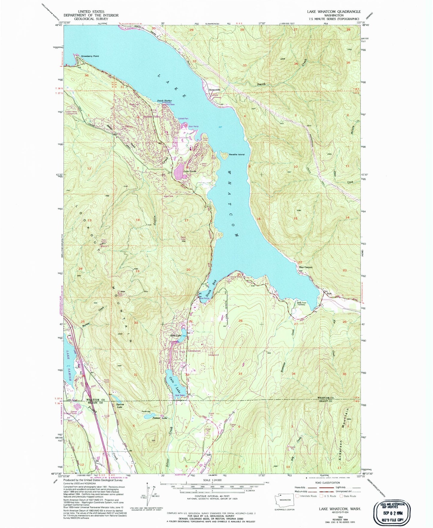
Historical USGS topographic quad map of Lake Whatcom in the state of Washington. Typical map scale is 1:24,000, but may vary for certain years, if available. Print size: 24" x 27"
This quadrangle is in the following counties: Skagit, Whatcom.
The map contains contour lines, roads, rivers, towns, and lakes. Printed on high-quality waterproof paper with UV fade-resistant inks, and shipped rolled.
Contains the following named places: Austin Creek, Bear Creek, Beaver Creek, Brannian Creek, Cain Lake, Dutch Harbor, Fir Creek, Lookout Mountain, Palmer Lake, Park, Reveille Island, Smith Creek, South Bay, Squires Lake, Strawberry Point, Blue Canyon, Sunnyside, Cedar Acres, Lake Louise, Reed Lake, Sudden Valley, Lake Whatcom, Louise Lake Dam, Glenhaven Lakes Dam, Floathaven Airstrip, Floathaven Seaplane Base, Sudden Valley Census Designated Place, Alger Learning Center and Independence High School, Lake Louise Substation, Sudden Valley Golf Club, South Whatcom Fire Authority Station 22, Whatcom County Fire District 18 Fire Station 25, Whatcom County Fire District 18 Station 26, Buckingham Creek, Rufus Creek