MyTopo
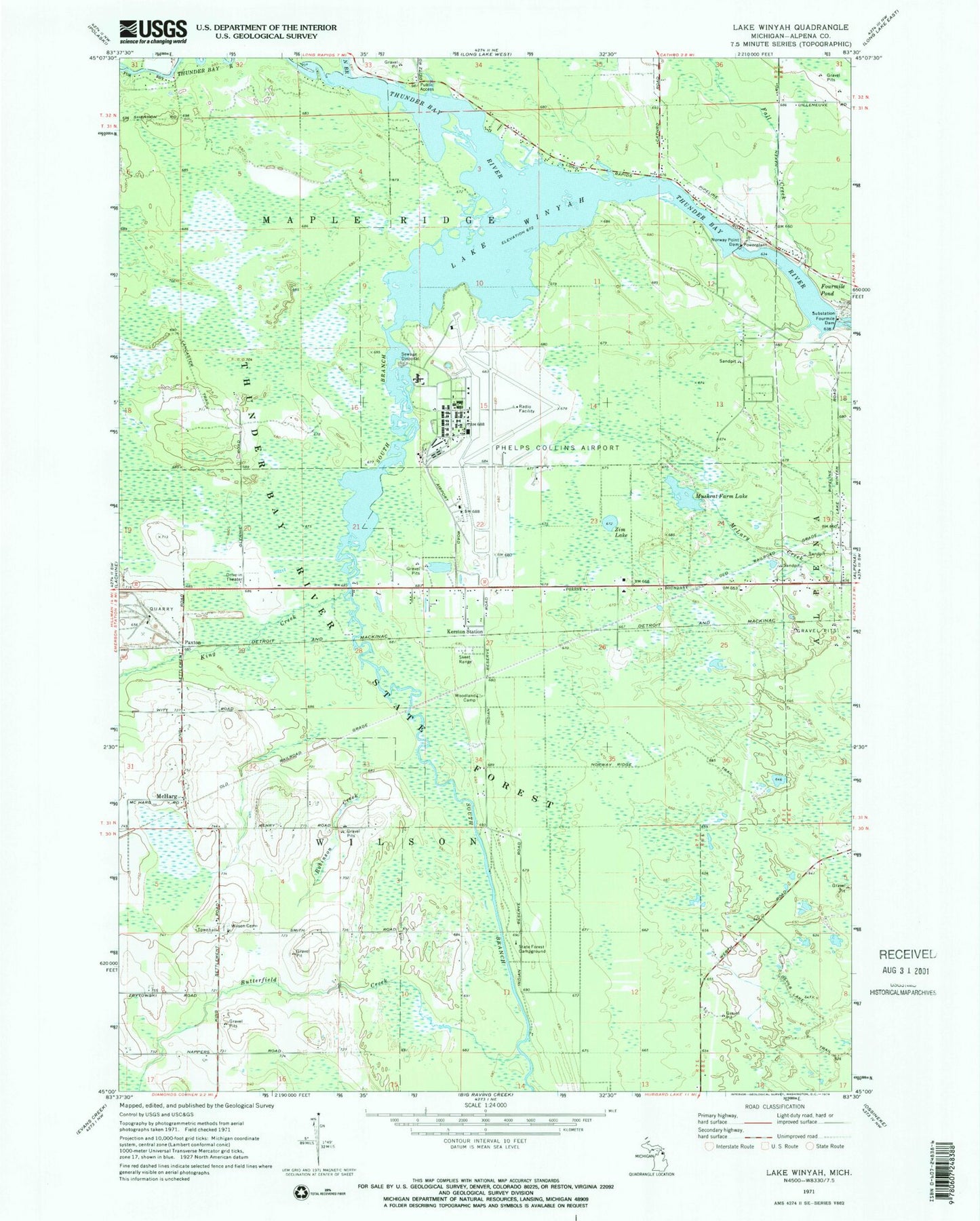
Classic USGS Lake Winyah Michigan 7.5'x7.5' Topo Map
Couldn't load pickup availability
Historical USGS topographic quad map of Lake Winyah in the state of Michigan. Typical map scale is 1:24,000, but may vary for certain years, if available. Print size: 24" x 27"
This quadrangle is in the following counties: Alpena.
The map contains contour lines, roads, rivers, towns, and lakes. Printed on high-quality waterproof paper with UV fade-resistant inks, and shipped rolled.
Contains the following named places: Butterfield Creek, Devils Lake Trail, Fall Creek, Fourmile Dam, Fourmile Pond, Kerston Station, King Creek, Kingsbury Creek, Lower South Branch Thunder Bay River, Muskrat Farm Lake, Norway Point Dam, Norway Ridge Trail, Robinson Creek, Wilson Cemetery, Lake Winyah, Woodland Camp, Zim Lake, McHarg, Paxton, Alpena County Regional Airport, North Branch Thunder Bay River, Township of Wilson, Alpena Army Air Field (historical), Huron Shores Fellowship Church, Campers Grove Campground, Thunder Bay River State Forest Campground, Alpena Combat Readiness Training Center Fire and Rescue Services, Michigan Department of Natural Resources Alpena Field Office, Wilson Township Fire and Rescue